
Abbots Bickington
About Abbots Bickington
Abbots Bickington lies within Devon. Local places nearby include Milton Damerel just 2.7 km South, Sutcombe just 4.2 km West South West, Stibb Cross only 5.0 km East North East and Holsworthy Beacon around 5.9 km South South West. Other rural places nearby include Haytown, Bulkworthy, Newton St Petrock, East Putford and West Putford.
You may find extra local information by clicking a nearby place.
All place information is taken from OS, ONS and OSM under open licence.
⇅
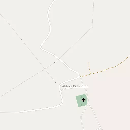
Local Map
⇅
Location Summary
- Abbots Bickington is located in Devon
- Administrative Area: Devon
- Ceremonial County: Devon
- Historic County: Devon
- Region & Country: South West / England
⇅
Nearby Towns & Cities
- Holsworthy 10.4 km SSW
- Great Torrington 12.5 km ENE
- Bideford 14.8 km NNE
- Stratton 16.8 km WSW
- Exeter 57.3 km ESE


⇅
Nearby Localities
- Milton DamerelVillage 2.7 km S
- SutcombeVillage 4.2 km WSW
- Stibb CrossVillage 5.0 km ENE
- Holsworthy BeaconVillage 5.9 km SSW
- BradworthyVillage 6.0 km W
- LangtreeVillage 6.9 km ENE
- ShebbearVillage 7.0 km SE
- ParkhamVillage 8.0 km N
- Buckland BrewerVillage 8.2 km NNE
- Frithelstock StoneVillage 8.9 km NE


⇅
Smaller Settlements
- Haytown 1.0 km N
- Bulkworthy 1.3 km NE
- Newton St Petrock 3.0 km ESE
- East Putford 3.4 km NNW
- West Putford 3.5 km NW
- Sessacott 4.0 km NW
- Thornbury 5.2 km SSE
- Tythecott 5.4 km NE
- Caute 5.5 km ESE
- Withacott 5.6 km ENE


⇅
Beaches
- Marsland Beach17.9 km W
- Mouthmill Beach15.9 km NW
- Westward Ho! Beach17.4 km NNE
⇅
Parks
- Pennsylvania Park57.4 km ESE
- Pleasure Grounds27.9 km SE
- Summerleaze Down18.7 km WSW
- The Warren38.9 km NNE
⇅
Woods
- Broomball Wood711 m E
- Gardenclose Wood499 m NNW
- The Grove1.0 km SE
- Woodford Wood1.2 km ESE

⇅
Hills
- Furzebeam Hill11.8 km NE
- Holsworthy Beacon5.7 km SSW
- Melbury Hill6.1 km N
- Woodsdown Hill8.6 km SW

⇅
Lakes
- Canns Water6.5 km NNW
- Cranford Water8.8 km NNW
- Melbury Reservoir6.7 km N
- Wooda Lakes9.2 km WSW
⇅
Waterfalls
- Becka Falls50.2 km SE
- Golitha Falls47.5 km SSW
- White Lady Waterfall32.1 km SSE
⇅
Headlands
- Cockington Head13.0 km N
- Gallantry Bower15.0 km NNW
⇅
Islands
- Chapel Rock19.5 km WSW
- Horsey Island22.3 km NNE
⇅
Wetlands
- Portledge Mouth11.3 km N
- Black Rock Marsh14.7 km ENE
- Pillhead Marsh16.4 km NNE
⇅
Health Services
- Holsworthy HospitalHospital 9.5 km SSW
- Torrington Community HospitalHospital 13.0 km ENE
- Deer Park Nursing HomeMedical 10.2 km SSW
- Hatchmoor Nursing HomeMedical 14.0 km ENE
⇅
Education
- West and East Putford Primary and Nursery SchoolSchool 3.4 km NW
- Sutcombe Community Primary SchoolSchool 4.3 km WSW
- PetrocUniversity 24.2 km NE
⇅
Railway Stations
- Chapelton23.3 km NE
- Umberleigh24.7 km ENE
⇅
Bus Stations
- Barnstaple Bus Station26.4 km NE
- Exeter Bus Station57.7 km ESE
⇅
Coach Stations
- Plymouth Coach Station59.4 km S
- Torquay Coach Station71.5 km SE
⇅
Ferry Terminals
- Torpoint Ferry Terminal58.5 km S
- Plymouth Stonehouse59.9 km S
⇅
Airports
- Plymouth City Airport54.4 km SSE
- Exeter Airport64.9 km ESE
⇅
Airfields
- Belle Vue Airfield16.9 km ENE
- Eaglescott Airfield22.1 km E
⇅
Heliports
- Lake Heliport15.4 km NNE
- Hartland Heliport20.4 km NW
⇅
Harbours
- Lynmouth Harbour49.5 km NE
- Weston Mill Lake56.7 km S