
Abington Pigotts
About Abington Pigotts
Abington Pigotts, in Cambridgeshire, has Litlington situated 1.8 km South South East, Bassingbourn around 2.5 km East South East, Steeple Morden only 2.9 km South West, Guilden Morden lying 3.0 km West and Kneesworth lying 3.5 km East. Other rural settlements include North Brook End, Shingay, Great Green and Morden Green.
You may find extra local information by clicking a nearby place.
Information is sourced from OS, ONS and OSM under open licence, using publicly available datasets.
⇅
Local Map
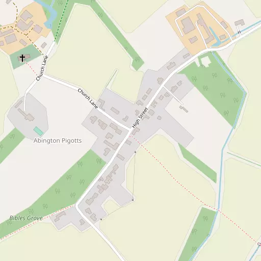
⇅
Location Summary
- Abington Pigotts is located in Cambridgeshire
- Administrative Area: Cambridgeshire
- Ceremonial County: Cambridgeshire
- Historic County: Cambridgeshire
- Region & Country: Eastern / England
⇅
Nearby Towns & Cities
- Royston
- Potton
- Biggleswade
- Stotfold
- Cambridge
⇅
Nearby Localities
⇅
Smaller Settlements
⇅
Beaches
- Hadleigh Ray
- Mill Beach
- West Mersea Beach
⇅
Parks
- Empty Common
- Fishers Green Meadow
- Reed Green
- Wimpole Park
⇅
Woods
- Ash Plantation
- Bibles Grove
- Boybridge Grove
- Woodlands
⇅
Hills
- Church Hill
- Croydon Hill
- Limlow Hill
- Mill Hill
⇅
Lakes
- Broadmoor Pond
- Johnston's Pond
- Long's Lake
- My Lady's Pond
⇅
Waterfalls
- Neptune Waterfall
- The Cascade
- Tower Waterfall
⇅
Headlands
- Tripcock Ness
- West Point
⇅
Islands
- Duck Island
- Riddy Island
⇅
Wetlands
- Fowlmere
- Chesterton Fen
- Ouse Fen
⇅
Health Services
- Kneesworth House Hospital
- Royston Hospital
- St George's Nursing Home
- Maycroft Care Home
⇅
Education
- Bassingbourn Primary School
- Bassingbourn Village College
- Madingley Hall
⇅
Railway Stations
- Royston
- Ashwell and Morden
⇅
Bus Stations
- Royston Bus Station
- Addenbrooke's Bus Station
⇅
Coach Stations
- Luton Airport Bus and Coach Station
- Stansted Airport Coach Station
⇅
Ferry Terminals
- Blackfriars Pier
- Bankside Pier
⇅
Airports
- Cambridge City Airport
- London Luton Airport
⇅
Airfields
- Top Farm Airfield
- Little Grandsden Airfield
⇅
Heliports
- The Egerton-Smith Centre
- Magpas Air Ambulance
⇅
Harbours
- Chelsea Harbour
- Cutter's Dock