
Addington
About Addington
Addington sits within Buckinghamshire. Places nearby include Adstock around 1.7 km North North West, East Claydon situated 3.0 km South, Padbury around 3.1 km North West, Great Horwood around 3.7 km North East and Botolph Claydon only 4.2 km South South West. Other rural settlements include Verney Junction, Shipton, Middle Claydon and Singleborough.
You might discover something new by clicking a nearby place for more local details.
The information presented here is derived from OS, ONS and OSM under open licence.
⇅
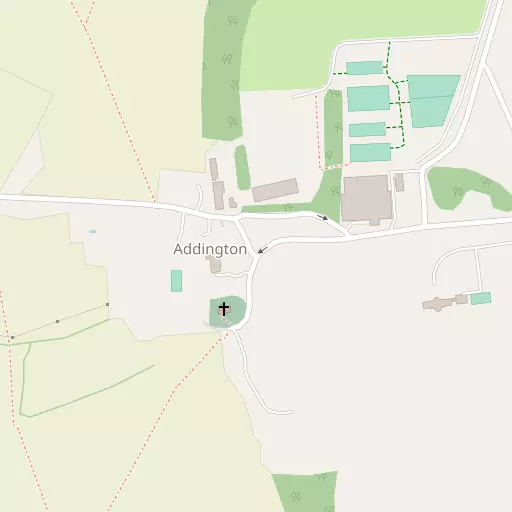
Local Map
⇅
Location Summary
- Addington is located in Buckinghamshire
- Administrative Area: Buckinghamshire
- Ceremonial County: Buckinghamshire
- Historic County: Buckinghamshire
- Region & Country: South East / England
⇅
Nearby Towns & Cities
- Winslow 2.9 km ESE
- Buckingham 7.2 km NW
- Bletchley 13.3 km ENE
- Aylesbury 16.7 km SSE
- Milton Keynes 15.3 km NE


⇅
Nearby Localities
- AdstockVillage 1.7 km NNW
- East ClaydonVillage 3.0 km S
- PadburyVillage 3.1 km NW
- Great HorwoodVillage 3.7 km NE
- Botolph ClaydonVillage 4.2 km SSW
- GranboroughVillage 4.3 km SSE
- Steeple ClaydonVillage 4.8 km WSW
- ThornboroughVillage 5.1 km N
- Little HorwoodVillage 5.2 km ENE
- HillesdenVillage 5.7 km W


⇅
Smaller Settlements
- Verney Junction 1.4 km SSW
- Shipton 3.6 km ESE
- Middle Claydon 3.7 km SW
- Singleborough 4.1 km NE
- Lenborough 5.3 km NW
- Hillesden Hamlet 7.0 km WNW
- Thornton 7.3 km N
- Greatmoor 7.4 km SSW
- Foscote 7.6 km NNW
- Shipton Lee 7.6 km S


⇅
Other places with this name
- Addington, Greater London 90.0 km SE
- Addington, Kent 114.8 km SE
- Addington, Cornwall296.9 km WSW

⇅
Beaches
- Cotswold Hills Beach78.4 km WSW
- Hadleigh Ray113.8 km ESE
- Mill Beach115.6 km ESE
⇅
Parks
- Elfield Park13.3 km NE
- The Green16.8 km WNW
- The Green17.2 km NE
- The Green24.8 km NW
⇅
Woods
- Fox Covert1.4 km NE
- Haskell Wood2.2 km NNW
- Larch Covert727 m ENE
- Tuckey Covert2.3 km SE
⇅
Hills
- Church Hill6.2 km E
- Knowl Hill5.9 km SW
- Millknob Hill3.7 km SE
- Sun Hill4.0 km E

⇅
Lakes
- Grebe Lake7.4 km WSW
- North Lake529 m N
- South Lake926 m SSE
- The Twins4.9 km NNW
⇅
Waterfalls
- Neptune Waterfall39.4 km SE
- The Cascade10.7 km NW
- Tower Waterfall38.7 km SE
⇅
Headlands
- Botany Bay Point64.0 km SSE
- Tripcock Ness85.3 km SE
⇅
Islands
- Grotto Island13.7 km SSW
- Monkey Island10.7 km NW
⇅
Wetlands
- Summer Leys37.8 km NNE
- Ranger's Marsh41.1 km W
- Cock Marsh44.0 km SSE

⇅
Health Services
- Buckingham HospitalHospital 7.3 km NW
- Bletchley Community HospitalHospital 13.0 km ENE
- Hamilton HouseMedical 7.3 km NW
- The Red House Nursing HomeMedical 7.7 km NNW
⇅
Education
- Sir Thomas Freemantle SchoolSchool 2.1 km E
- Furze Down SchoolSchool 2.1 km ESE
- Verney Park CampusUniversity 6.3 km NW
⇅
Railway Stations
- Quainton Road9.6 km S
- Bletchley13.5 km ENE
⇅
Bus Stations
- Bletchley Bus Station13.7 km ENE
- Aylesbury Bus Station16.7 km SSE
⇅
Coach Stations
- Milton Keynes Coachway19.1 km NE
- Luton Airport Bus and Coach Station38.2 km ESE
⇅
Ferry Terminals
- Hammerton's Pier69.9 km SE
- Hampton Ferry Boathouse71.1 km SSE
⇅
Airports
- London Oxford Airport30.2 km WSW
- Wycombe Air Park38.7 km SSE
⇅
Airfields
- Holmbeck Farm Airfield13.9 km ESE
- Bicester Airfield15.0 km WSW
⇅
Heliports
- Magpas Air Ambulance65.9 km NE
- The London Heliport73.9 km SE
⇅
Harbours
- Chelsea Harbour73.4 km SE
- Lydney Harbour112.4 km WSW