
Billinghay
About Billinghay
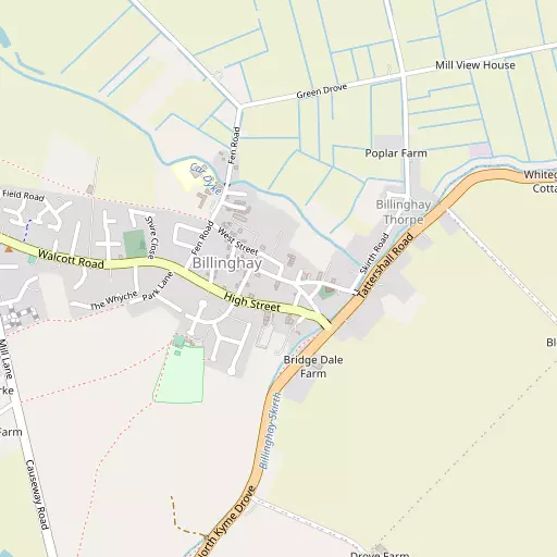
Billinghay, in Lincolnshire, has North Kyme just 2.2 km South, Walcott around 2.9 km North West, Tattershall Bridge around 4.3 km East North East and Timberland only 4.9 km North West. Other places in the surrounding countryside include Thorpe Tilney, Timberland Dales, Ewerby Thorpe, Kirkstead and Howell.
You may notice something interesting if you explore one of the nearby places.
The place data here is drawn from OS, ONS and OSM under open licence.
⇅
Local Map
⇅
Location Summary
- Billinghay is located in Lincolnshire
- Administrative Area: Lincolnshire
- Ceremonial County: Lincolnshire
- Historic County: Lincolnshire
- Region & Country: East Midlands / England
⇅
Nearby Towns & Cities
⇅
Nearby Localities
⇅
Smaller Settlements
⇅
Beaches
- Chapel St Leonards Beach
- Ingoldmells Beach
- Skegness Beach
⇅
Parks
- Bulwell Forest
- Burgage Green
- Larks Green
- Wilsford Warren
⇅
Woods
- Car Dike Plantation
- Drury Holt
- Sheath Wood
- Willow Row
⇅
Hills
- Bargate Hill
- Boughton Hill
- Corbet Hill
- Fox Hill
⇅
Lakes
- Kyme Eau
- Manor Lake
- Marsh Lake
- Meadow Lake
⇅
Waterfalls
- Kinder Downfall
- Lumb Fall
- The Cascade
⇅
Headlands
- Flamborough Head
- Red Cliff Point
⇅
Islands
- Branston Island
- Torksey Island
⇅
Wetlands
- Guildhall Springs
- Rush Marsh
- Gosberton Marsh
⇅
Health Services
- Magna House
- Ash Villa
- Martin Hall Nursing Home
- St Andrew's Nursing Home
⇅
Education
- The Billinghay Church of England Primary School
- Walcott Primary School
- Boston College
⇅
Railway Stations
- Ruskington
- Metheringham
⇅
Bus Stations
- Lincoln Central Bus Station
- Grantham Bus Station
⇅
Coach Stations
- Chesterfield Coach Station
- Meadowhall Interchange
⇅
Ferry Terminals
- Normanton Chain Ferry
- Hull Ferry Port
⇅
Airports
- Wickenby Aerodrome
- Humberside Airport
⇅
Airfields
- RAF Coningsby
- RAF Cranwell
⇅
Heliports
- Lincs and Notts Air Ambulance HQ
- Nottingham Heliport
⇅
Harbours
- Farndon Harbour
- South Killingholme Haven