
Boasley Cross
About Boasley Cross
Boasley Cross is in Devon. Neighbouring places include Bratton Clovelly around 4.0 km West South West, Bridestowe only 4.5 km South South East, Sourton only 4.8 km South East and Northlew just 5.4 km North. Other rural areas close to here include Thorndon Cross, Broadbury, Pool, Ashbury and Forda.
You might learn something new by clicking through to a nearby place.
All information is drawn from OS, ONS and OSM under open licence, reflecting the best available public data.
⇅
Local Map
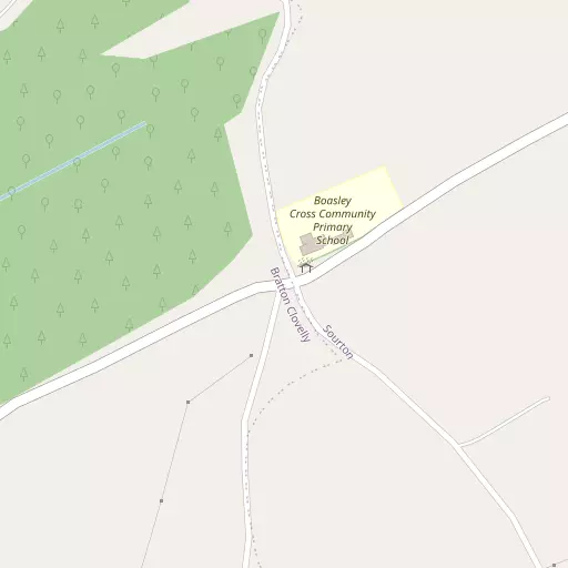
⇅
Location Summary
- Boasley Cross is located in Devon
- Administrative Area: Devon
- Ceremonial County: Devon
- Historic County: Devon
- Region & Country: South West / England
⇅
Nearby Towns & Cities
- Okehampton 8.9 km ENE
- North Tawton 18.2 km ENE
- Holsworthy 18.7 km WNW
- Launceston 19.2 km WSW
- Plymouth 39.3 km S


⇅
Nearby Localities
- Bratton ClovellyVillage 4.0 km WSW
- BridestoweVillage 4.5 km SSE
- SourtonVillage 4.8 km SE
- NorthlewVillage 5.4 km N
- GermansweekVillage 6.5 km W
- Halwill JunctionVillage 8.4 km NW
- Folly GateVillage 8.5 km ENE
- LewdownVillage 8.7 km SW
- LydfordVillage 8.8 km S
- HalwillVillage 9.2 km NW


⇅
Smaller Settlements
- Thorndon Cross 2.9 km E
- Broadbury 3.6 km NW
- Pool 4.1 km SSE
- Ashbury 4.3 km N
- Forda 4.4 km SE
- Patchacott 5.3 km NNW
- Eworthy 5.4 km WNW
- Combebow 6.0 km SSW
- Meldon 6.1 km E
- Beaworthy 7.0 km NW


⇅
Beaches
- Crooklets Beach32.7 km WNW
- Summerleaze Beach32.3 km WNW
- Widemouth Sand31.4 km WNW
⇅
Parks
- Palm Cross Green44.7 km SSE
- Pennsylvania Park42.6 km E
- Pleasure Grounds9.2 km E
- Summerleaze Down31.8 km WNW
⇅
Woods
- Boasley Wood1.2 km S
- Fursdon Wood2.1 km SW
- Knowle Plantation2.3 km SE
- Owlshole Wood542 m S
⇅
Hills
- Beara Down5.9 km SSE
- Cleave Hill5.3 km ENE
- Scobchester Down3.1 km NE
- Sourton Tors5.8 km SE

⇅
Lakes
- Alder Lake6.8 km SSW
- Meldon Reservoir6.5 km ESE
- Roadford Lake7.4 km WSW
- Westdown Pool8.0 km SSW

⇅
Waterfalls
- Becka Falls29.4 km ESE
- Broad Falls30.7 km SSE
- White Lady Waterfall10.2 km S
⇅
Headlands
- Pennard's Point31.5 km S
- Weir Point32.3 km S
⇅
Islands
- Combestone Island27.5 km SE
- Island of Rocks6.7 km ESE
⇅
Wetlands
- Smerdon Marsh8.1 km NE
- Taw Marsh12.5 km ESE
- Raybarrow Pool14.2 km ESE
⇅
Health Services
- Holsworthy HospitalHospital 18.9 km NW
- Launceston HospitalHospital 19.5 km WSW
- Hatherleigh Nursing HomeMedical 10.7 km NNE
- Blackdown Nursing HomeMedical 13.5 km S

⇅
Education
- Boasley Cross Community Primary SchoolSchool 77 m NE
- Bridestowe Primary SchoolSchool 4.6 km SSE
- University of St Mark and St JohnUniversity 33.7 km S
⇅
Railway Stations
- Meldon Viaduct6.8 km E
- Okehampton9.2 km E
⇅
Bus Stations
- Barnstaple Bus Station39.8 km N
- Exeter Bus Station42.4 km E
⇅
Coach Stations
- Plymouth Coach Station39.0 km S
- Torquay Coach Station50.0 km ESE
⇅
Ferry Terminals
- Torpoint Ferry Terminal39.0 km S
- Barbican Landing Stage39.8 km S
⇅
Airports
- Plymouth City Airport33.4 km S
- Exeter Airport50.3 km E
⇅
Airfields
- Eggesford Airfield24.4 km NE
- Eaglescott Airfield24.8 km NNE
⇅
Heliports
- Lake Heliport35.5 km NNW
- Hartland Heliport42.8 km NW
⇅
Harbours
- Weston Mill Lake37.1 km S
- Sutton Harbour39.5 km S