
Broad Green
About Broad Green
Broad Green, in Cambridgeshire, has Cheveley situated 1.3 km North North West, Saxon Street situated 1.4 km West South West, Ashley situated 1.9 km North North East, Kirtling just 2.8 km South and Ditton Green lying 3.2 km West South West. Other places in the surrounding countryside include Upend, Little Ditton, Woodditton and Back Street.
You might discover something new by clicking a nearby place for more local details.
The place data here is drawn from OS, ONS and OSM under open licence.
⇅
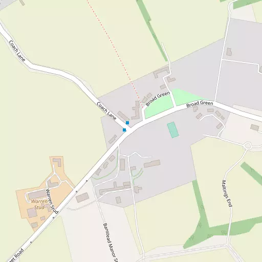
Local Map
⇅
Location Summary
- Broad Green is located in Cambridgeshire
- Administrative Area: Cambridgeshire
- Ceremonial County: Cambridgeshire
- Historic County: Cambridgeshire
- Region & Country: Eastern / England
⇅
Nearby Towns & Cities


⇅
Nearby Localities
- CheveleyVillage 1.3 km NNW
- Saxon StreetVillage 1.4 km WSW
- AshleyVillage 1.9 km NNE
- KirtlingVillage 2.8 km S
- Ditton GreenVillage 3.2 km WSW
- Lidgate Village 3.9 km SE
- Dalham Village 4.0 km ENE
- Kirtling GreenVillage 4.1 km S
- Moulton Village 4.5 km N
- StetchworthVillage 4.9 km WSW


⇅
Smaller Settlements
- Upend 2.0 km SE
- Little Ditton 2.4 km WSW
- Woodditton 3.1 km WSW
- Back Street 5.6 km ESE
- Dullingham Ley 5.7 km SW
- Cross Green 5.7 km WSW
- Dunstall Green 6.0 km E
- East Green 6.3 km S
- Boyden End 6.5 km SE
- Genesis Green 6.6 km ESE


⇅
Other places with this name
Closest
- Broad Green, Suffolk 9.5 km E
- Broad Green, Essex 18.2 km S
- Broad Green, Essex 31.8 km SW
- Broad Green, Suffolk 40.2 km E
- Broad Green, Essex 41.2 km SSE

Furthest away
- Broad Green 262.3 km WNW
- Broad Green, County of Herefordshire 220.3 km W
- Broad Green, Worcestershire 191.4 km W
- Broad Green, Greater London 100.5 km SSW
- Broad Green, Central Bedfordshire74.5 km W


⇅
Beaches
- Brightlingsea Beach58.5 km SE
- Mill Beach56.0 km SSE
- West Mersea Beach57.8 km SSE
⇅
Parks
- Cole Green20.4 km SSE
- Pound Green17.1 km E
- Risbridge Meadow13.0 km S
- The Green18.8 km SE
⇅
Woods
- Blackthorn Wood817 m S
- Bushy Wood750 m SSE
- Gorse Covert621 m ESE
- Osier Wood611 m S
⇅
Hills
- Bury Hill5.4 km NNW
- Folly Hill5.3 km N
- Side Hill4.5 km NW
- Warren Hill4.5 km NW
⇅
Lakes
- Bailey Pond3.8 km ESE
- Horseheath Pond5.8 km WSW
- Punchbowl Pond6.4 km WSW
- Todd's Pond7.1 km WSW
⇅
Waterfalls
- Neptune Waterfall92.1 km SW
- The Cascade103.5 km W
- Tower Waterfall92.3 km SW
⇅
Headlands
- North Weir Point70.4 km ESE
- West Point81.3 km S
⇅
Islands
- Riddy Island26.5 km WSW
- The Island8.8 km SSW
⇅
Wetlands
- The Marsh8.2 km NW
- Chesterton Fen20.7 km W
- Fowlmere31.6 km WSW
⇅
Health Services
- Newmarket HospitalHospital 6.5 km NW
- West Suffolk HospitalHospital 16.4 km E
- Brampton ManorMedical 6.4 km NW
- Kentford ManorMedical 6.6 km NNE
⇅
Education
- Cheveley Church of England Primary SchoolSchool 1.2 km NNW
- Moulton Church of England (Voluntary Controlled) Primary SchoolSchool 4.9 km N
- West Suffolk CollegeUniversity 16.1 km ENE
⇅
Railway Stations
- Newmarket5.2 km NW
- Dullingham7.2 km W
⇅
Bus Stations
- Haverhill Bus Station14.6 km S
- Mildenhall Bus Station14.9 km N
⇅
Coach Stations
- Stansted Airport Coach Station38.6 km SSW
- Luton Airport Bus and Coach Station68.7 km WSW
⇅
Ferry Terminals
- Harwich Ferry Port61.0 km ESE
- Burnham Ferry69.6 km SSE
⇅
Airports
- Cambridge City Airport20.1 km W
- Stansted Airport39.3 km SSW
⇅
Airfields
- RAF Mildenhall16.8 km N
- Ridgewell Airfield19.2 km SSE
⇅
Heliports
- The Egerton-Smith Centre20.4 km W
- Magpas Air Ambulance52.3 km WNW
⇅
Harbours
- Harwich Harbour63.2 km ESE
- Southwold Harbour82.3 km E