
Busveal
About Busveal
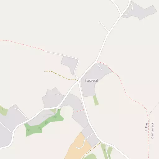
Busveal lies within Cornwall. Among the nearby places are Vogue only 940 m North East, Tolcarne around 1.0 km East North East, St Day situated 1.3 km East North East, Carharrack situated 1.4 km East South East and Mount Ambrose just 1.5 km North North West. Other countryside settlements include Higher Ninnis, Lower Ninnis, Trefula and Trevarth.
You may notice something interesting if you explore one of the nearby places.
All information is drawn from OS, ONS and OSM under open licence, reflecting the best available public data.
⇅
Local Map
⇅
Location Summary
- Busveal is located in Cornwall
- Administrative Area: Cornwall
- Ceremonial County: Cornwall
- Historic County: Cornwall
- Region & Country: South West / England
⇅
Nearby Towns & Cities
⇅
Nearby Localities
⇅
Smaller Settlements
⇅
Beaches
- Loe Beach
- Porthtowan Beach
- Portreath Beach
⇅
Parks
- Lanner Moor
- Palm Cross Green
- Summerleaze Down
- Trungle Moor
⇅
Woods
- Horse Wood
- Outer Wood
- Trevince Plantations
- Unity Wood
⇅
Hills
- Carn Brea
- Carn Marth
- North Downs
- Tubbon Hill
⇅
Lakes
- Boswyn Reservoir
- House of Water
- Stithians Reservoir
- Wheal Maid Tailings
⇅
Waterfalls
- Golitha Falls
- White Lady Waterfall
- Yealm Steps
⇅
Headlands
- Gooden Heane Point
- Tubby's Head
⇅
Islands
- Godrevy Island
- The Island
⇅
Wetlands
- Weir Point
- Pill Point
- Turnaware Point
⇅
Health Services
- Camborne Redruth Community Hospital
- Treliske Hospital
- Trefula House Nursing Home
- The Green
⇅
Education
- St Day and Carharrack Community School
- Pennoweth Primary School
- Cornwall College of Further and Higher Education
⇅
Train Stations
- Redruth
- Perranwell
⇅
Bus Stations
- Camborne Bus Station
- Truro Bus Station
⇅
Coach Stations
- Plymouth Coach Station
- Torquay Coach Station
⇅
Ferry Terminals
- Trelissick
- Philleigh
⇅
Airports
- Newquay Cornwall Airport
- Land's End Airport
⇅
Airfields
- Truro Airfield
⇅
Heliports
- Penzance Heliport
⇅
Harbours
- South Harbour
- Penryn Harbour