
Castle Camps
About Castle Camps
Castle Camps lies within Cambridgeshire. Nearby places include Shudy Camps situated 1.7 km North West, Hazel Stub only 2.5 km East North East, Helions Bumpstead only 2.6 km South East, Chimswell only 3.0 km North East and Hanchett End just 3.2 km North North East. Other rural communities nearby include Nosterfield End, Camps End, Mill Green and Pale Green.
You may notice something interesting if you explore one of the nearby places.
All information is drawn from OS, ONS and OSM under open licence, reflecting the best available public data.
⇅
Local Map
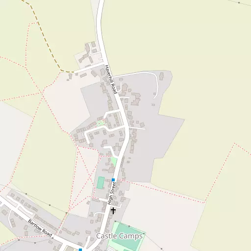
⇅
Location Summary
- Castle Camps is located in Cambridgeshire
- Administrative Area: Cambridgeshire
- Ceremonial County: Cambridgeshire
- Historic County: Cambridgeshire
- Region & Country: Eastern / England
⇅
Nearby Towns & Cities
- Haverhill 4.2 km ENE
- Saffron Walden 10.7 km WSW
- Thaxted 12.9 km SSW
- Clare 13.7 km E
- Cambridge 23.6 km NW


⇅
Nearby Localities
- Shudy CampsVillage 1.7 km NW
- Hazel Stub District 2.5 km ENE
- Helions Bumpstead Village 2.6 km SE
- Chimswell District 3.0 km NE
- Hanchett End District 3.2 km NNE
- Clements District 3.4 km ENE
- Steventon End Village 3.7 km W
- Parkway District 3.7 km NE
- HorseheathVillage 4.0 km NNW
- Chalkstone District 4.9 km ENE


⇅
Smaller Settlements
- Nosterfield End 793 m NNE
- Camps End 2.0 km WSW
- Mill Green 2.0 km NNW
- Pale Green 2.7 km ESE
- Cardinal's Green 3.1 km NNW
- Wiggens Green 3.3 km ESE
- Radwinter End 4.4 km SSW
- Streetly End 4.8 km NNW
- Smith's Green 5.0 km SE
- Water End 5.4 km WSW

⇅
Beaches
- Brightlingsea Beach52.0 km SE
- Mill Beach44.0 km SSE
- West Mersea Beach49.4 km SE

⇅
Parks
- Cole Green15.8 km E
- Risbridge Meadow7.8 km ENE
- The Green18.5 km SW
- The Green21.7 km ENE

⇅
Woods
- Castle Camps Millennium Wood912 m SW
- Lake Plantation1.5 km NW
- New Plantation897 m NW
- Priory Plantation1.6 km NNW
⇅
Hills
- Haw's Hill7.3 km WNW
- Jarvis Hill6.3 km NE
- Midsummer Hill4.8 km SW
- Red Oaks Hill4.8 km SW

⇅
Lakes
- Acre Pond4.0 km NNW
- Baythorne Deeps8.7 km E
- Moll Pond8.3 km WSW
- The Waver7.7 km ESE
⇅
Waterfalls
- Neptune Waterfall77.6 km WSW
- The Cascade95.7 km W
- Tower Waterfall77.9 km WSW
⇅
Headlands
- Tripcock Ness65.2 km SSW
- West Point66.3 km SSE
⇅
Islands
- Duck Island12.5 km WSW
- The Island8.4 km NNE
⇅
Wetlands
- The Marsh21.1 km N
- Fowlmere22.7 km W
- Chesterton Fen23.3 km NW

⇅
Health Services
- Saffron Walden Community HospitalHospital 9.7 km WSW
- Ida Darwin HospitalHospital 17.9 km NW
- The MeadowsMedical 3.1 km NE
- Cleves Place Care HomeMedical 4.6 km ENE
⇅
Education
- Castle Camps Church of England (Controlled) Primary SchoolSchool 512 m SSW
- St Felix Roman Catholic Primary SchoolSchool 3.0 km ENE
- Strangeways Research LaboratoryUniversity 19.8 km NW
⇅
Railway Stations
- Great Chesterford12.9 km W
- Audley End13.8 km WSW
⇅
Bus Stations
- Haverhill Bus Station4.4 km ENE
- Addenbrooke's Bus Station20.2 km NW
⇅
Coach Stations
- Stansted Airport Coach Station21.4 km SSW
- Luton Airport Bus and Coach Station55.9 km WSW
⇅
Ferry Terminals
- Burnham Ferry57.7 km SSE
- Harwich Ferry Port60.9 km ESE
⇅
Airports
- Cambridge City Airport20.7 km NW
- Stansted Airport22.1 km SSW
⇅
Airfields
- Ridgewell Airfield12.1 km E
- Wethersfield Airfield13.6 km SE
⇅
Heliports
- The Egerton-Smith Centre21.2 km NW
- Magpas Air Ambulance55.2 km NW
⇅
Harbours
- Harwich Harbour63.6 km ESE
- Chelsea Harbour76.4 km SSW