
Caversfield, Bicester
About Caversfield
Caversfield lies 1.1 km SSW from Bicester in Oxfordshire. Among the nearby places are Woodfield just 1.1 km South South West, Bure Park situated 1.4 km South South West, Highfield only 2.0 km South South West and Stratton Audley only 2.2 km East North East. Other nearby settlements include Bainton, Hardwick, Godington, Little Chesterton and Baynard's Green.
You may find extra local information by clicking a nearby place.
The place data here is drawn from OS, ONS and OSM under open licence.
⇅
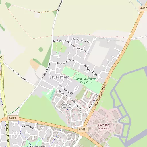
Local Map
⇅
Location Summary
- Caversfield is a neighbourhood in Bicester
- Administrative Area: Oxfordshire
- Ceremonial County: Oxfordshire
- Historic County: Oxfordshire
- Region & Country: South East / England
⇅
Nearby Towns & Cities
- Parent town: Bicester
- Bicester 2.7 km S
- Brackley 12.5 km N
- Buckingham 14.1 km NE
- Kidlington 14.7 km SW
- Oxford 20.2 km SSW


⇅
Nearby Localities
- WoodfieldDistrict 1.1 km SSW
- Bure ParkDistrict 1.4 km SSW
- HighfieldDistrict 2.0 km SSW
- Stratton AudleyVillage 2.2 km ENE
- GreenwoodDistrict 2.4 km SW
- King's EndDistrict 2.7 km SSW
- LauntonVillage 2.9 km SE
- BucknellVillage 3.0 km W
- Bicester VillageDistrict 3.1 km SSW
- Langford VillageDistrict 3.6 km S


⇅
Smaller Settlements
- Bainton 2.2 km NNW
- Hardwick 4.8 km NNW
- Godington 5.5 km ENE
- Little Chesterton 5.6 km SW
- Baynard's Green 5.8 km NW
- Tusmore 6.3 km NNW
- Chetwode 7.0 km NE
- Lower Arncott 7.2 km SSE
- Juniper Hill 7.6 km N
- Barton Hartshorn 7.7 km NE


⇅
Beaches
- Cotswold Hills Beach63.0 km WSW
- Goatee Beach114.6 km SSW
- Weston Point115.8 km S

⇅
Parks
- Elfield Park28.6 km ENE
- Merton Field20.3 km SSW
- The Green9.8 km N
- The Green18.3 km NNW
⇅
Woods
- Bainton Copse1.3 km NNW
- Bainton Spinney2.1 km NNW
- Cotmore Covert1.2 km N
- Longlands Spinney1.8 km ESE

⇅
Hills
- Blackthorn Hill4.8 km SSE
- Fringford Hill3.8 km NE
- Graven Hill4.5 km S
- Poundon Hill4.8 km E

⇅
Lakes
- Bradbury Brook5.3 km NE
- Bull's Corner3.9 km NNE
- Trigger Pond3.0 km W
- Trow Pool4.2 km W

⇅
Waterfalls
- Neptune Waterfall48.7 km ESE
- The Cascade14.8 km NE
- Tower Waterfall47.9 km ESE
⇅
Headlands
- Botany Bay Point68.1 km SE
- Tripcock Ness96.7 km ESE
⇅
Islands
- China Island12.4 km SE
- Grotto Island12.3 km SE
⇅
Wetlands
- Ranger's Marsh25.3 km W
- Brassey44.8 km W
- Cock Marsh48.2 km SE
⇅
Health Services
- Bicester Community HospitalHospital 2.8 km SSW
- Brackley Medical Centre and Community HospitalHospital 13.1 km N
- Cherwood HouseMedical 475 m ENE
- Fewcott House Nursing HomeMedical 5.7 km WNW

⇅
Education
- Bardwell SchoolSchool 1.0 km S
- Southwold SchoolSchool 1.0 km SSW
- University of BuckinghamUniversity 13.5 km NE
⇅
Railway Stations
- Bicester North1.9 km S
- Bicester Village3.1 km S
⇅
Bus Stations
- Aylesbury Bus Station25.6 km ESE
- Bletchley Bus Station29.4 km ENE
⇅
Coach Stations
- Milton Keynes Coachway34.0 km ENE
- High Wycombe Coachway43.0 km SE
⇅
Ferry Terminals
- Hammerton's Pier77.8 km SE
- Hampton Ferry Boathouse78.1 km SE
⇅
Airports
- London Oxford Airport15.1 km SW
- Wycombe Air Park41.7 km SE
⇅
Airfields
- Bicester Airfield940 m ESE
- Weston-on-the-Green Airfield6.9 km SW
⇅
Heliports
- Magpas Air Ambulance79.5 km NE
- The London Heliport83.3 km SE
⇅
Harbours
- Chelsea Harbour82.8 km SE
- Lydney Harbour96.6 km WSW