
Church Cove, Lizard
About Church Cove
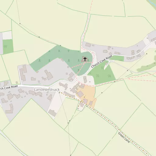
Church Cove is 744 m W from Lizard in the county of Cornwall. Among the nearby places are Lizard only 744 m West, Cadgwith lying 2.2 km North North East, Ruan Minor just 2.8 km North North East and Kuggar only 3.9 km North North East. Other places in the wider area include Housel Bay, St Ruan, Poltesco, Treal and Ruan Major.
You may find extra local information by clicking a nearby place.
The details shown here use OS, ONS and OSM data provided under open licence.
⇅
Local Map
⇅
Location Summary
- Church Cove is a neighbourhood in Lizard
- Administrative Area: Cornwall
- Ceremonial County: Cornwall
- Historic County: Cornwall
- Region & Country: South West / England
⇅
Nearby Towns & Cities
⇅
Nearby Localities
⇅
Smaller Settlements
⇅
Beaches
- Kennack Sands
- Pentreath Beach
- Sandy Vro
⇅
Parks
- Lanner Moor
- Palm Cross Green
- Summerleaze Down
- Trungle Moor
⇅
Woods
- Bonython Plantations
- Croft Pascoe Forest
- Fox Covert
- Twenty Acre Plantation
⇅
Hills
- Brill Hill
- Prospidnick Hill
- Roskruge Beacon
- Trenoweth Hill
⇅
Lakes
- Croft Pascoe Pool
- Hayle Kimbro Pool
- Leech Pool
- Ruan Pool
⇅
Waterfalls
- Golitha Falls
- White Lady Waterfall
- Yealm Steps
⇅
Headlands
- Bass Point
- Lizard Point
⇅
Islands
- Mullion Island
- The Island
⇅
Wetlands
- Polbream Point
- Lowland Point
- Polcries
⇅
Health Services
- Helston Community Hospital
- Falmouth Hospital
- Poldhu Nursing and Residential Home
- Porthgwara
⇅
Education
- Landewednack Community Primary School
- Grade Ruan Church of England School
- Falmouth University
⇅
Train Stations
- Truthall Halt
- Tregadjack Sidings
⇅
Bus Stations
- Camborne Bus Station
- Penzance Bus Station
⇅
Coach Stations
- Plymouth Coach Station
- Torquay Coach Station
⇅
Ferry Terminals
- Penzance Ferry Terminal
- Trelissick
⇅
Airports
- Land's End Airport
- Newquay Cornwall Airport
⇅
Airfields
- Predannack Airfield
⇅
Heliports
- Penzance Heliport
⇅
Harbours
- Gillan Harbour
- Porthleven Harbour