
Churchtown
About Churchtown
Churchtown, in Devon, has Bridgerule just 1.2 km West South West, Derril only 2.4 km East, Pyworthy situated 3.0 km East, Grimscott lying 4.2 km North North West and Whitstone situated 5.0 km South South West. Other rural places nearby include Borough, Red Post, Pancrasweek and Kingford.
You may notice something interesting if you explore one of the nearby places.
The details shown here use OS, ONS and OSM data provided under open licence.
⇅
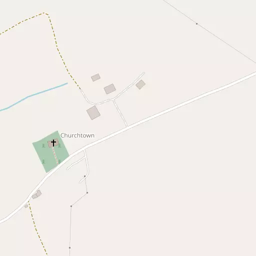
Local Map
⇅
Location Summary
- Churchtown is located in Devon
- Administrative Area: Devon
- Ceremonial County: Devon
- Historic County: Devon
- Region & Country: South West / England
⇅
Nearby Towns & Cities
- Holsworthy 6.0 km E
- Stratton 6.1 km WNW
- Bude 8.1 km WNW
- Launceston 19.4 km SSE
- Plymouth 52.5 km SSE


⇅
Nearby Localities
- BridgeruleVillage 1.2 km WSW
- DerrilVillage 2.4 km E
- PyworthyVillage 3.0 km E
- GrimscottVillage 4.2 km NNW
- WhitstoneVillage 5.0 km SSW
- ChilsworthyVillage 5.5 km NE
- MarhamchurchVillage 5.9 km W
- HillheadDistrict 6.5 km WNW
- WhimbleVillage 6.6 km E
- North TamertonVillage 6.7 km SSE


⇅
Smaller Settlements
- Borough 2.3 km WSW
- Red Post 2.6 km NW
- Pancrasweek 2.9 km NNE
- Kingford 2.9 km N
- Budd's Titson 4.4 km WSW
- Lana 4.5 km NNE
- Launcells 4.6 km WNW
- Hersham 5.2 km NNW
- Derriton 5.2 km E
- Chasty 5.8 km E


⇅
Other places with this name
- Churchtown, Cornwall31.9 km SSW
- Churchtown, Somerset77.1 km ENE
- Churchtown, Shropshire 208.5 km NNE
- Churchtown, Derbyshire 326.5 km NE
- Churchtown 333.2 km NNE
- Churchtown, Lancashire 360.1 km NNE

⇅
Beaches
- Crooklets Beach9.0 km WNW
- Summerleaze Beach8.7 km WNW
- Widemouth Sand8.7 km W
⇅
Parks
- Palm Cross Green63.5 km SE
- Pleasure Grounds32.0 km ESE
- Summerleaze Down8.2 km WNW
- The Warren52.7 km NNE


⇅
Woods
- Burn Wood1.3 km WNW
- Derrill Plantation2.0 km ENE
- North Wood2.6 km WSW
- Worthen Wood2.7 km SSE
⇅
Hills
- Horslett Hill7.0 km SE
- Raggot Hill6.2 km SE
- Shalder Hill8.1 km WNW
- Woodsdown Hill6.3 km NNE
⇅
Lakes
- Lower Tamar Lake7.9 km N
- Maer Lake Nature Reserve8.7 km WNW
- Upper Tamar Lake9.0 km N
- Wooda Lakes6.1 km NNE
⇅
Waterfalls
- Broad Falls51.7 km SE
- Golitha Falls35.1 km S
- White Lady Waterfall29.4 km SE

⇅
Headlands
- Lower Sharpnose Point12.6 km NW
- Menachurch Point9.9 km WNW
⇅
Islands
- Chapel Rock8.9 km WNW
- The Island27.2 km WSW
⇅
Wetlands
- Crowdy Marsh23.7 km SSW
- Portledge Mouth23.9 km NNE
- Trewint Marsh23.9 km SSW
⇅
Health Services
- Stratton HospitalHospital 6.3 km WNW
- Holsworthy HospitalHospital 6.5 km ENE
- Deer Park Nursing HomeMedical 5.6 km ENE
- TrelanaMedical 7.8 km NW
⇅
Education
- Bridgerule Church of England Primary SchoolSchool 746 m WSW
- Highgate Hill House SchoolSchool 5.0 km SSW
- PetrocUniversity 38.5 km NE
⇅
Railway Stations
- Newmills18.2 km S
- Launceston18.8 km SSE
⇅
Bus Stations
- Barnstaple Bus Station40.7 km NE
- Newquay Bus Station63.0 km SW

⇅
Coach Stations
- Plymouth Coach Station52.1 km SSE
- Torquay Coach Station73.4 km ESE
⇅
Ferry Terminals
- Torpoint Ferry Terminal50.6 km SSE
- Plymouth Stonehouse52.3 km SSE
⇅
Airports
- Plymouth City Airport48.2 km SSE
- Newquay Cornwall Airport57.2 km SW
⇅
Airfields
- Davidstow Airfield22.2 km SW
- Belle Vue Airfield31.0 km NE
⇅
Heliports
- Hartland Heliport24.6 km NNW
- Lake Heliport28.7 km NNE
⇅
Harbours
- Weston Mill Lake48.9 km SSE
- Polperro Harbour52.7 km S