
Claypits
About Claypits
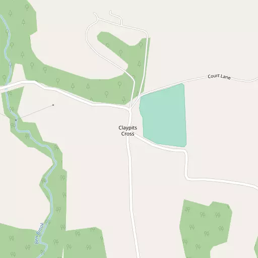
Claypits sits within Devon. Local places nearby include Morebath lying 1.4 km West South West, Shillingford situated 2.0 km South East, Bampton only 3.2 km South South West, Exebridge just 3.9 km West South West and Upton just 4.4 km North North East. Other nearby hamlets and settlements include Skilgate, Bury, Petton and Hartford.
You may find out something new or interesting if you click a nearby place to see more local information.
The place data here is drawn from OS, ONS and OSM under open licence.
⇅
Local Map
⇅
Location Summary
- Claypits is located in Devon
- Administrative Area: Devon
- Ceremonial County: Devon
- Historic County: Devon
- Region & Country: South West / England
⇅
Nearby Towns & Cities
- Dulverton 6.0 km WNW
- Wiveliscombe 11.5 km ENE
- Tiverton 12.9 km S
- Wellington 17.7 km ESE
- Exeter 33.2 km S


⇅
Nearby Localities
- MorebathVillage 1.4 km WSW
- ShillingfordVillage 2.0 km SE
- BamptonVillage 3.2 km SSW
- ExebridgeVillage 3.9 km WSW
- UptonVillage 4.4 km NNE
- BrushfordVillage 4.5 km W
- HuntshamVillage 6.0 km SE
- CoveVillage 6.0 km S
- BattletonVillage 6.0 km WNW
- Brompton RegisVillage 6.4 km NNW


⇅
Smaller Settlements
- Skilgate 2.7 km NE
- Bury 3.2 km NW
- Petton 3.8 km E
- Hartford 4.2 km NNW
- Venn 5.0 km NNW
- Raddington 5.2 km E
- Clayhanger 5.8 km ESE
- Oakfordbridge 6.0 km SW
- Woolcotts 6.2 km N
- Chipstable 7.6 km ENE


⇅
Other places with this name
- Claypits, Gloucestershire 113.3 km NE
⇅
Beaches
- Blue Anchor Beach19.4 km NNE
- Dunster Beach20.2 km N
- West Street Beach20.8 km NNE
⇅
Parks
- Pennsylvania Park31.4 km S
- Pleasure Grounds48.4 km SW
- The Lawn48.6 km S
- The Warren47.2 km WNW
⇅
Woods
- Alder Copse353 m NW
- Beech Copse408 m N
- Loyton Plantation372 m SW
- Loytonpark Copse263 m SE
⇅
Hills
- Cornet Hill3.1 km E
- Haddon Hill3.2 km N
- Hukeley Knap1.7 km S
- Quartley Hill2.2 km ENE
⇅
Lakes
- Bird Pond3.7 km NNW
- Black Pool3.3 km W
- Meeting of the Waters3.4 km W
- Sedge Pool4.7 km WNW
⇅
Waterfalls
- Becka Falls49.8 km SSW
- Horseshoe Falls60.6 km SSW
- White Lady Waterfall62.7 km SW
⇅
Headlands
- Blue Ben24.1 km NE
- Hurlstone Point24.8 km NNW
⇅
Islands
- Fenning Island38.3 km NE
- Stert Island39.7 km NE
⇅
Wetlands
- Barton Marsh10.7 km W
- New Marsh18.2 km ENE
- Kermoor Piling19.0 km NNE
⇅
Health Services
- Castle Place PracticeHospital 12.2 km S
- Wellington Community HospitalHospital 17.8 km ESE
- Castle Grove Residential HomeMedical 3.1 km SSW
- Oaktree CourtMedical 18.4 km ESE
⇅
Education
- Bampton (Voluntary Aided) Primary SchoolSchool 3.7 km SSW
- Dulverton Middle and Community SchoolSchool 5.5 km WNW
- Exeter AcademyUniversity 31.3 km S
⇅
Railway Stations
- Tiverton Parkway13.7 km SE
- Washford17.5 km NNE
⇅
Bus Stations
- Taunton Bus Station25.6 km E
- Exeter Bus Station32.7 km S
⇅
Coach Stations
- Torquay Coach Station60.7 km S
- Plymouth Coach Station86.0 km SSW
⇅
Ferry Terminals
- Starcross Pier43.6 km S
- Newport Transporter Bridge West70.1 km NNE
⇅
Airports
- Exeter Airport31.8 km S
- Cardiff Airport43.2 km NNE
⇅
Airfields
- Dunkeswell Airfield24.1 km SE
- Watchford Farm29.3 km ESE
⇅
Heliports
- Lake Heliport54.5 km W
- Cardiff City Heliport55.1 km NNE
⇅
Harbours
- Watchet Harbour20.9 km NNE
- Lynmouth Harbour34.5 km NW