
Copperhouse, Hayle
About Copperhouse
Copperhouse sits 443 m NW of Hayle in Cornwall. Local places nearby include Phillack situated 443 m North West, Ventonleague lying 510 m East North East, Guildford only 704 m East and Foundry situated 1.2 km South West. Other nearby settlements include Trelissick, St Erth Praze, Griggs, Fraddam and Calloose.
You might learn something new by clicking through to a nearby place.
This information is based on OS, ONS and OSM data released under open licence.
⇅
Local Map
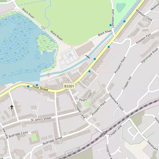
⇅
Location Summary
- Copperhouse is a neighbourhood in Hayle
- Administrative Area: Cornwall
- Ceremonial County: Cornwall
- Historic County: Cornwall
- Region & Country: South West / England
⇅
Nearby Towns & Cities
⇅
Nearby Localities
⇅
Smaller Settlements
⇅
Beaches
- Beach View
- Hayle Towans
- Mexico Towans
⇅
Parks
- Lanner Moor
- Palm Cross Green
- Summerleaze Down
- Trungle Moor
⇅
Woods
- Gyes Moor
- Lower Covert
- Park Plantation
- Start Plantation
⇅
Hills
- Carn Stabba
- The Knavocks
- Trencrom Hill
- Trink Hill
⇅
Lakes
- Bussow Reservoir
- Cargenwen Reservoir
- Carnsew Pool
- Nance Fishing Lakes
⇅
Waterfalls
- Golitha Falls
- White Lady Waterfall
- Yealm Steps
⇅
Headlands
- Carrack Gladden
- Porthminster Point
⇅
Islands
- Godrevy Island
- St Michael's Mount
⇅
Wetlands
- Copperhouse Pool
- Bamaluz Point
- Marazion Marsh
⇅
Health Services
- St Michael's Hospital
- Edward Hain Community Hospital
- Bonaer Care Home
- The Beeches Nursing Home
⇅
Education
- Bodriggy Academy
- Hayle Academy
- Cornwall College of Further and Higher Education
⇅
Train Stations
- Hayle
- Lelant
⇅
Bus Stations
- St Ives
- Camborne Bus Station
⇅
Coach Stations
- Plymouth Coach Station
- Torquay Coach Station
⇅
Ferry Terminals
- Penzance Ferry Terminal
- Trelissick
⇅
Airports
- Land's End Airport
- Newquay Cornwall Airport
⇅
Airfields
- Royal Navy Air Station Culdrose
⇅
Heliports
- Penzance Heliport
⇅
Harbours
- Porthleven Harbour
- Newlyn Harbour