
Crediton
About Crediton
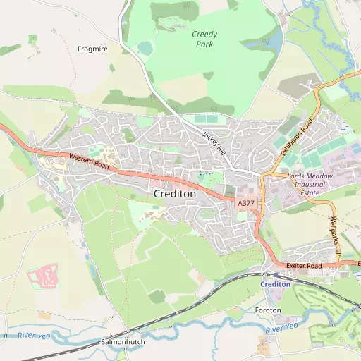
Crediton, in Devon, has West Town only 545 m West, East Town around 623 m East, Westwood around 948 m West South West and Fordton lying 1.2 km South East. Other rural localities include Salmonhutch, Uton, Hookway, Lower Creedy and West Sandford.
You might learn something new by clicking through to a nearby place.
Data shown here comes from OS, ONS and OSM under open licence, using the latest public sources available.
⇅
Local Map
⇅
Location Summary
- Crediton is located in Devon
- Administrative Area: Devon
- Ceremonial County: Devon
- Historic County: Devon
- Region & Country: South West / England
⇅
Nearby Towns & Cities
⇅
Nearby Localities
⇅
Smaller Settlements
⇅
Beaches
- Cockle Sand
- Powderham Sand
- Starcross Sand
⇅
Parks
- Palm Cross Green
- Pennsylvania Park
- Pleasure Grounds
- The Lawn
⇅
Woods
- Long Plantation
- Poundshill Plantation
- The Rookery
- Two Acre Plantation
⇅
Hills
- Downes Head
- Pounds Hill
- Red Cross Hill
- Round Hill
⇅
Lakes
- Binneford
- Combe Fish Ponds
- Shoebrooke Lake
- The Lake
⇅
Waterfalls
- Becka Falls
- Horseshoe Falls
- White Lady Waterfall
⇅
Headlands
- Hole Head
- The Ness
⇅
Islands
- Bellpool Island
- Island of Rocks
⇅
Wetlands
- Duck's Marsh
- Long Marsh
- West Mud
⇅
Health Services
- Crediton Hospital
- Franklyn Community Hospital
- Langford Park
- Barton Place
⇅
Education
- Queen Elizabeth's School Upper
- Haywards Primary School
- Duryard Halls of Residence
⇅
Train Stations
- Newton St Cyres
- Yeoford
⇅
Bus Stations
- Exeter Bus Station
- Barnstaple Bus Station
⇅
Coach Stations
- Torquay Coach Station
- Plymouth Coach Station
⇅
Ferry Terminals
- Starcross Pier
- Greenway Quay
⇅
Airports
- Exeter Airport
- Plymouth City Airport
⇅
Airfields
- Eggesford Airfield
⇅
Heliports
- Lake Heliport
⇅
Harbours
- Lympstone Boat Shelter
- Old Harbour