
Crumplehorn, Polperro
About Crumplehorn
Crumplehorn sits 593 m SSE of Polperro in Cornwall. Nearby places include Polperro around 593 m South South East, Carey Park around 983 m East North East, Trelawne situated 2.7 km North North East, Pelynt situated 3.5 km North and West Looe situated 4.6 km East North East. Other communities nearby include Porthallow, Talland, Lansallos and Trenewan.
You may notice something interesting if you explore one of the nearby places.
All information is drawn from OS, ONS and OSM under open licence, reflecting the best available public data.
⇅
Local Map
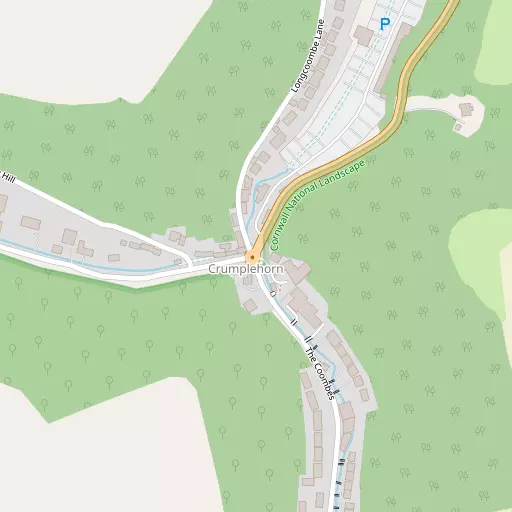
⇅
Location Summary
- Crumplehorn is a neighbourhood in Polperro
- Administrative Area: Cornwall
- Ceremonial County: Cornwall
- Historic County: Cornwall
- Region & Country: South West / England
⇅
Nearby Towns & Cities


⇅
Nearby Localities


⇅
Smaller Settlements
- Porthallow 2.1 km ENE
- Talland 2.5 km E
- Lansallos 3.2 km W
- Trenewan 3.6 km WNW
- Portlooe 3.8 km ENE
- Muchlarnick 5.2 km NNE
- Lanteglos Highway 6.1 km WNW
- Pendriscott 6.3 km N
- Penpoll 6.5 km WNW
- St Martin 6.6 km NE


⇅
Beaches
- Rotterdam Beach2.1 km E
- Samphire Beach4.4 km E
- Talland Sand1.9 km E
⇅
Parks
- Lanner Moor49.6 km WSW
- Palm Cross Green45.0 km E
- Pleasure Grounds57.9 km NE
- Summerleaze Down55.2 km N

⇅
Woods
- Catherinepark Wood3.3 km NNE
- Marypark Wood3.0 km NNE
- Ten Acre Wood3.7 km NE
- Warren Plantation3.7 km NNE
⇅
Hills
- Chapel Hill904 m SE
- Hard Head841 m SSW
- Hobb's Hill782 m ENE
- Trefanny Hill5.8 km N


⇅
Lakes
- Higher Penventinue Reservoir9.0 km W
- Shillamill Lakes7.1 km NNW
- The Lake10.2 km NW
- Wayland Reservoir3.7 km ENE
⇅
Waterfalls
- Golitha Falls17.2 km N
- White Lady Waterfall43.5 km NE
- Yealm Steps42.9 km ENE
⇅
Headlands
- Downend Point1.6 km ESE
- Peak Rock898 m SE

⇅
Islands
- Little Island5.5 km E
- St George's Island5.2 km E
⇅
Wetlands
- Trenant Point5.3 km ENE
- Brawn Point7.6 km W
- Hay Point8.4 km WNW
⇅
Health Services
- Fowey HospitalHospital 8.1 km W
- LaylandHospital 13.7 km NNE
- Hillcrest HouseMedical 6.1 km ENE
- Meadowbrook HouseMedical 12.4 km NW
⇅
Education
- Polperro Community Primary SchoolSchool 888 m E
- Pelynt SchoolSchool 3.7 km N
- Peninsula Dental SchoolUniversity 25.5 km E
⇅
Railway Stations
- Looe5.5 km ENE
- Sandplace7.1 km NE
⇅
Bus Stations
- Truro Bus Station38.2 km WSW
- Newquay Bus Station40.8 km WNW
⇅
Coach Stations
- Plymouth Coach Station27.3 km E
- Torquay Coach Station71.7 km ENE
⇅
Ferry Terminals
- Bodinnick7.6 km W
- Caffa Mill Slipway7.8 km W
⇅
Airports
- Plymouth City Airport31.0 km ENE
- Newquay Cornwall Airport36.8 km WNW
⇅
Airfields
- Bodmin Airfield20.9 km NNW
- Davidstow Airfield34.1 km N
⇅
Heliports
- Cornwall Air Ambulance Station34.3 km WNW
- Penzance Heliport74.0 km WSW
⇅
Harbours
- Polperro Harbour732 m SE
- Fowey Harbour7.8 km W