
Culverhays
About Culverhays
Culverhays, in Somerset, has Bicknoller just 1.3 km North, Stogumber just 1.7 km West South West, Crowcombe situated 3.2 km East South East and Sampford Brett situated 3.2 km North West. Other rural communities nearby include Newton, Kingswood, Heddon Oak, Higher Halsway and Lower Halsway.
You may notice something interesting if you explore one of the nearby places.
The information presented here is derived from OS, ONS and OSM under open licence.
⇅
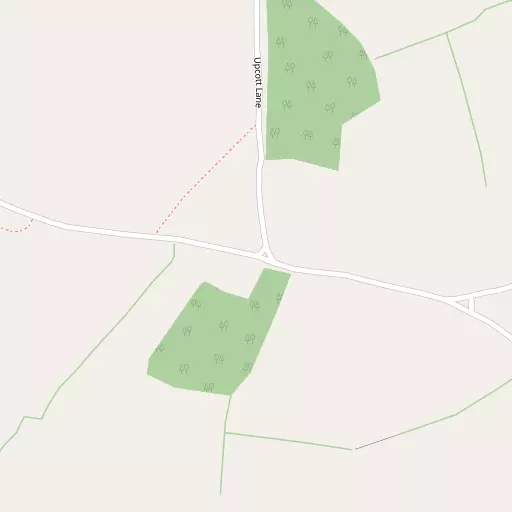
Local Map
⇅
Location Summary
- Culverhays is located in Somerset
- Administrative Area: Somerset
- Ceremonial County: Somerset
- Historic County: Somerset
- Region & Country: South West / England
⇅
Nearby Towns & Cities
- Watchet 6.7 km NW
- Wiveliscombe 10.7 km SSW
- Minehead 16.5 km WNW
- Taunton 17.6 km SE
- Cardiff 38.9 km N


⇅
Nearby Localities
- BicknollerVillage 1.3 km N
- StogumberVillage 1.7 km WSW
- CrowcombeVillage 3.2 km ESE
- Sampford BrettVillage 3.2 km NW
- West QuantoxheadVillage 3.5 km N
- MonksilverVillage 4.0 km W
- WillitonVillage 4.6 km NW
- HolfordVillage 5.2 km NE
- DonifordVillage 5.4 km NNW
- Lydeard St LawrenceVillage 5.8 km SSE


⇅
Smaller Settlements
- Newton 811 m NW
- Kingswood 875 m WSW
- Heddon Oak 1.2 km SE
- Higher Halsway 1.3 km E
- Lower Halsway 1.7 km E
- Vellow 1.8 km WNW
- Cottiford 1.9 km NW
- Escott 2.1 km W
- Woolston 2.4 km NW
- Lawford 2.5 km SE

⇅
Beaches
- Blue Anchor Beach10.8 km WNW
- Dunster Beach12.9 km WNW
- West Street Beach7.0 km NW
⇅
Parks
- Castle Green39.1 km N
- Cooper's Fields39.3 km N
- Splott Park39.9 km NNE
- Worle Moor34.2 km NE

⇅
Woods
- Alder Grove Plot192 m NNE
- Doble's Wood76 m SSW
- Holly Copse648 m SSE
- Upcott Wood409 m NNE
⇅
Hills
- Bicknoller Hill1.8 km NNE
- Halsway Hill2.1 km ENE
- Thorncombe Hill2.2 km ENE
- Weacombe Hill2.1 km N

⇅
Lakes
- Island Pond5.2 km W
- Mare's Pool5.3 km NE
- The Swill5.3 km NNW
- Wilmot's Pool4.0 km E
⇅
Waterfalls
- Becka Falls67.7 km SSW
- Berw-ddu65.7 km NNW
- Melin Court Waterfall69.7 km NNW
⇅
Headlands
- Blue Ben5.9 km N
- Stert Point19.6 km ENE
⇅
Islands
- Fenning Island19.4 km ENE
- Stert Island20.7 km ENE
⇅
Wetlands
- New Marsh4.3 km SSE
- Swill Point6.0 km NNW
- Kermoor Piling11.4 km WNW
⇅
Health Services
- Williton HospitalHospital 4.8 km NW
- Dene Barton Community HospitalHospital 12.4 km SSE
- Wey HouseMedical 13.8 km SSE
- Frethey HouseMedical 15.7 km SE
⇅
Education
- Stogumber Church of England Primary SchoolSchool 1.6 km SW
- Crowcombe Church of England Voluntary Aided Primary SchoolSchool 3.2 km ESE
- Weston College South West Skills CampusUniversity 32.8 km NE

⇅
Railway Stations
- Stogumber886 m S
- Williton4.4 km NW

⇅
Bus Stations
- Taunton Bus Station17.6 km SE
- Cardiff Bus Interchange38.5 km N
⇅
Coach Stations
- Torquay Coach Station75.8 km SSW
- Millstream Coach Park103.0 km E
⇅
Ferry Terminals
- Newport Transporter Bridge West52.3 km NNE
- Newport Transporter Bridge East52.3 km NNE
⇅
Airports
- Cardiff Airport29.8 km N
- Exeter Airport45.6 km SSW
⇅
Airfields
- Westonzoyland25.3 km E
- Watchford Farm28.5 km SSE
⇅
Heliports
- Cardiff City Heliport38.1 km NNE
- Lake Heliport69.5 km W
⇅
Harbours
- Watchet Harbour6.7 km NW
- Lynmouth Harbour40.5 km WNW