
Curtisknowle
About Curtisknowle
Curtisknowle is in Devon. Neighbouring places include Diptford just 3.0 km North North West, Moreleigh just 3.2 km East South East, Halwell just 4.1 km East, Avonwick situated 5.0 km North North West and Harbertonford just 5.4 km East North East. Other countryside settlements include Bickham, North Huish, Brownston and Grimpstonleigh.
You may find extra local information by clicking a nearby place.
These details are compiled from OS, ONS and OSM data released under open licence.
⇅
Local Map
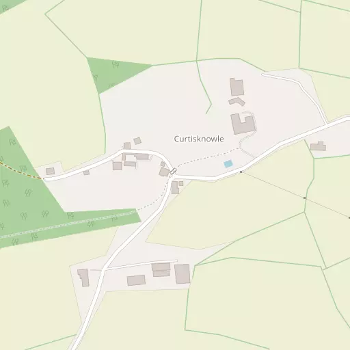
⇅
Location Summary
- Curtisknowle is located in Devon
- Administrative Area: Devon
- Ceremonial County: Devon
- Historic County: Devon
- Region & Country: South West / England
⇅
Nearby Towns & Cities
- Totnes 9.3 km NE
- Kingsbridge 9.7 km S
- Ivybridge 10.2 km WNW
- Buckfastleigh 12.2 km N
- Plymouth 25.8 km W


⇅
Nearby Localities
- DiptfordVillage 3.0 km NNW
- MoreleighVillage 3.2 km ESE
- HalwellVillage 4.1 km E
- AvonwickVillage 5.0 km NNW
- HarbertonfordVillage 5.4 km ENE
- LoddiswellVillage 5.7 km SSW
- HarbertonVillage 6.1 km NE
- UgboroughVillage 6.2 km WNW
- East AllingtonVillage 6.3 km SSE
- South BrentVillage 7.3 km NNW


⇅
Smaller Settlements
- Bickham 2.0 km NW
- North Huish 3.6 km NW
- Brownston 4.0 km WSW
- Grimpstonleigh 5.0 km SSE
- Woodleigh 5.1 km S
- Hutcherleigh 5.8 km SE
- Belsford 6.2 km NNE
- Warcombe 6.5 km S
- Woodford 6.8 km ESE
- Tigley 6.9 km NNE


⇅
Beaches
- Aunemouth Sands11.4 km SSW
- Challaborough Beach12.6 km SW
- Green Well10.9 km SSW

⇅
Parks
- Palm Cross Green8.2 km WSW
- Pennsylvania Park44.6 km NNE
- Pleasure Grounds43.3 km NNW
- The Lawn32.0 km NE
⇅
Woods
- Emeridge Wood509 m SSE
- Garaland Copse669 m WNW
- Lower Common813 m SSW
- The Grove691 m SSW
⇅
Hills
- Ball Hill3.5 km ENE
- Blackdown Hill2.6 km SW
- Cox Hill640 m SW
- Tarr Hill363 m SW
⇅
Lakes
- Old Mill Leat5.0 km NE
- Old Mill Leat5.1 km ENE
- Old Mill Leat5.8 km ENE
- Watergate4.4 km E
⇅
Waterfalls
- Broad Falls15.5 km NNW
- Horseshoe Falls16.8 km N
- Yealm Steps15.4 km NW
⇅
Headlands
- Langham Wood Point10.4 km ENE
- Sharpham Point10.4 km ENE
⇅
Islands
- Snipe Island10.0 km NE
- Vire Island9.4 km NE
⇅
Wetlands
- The Gut10.4 km ENE
- Stoke Point10.8 km ENE
- Middle Back11.2 km ENE
⇅
Health Services
- South Hams HospitalHospital 9.1 km S
- Totnes HospitalHospital 9.6 km NE
- Ivydene Nursing HomeMedical 10.1 km W
- BeaconvilleMedical 10.5 km WNW
⇅
Education
- Diptford Parochial Church of England Primary SchoolSchool 3.0 km NNW
- Loddiswell Primary SchoolSchool 5.1 km SSW
- Schumacher CollegeUniversity 10.2 km NNE
⇅
Railway Stations
- Ivybridge9.2 km WNW
- Totnes9.6 km NE
⇅
Bus Stations
- Kingsbridge Bus Station9.8 km S
- Exeter Bus Station43.4 km NNE
⇅
Coach Stations
- Torquay Coach Station20.6 km NE
- Plymouth Coach Station25.9 km W
⇅
Ferry Terminals
- Greenway Quay13.3 km E
- Dartmouth Naval College14.4 km E
⇅
Airports
- Plymouth City Airport24.1 km WNW
- Exeter Airport48.0 km NNE
⇅
Airfields
- Bolt Head Airfield16.3 km S
- Eggesford Airfield55.5 km N
⇅
Heliports
- Lake Heliport80.7 km NNW
- Cornwall Air Ambulance Station85.7 km W
⇅
Harbours
- Dartmouth14.4 km E
- Dartmouth Harbour14.8 km E