
Deadman's Cross
About Deadman's Cross
Deadman's Cross sits within Central Bedfordshire. Among the nearby places are Haynes only 1.3 km West North West, Chicksands situated 3.4 km South South East, Southill just 3.5 km East, Old Warden situated 3.5 km North East and Chapel End lying 4.0 km North West. Other rural areas close to here include Appley Corner, Ireland, Haynes Church End and Beadlow.
You may find extra local information by clicking a nearby place.
Information is sourced from OS, ONS and OSM under open licence, using publicly available datasets.
⇅
Local Map
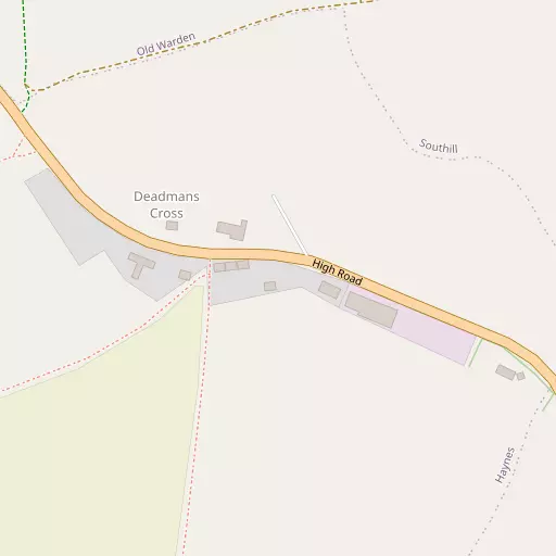
⇅
Location Summary
- Deadman's Cross is located in Central Bedfordshire
- Administrative Area: Central Bedfordshire
- Ceremonial County: Bedfordshire
- Historic County: Central Bedfordshire
- Region & Country: Eastern / England
⇅
Nearby Towns & Cities
- Shefford 4.2 km SE
- Wixams 6.4 km WNW
- Biggleswade 8.3 km ENE
- Ampthill 8.6 km WSW
- Milton Keynes 25.8 km W


⇅
Nearby Localities
- HaynesVillage 1.3 km WNW
- ChicksandsVillage 3.4 km SSE
- SouthillVillage 3.5 km E
- Old WardenVillage 3.5 km NE
- Chapel EndDistrict 4.0 km NW
- CamptonVillage 4.1 km SSE
- Cotton EndVillage 4.3 km NW
- ClophillVillage 4.8 km SW
- WilsteadVillage 5.1 km WNW
- StanfordVillage 5.2 km E


⇅
Smaller Settlements
- Appley Corner 1.0 km SW
- Ireland 2.2 km ESE
- Haynes Church End 3.2 km WSW
- Beadlow 3.5 km SSW
- Littleworth 3.7 km NW
- Haynes West End 4.8 km WSW
- Chapel End 5.8 km W
- Hall End 5.8 km SW
- Green End 6.0 km SW
- Water End 6.3 km SW


⇅
Beaches
- Bell Wharf Beach91.9 km SE
- Hadleigh Ray88.9 km SE
- Mill Beach84.3 km ESE
⇅
Parks
- Fishers Green Meadow19.4 km SSE
- South Field23.0 km SE
- Wimpole Park24.2 km ENE
- Woolenwick Schools Meadow20.5 km SSE
⇅
Woods
- Keepers' Warren1.8 km E
- Rowney Warren Wood1.2 km SSE
- Warden Great Wood999 m N
- Warden Little Wood1.9 km N

⇅
Hills
- Hammer Hill2.0 km NW
- Icehouse Hill3.0 km E
- Quince Hill3.5 km NE
- The Hill2.4 km SSW
⇅
Lakes
- Basin Pond4.3 km NE
- Bath Ponds4.5 km ENE
- Old Fish Pond2.2 km NNE
- Round Basin3.1 km E

⇅
Waterfalls
- Neptune Waterfall44.7 km SSW
- The Cascade43.7 km W
- Tower Waterfall44.6 km SSW
⇅
Headlands
- Botany Bay Point74.1 km SSW
- Tripcock Ness69.8 km SSE
⇅
Islands
- Longholme Island8.8 km NNW
- Rink Islands9.7 km NW

⇅
Wetlands
- Fowlmere29.6 km E
- Summer Leys31.3 km NW
- Waterford Marsh34.0 km SE
⇅
Health Services
- Bedford Hospital South WingHospital 9.6 km NW
- Biggleswade HospitalHospital 9.8 km ENE
- Elstow ManorMedical 7.0 km WNW
- Taymer Nursing HomeMedical 7.9 km SSW
⇅
Education
- Haynes Lower SchoolSchool 1.1 km WNW
- Southill Lower SchoolSchool 3.7 km E
- Polhill CampusUniversity 9.7 km NNW
⇅
Railway Stations
- Biggleswade8.3 km ENE
- Arlesey8.7 km ESE
⇅
Bus Stations
- Stevenage Interchange21.7 km SSE
- Royston Bus Station24.5 km E
⇅
Coach Stations
- Luton Airport Bus and Coach Station20.6 km S
- Milton Keynes Coachway21.9 km W

⇅
Ferry Terminals
- Blackfriars Pier64.5 km SSE
- Embankment Pier64.5 km SSE
⇅
Airports
- London Luton Airport20.9 km S
- Cambridge City Airport40.9 km ENE
⇅
Airfields
- Biggleswade Airfield5.2 km ENE
- Meppershall Airfield5.2 km SSE
⇅
Heliports
- Magpas Air Ambulance35.9 km NNE
- The Egerton-Smith Centre40.7 km ENE
⇅
Harbours
- Chelsea Harbour66.9 km SSE
- Cutter's Dock105.7 km SE