
Duddlestone
About Duddlestone
Duddlestone sits within Somerset. Neighbouring places include Shoreditch lying 1.3 km North North East, Dowslands around 1.7 km North, Corfe just 1.7 km South South West, Eastbrook only 2.1 km West North West and Trull around 2.4 km West North West. Other rural settlements include Orchard Portman, Heale, Kibbear and Poundisford.
You may find extra local information by clicking a nearby place.
All place information is taken from OS, ONS and OSM under open licence.
⇅
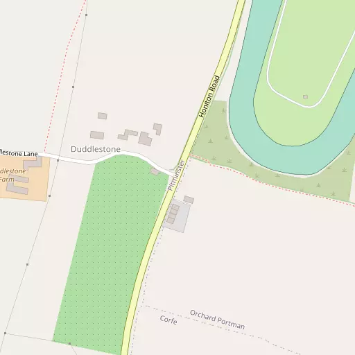
Local Map
⇅
Location Summary
- Duddlestone is located in Somerset
- Administrative Area: Somerset
- Ceremonial County: Somerset
- Historic County: Somerset
- Region & Country: South West / England
⇅
Nearby Towns & Cities
- Taunton 3.5 km NNW
- Wellington 9.8 km W
- North Petherton 12.9 km NNE
- Ilminster 13.7 km ESE
- Wells 39.6 km NE


⇅
Nearby Localities
- ShoreditchVillage 1.3 km NNE
- DowslandsDistrict 1.7 km N
- CorfeVillage 1.7 km SSW
- EastbrookDistrict 2.1 km WNW
- TrullVillage 2.4 km WNW
- PitminsterVillage 2.4 km SW
- StaplehayDistrict 2.5 km WNW
- HolwayDistrict 2.6 km NNE
- SherfordDistrict 2.8 km NW
- Stoke St MaryVillage 2.8 km ENE


⇅
Smaller Settlements
- Orchard Portman 838 m ENE
- Heale 1.1 km SSE
- Kibbear 1.3 km NW
- Poundisford 1.3 km W
- Netherclay 1.7 km ESE
- Winter Well 2.4 km ESE
- Woodram 2.5 km SSW
- Badger Street 2.7 km ESE
- Fulwood 2.8 km WSW
- Park Gate 2.8 km S


⇅
Beaches
- Burnham-on-Sea Beach30.1 km N
- Charmouth Beach30.7 km SSE
- West Street Beach28.1 km NW
⇅
Parks
- Pennsylvania Park40.9 km SW
- The Lawn52.2 km SSW
- Worle Moor42.9 km NNE
- Yargrass Green38.9 km NE
⇅
Woods
- Lime Ridge Wood1.7 km SSE
- Orchard Wood1.5 km ESE
- Pickeridge Wood1.6 km S
- Shortlands Coppice1.9 km ESE
⇅
Hills
- Adcombe Hill3.8 km SSW
- Cotlake Hill1.8 km NW
- Pickeridge Hill2.4 km S
- Stoke Hill3.4 km ENE
⇅
Lakes
- Blagdon Reservoir5.3 km SW
- Leigh Reservoir5.3 km SW
- Luxhay Reservoir4.9 km SW
- Steps Water3.9 km NNW
⇅
Waterfalls
- Becka Falls62.7 km SW
- Broad Falls79.5 km SW
- Horseshoe Falls72.9 km SW
⇅
Headlands
- Blue Ben25.5 km NNW
- Stert Point26.4 km N
⇅
Islands
- Fenning Island26.2 km N
- Stert Island28.2 km N
⇅
Wetlands
- New Marsh16.9 km NW
- Farway Marsh17.5 km SSE
- The Cut20.0 km NNE
⇅
Health Services
- Musgrove Park HospitalHospital 3.8 km NW
- Nuffield Health Taunton HospitalHospital 5.7 km NNW
- Cygnet Hospital TauntonMedical 1.2 km NE
- Calway HouseMedical 2.4 km N
⇅
Education
- Trull Church of England (Voluntary Aided) Primary SchoolSchool 2.4 km WNW
- Bishop Fox's SchoolSchool 2.4 km NNW
- Architectural Association Hooke ParkUniversity 36.2 km SE

⇅
Railway Stations
- Taunton4.4 km NNW
- Bishops Lydeard10.6 km NW
⇅
Bus Stations
- Taunton Bus Station3.7 km NNW
- Exeter Bus Station41.9 km SW
⇅
Coach Stations
- Torquay Coach Station64.9 km SSW
- Millstream Coach Park90.8 km E

⇅
Ferry Terminals
- Starcross Pier47.0 km SSW
- SS Great Britain Ferry Landing61.6 km NNE
⇅
Airports
- Exeter Airport35.9 km SW
- Cardiff Airport49.5 km NNW
⇅
Airfields
- Watchford Farm9.1 km S
- Royal Navy Air Station Merryfield10.8 km ESE
⇅
Heliports
- Cardiff City Heliport53.9 km N
- Lake Heliport81.6 km W
⇅
Harbours
- Watchet Harbour27.8 km NW
- Bridport Harbour38.0 km SE