
Englishcombe
About Englishcombe
Englishcombe is in Bath and North East Somerset. Places nearby include Southdown only 1.0 km North East, Whiteway situated 1.1 km North North East, Rush Hill lying 1.3 km East, Kingsway around 1.4 km East North East and The Oval just 1.6 km East North East. Other countryside places nearby include Inglesbatch, Nailwell, Wilmington and Longhouse.
You may find out something new or interesting if you click a nearby place to see more local information.
The information presented here is derived from OS, ONS and OSM under open licence.
⇅
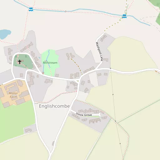
Local Map
⇅
Location Summary
- Englishcombe is located in Bath and North East Somerset
- Administrative Area: Bath and North East Somerset
- Ceremonial County: Somerset
- Historic County: Bath and North East Somerset
- Region & Country: South West / England
⇅
Nearby Towns & Cities
- Radstock 8.5 km SSW
- Keynsham 8.7 km NW
- Midsomer Norton 10.2 km SSW
- Bradford-on-Avon 10.9 km E
- Bath 3.9 km ENE


⇅
Nearby Localities
- SouthdownDistrict 1.0 km NE
- WhitewayDistrict 1.1 km NNE
- Rush HillDistrict 1.3 km E
- KingswayDistrict 1.4 km ENE
- The OvalDistrict 1.6 km ENE
- South TwertonDistrict 1.8 km NE
- Odd DownDistrict 1.9 km ESE
- TwertonDistrict 2.0 km NNE
- MoorlandsDistrict 2.2 km E
- LocksbrookDistrict 2.4 km NNE


⇅
Smaller Settlements
- Inglesbatch 2.0 km SW
- Nailwell 2.2 km SSW
- Wilmington 2.5 km W
- Longhouse 2.9 km SSW
- Withyditch 3.8 km SSW
- Stanton Prior 4.0 km W
- White Ox Mead 4.5 km S
- Twinhoe 4.5 km SE
- Tucking Mill 4.9 km ESE
- Charlcombe 5.3 km NNE


⇅
Beaches
- Backhill Sands32.5 km WNW
- Royal Sands and Uphill41.2 km W
- Sugar Loaf Beach29.9 km WNW

⇅
Parks
- Clifton Down19.1 km NW
- High Common3.7 km NE
- Lower Common3.3 km NE
- Pur Down17.3 km NW
⇅
Woods
- Breach Wood742 m ESE
- Hoggen Coppice1.4 km ESE
- Middle Wood1.2 km SE
- Padleigh Wood424 m ENE
⇅
Hills
- Duncorn Hill2.3 km SSW
- High Barrow Hill832 m NE
- Hodshill3.4 km ESE
- Southdown822 m NE
⇅
Lakes
- Boyd Valley Lake8.4 km NNW
- Monkswood Reservoir9.2 km NNE
- Tucking Mill Reservoir4.8 km ESE
- Weston Cut2.2 km NNE

⇅
Waterfalls
- Berw-ddu85.0 km WNW
- Pwll Annie82.4 km WNW
- Pwll yr Hesg80.1 km NW
⇅
Headlands
- Battery Point29.3 km WNW
- Beachley Point32.4 km NNW
⇅
Islands
- Denny Island14.5 km W
- Denny Island31.6 km NW
⇅
Wetlands
- Hollow Marsh11.9 km WSW
- Hilperton Marsh15.0 km E
- Horseshoe Point22.6 km NW

⇅
Health Services
- St Martins HospitalHospital 2.5 km ESE
- Royal United HospitalHospital 3.3 km NNE
- Culverhayes Nursing HomeMedical 1.9 km NE
- Poolemead CentreMedical 1.9 km NNE
⇅
Education
- Roundhill Primary SchoolSchool 837 m ENE
- Bath Spa UniversitySchool 854 m E
- Bath Spa UniversityUniversity 854 m E
⇅
Railway Stations
- Oldfield Park2.5 km NE
- Bath Spa3.8 km ENE
⇅
Bus Stations
- Cribbs Causeway Bus Station22.4 km NW
- Chippenham Bus Station22.7 km ENE
⇅
Coach Stations
- Millstream Coach Park53.3 km SE
- Southampton Coach Station86.2 km SE
⇅
Ferry Terminals
- Harbour Inlet Ferry Landing16.8 km NW
- SS Great Britain Ferry Landing16.9 km NW
⇅
Airports
- Bristol Airport21.8 km W
- Cotswold Airport41.6 km NE
⇅
Airfields
- Clutton Hill Airfield8.5 km WSW
- Colerne Airfield12.2 km NE
⇅
Heliports
- Cardiff City Heliport52.1 km WNW
- Lake Heliport133.8 km WSW
⇅
Harbours
- Floating Harbour16.2 km NW
- Mud Dock16.3 km NW