
Fawsley
About Fawsley
Fawsley sits within West Northamptonshire. Among the nearby places are Charwelton lying 2.1 km West South West, Badby around 2.3 km North, Preston Capes only 2.8 km South East and Newnham only 3.4 km North East. Other rural communities nearby include Church Charwelton, Upper Catesby, Little Everdon, Little Preston and Lower Catesby.
You may notice something interesting if you explore one of the nearby places.
These details are compiled from OS, ONS and OSM data released under open licence.
⇅
Local Map
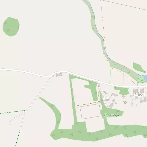
⇅
Location Summary
- Fawsley is located in West Northamptonshire
- Administrative Area: West Northamptonshire
- Ceremonial County: West Northamptonshire
- Historic County: West Northamptonshire
- Region & Country: East Midlands / England
⇅
Nearby Towns & Cities


⇅
Nearby Localities
- CharweltonVillage 2.1 km WSW
- BadbyVillage 2.3 km N
- Preston CapesVillage 2.8 km SE
- NewnhamVillage 3.4 km NE
- EverdonVillage 3.7 km E
- StavertonVillage 4.5 km NNW
- Woodford HalseVillage 4.5 km SSW
- HellidonVillage 4.6 km WNW
- HintonVillage 4.8 km SSW
- Church EndDistrict 5.5 km SW


⇅
Smaller Settlements
- Church Charwelton 1.9 km SW
- Upper Catesby 3.8 km NW
- Little Everdon 3.8 km ENE
- Little Preston 4.1 km SE
- Lower Catesby 4.8 km WNW
- West Farndon 6.2 km SSW
- Canons Ashby 6.6 km SSE
- Nethercote 8.2 km NNW
- Stowehill 8.7 km ENE
- Lower Shuckburgh 8.8 km NW


⇅
Beaches
- Cotswold Hills Beach80.6 km SW
- Snettisham Beach132.2 km NE
- Snettisham Scalp132.6 km NE
⇅
Parks
- Bilton Common18.0 km NNW
- The Green2.2 km N
- The Green14.3 km E
- The Green14.6 km S

⇅
Woods
- Badby Plantation1.5 km NNW
- Badby Wood1.5 km NNE
- Houseground Clump506 m NW
- Mill Spinney1.6 km ESE
⇅
Hills
- Arbury Hill2.5 km NW
- Everdon Hill2.5 km ENE
- Sharman's Hill1.9 km WNW
- Temple Hill1.1 km ENE
⇅
Lakes
- Big Waters1.0 km ESE
- Horse Pond480 m E
- The Angles Water1.4 km ESE
- The Canal704 m ESE
⇅
Waterfalls
- Neptune Waterfall73.1 km SE
- The Cascade23.3 km SSE
- Tower Waterfall72.4 km SE
⇅
Headlands
- Botany Bay Point97.4 km SSE
- Tripcock Ness117.2 km SE
⇅
Islands
- Millholme Island38.5 km E
- Monkey Island23.3 km SSE
⇅
Wetlands
- Welches Meadow24.6 km WNW
- Wyken Slough32.9 km NW
- Summer Leys33.4 km E
⇅
Health Services
- Danetre HospitalHospital 5.2 km NNE
- Berrywood HospitalHospital 16.0 km ENE
- Badby ParkMedical 4.2 km N
- Brownlands Nursing HomeMedical 5.5 km NNE
⇅
Education
- Badby SchoolSchool 2.1 km N
- Newnham Primary SchoolSchool 3.4 km NE
- University of Northampton Waterside CampusUniversity 20.5 km E
⇅
Railway Stations
- Long Buckby11.8 km NE
- Banbury19.1 km SSW
⇅
Bus Stations
- Daventry Bus Station5.7 km NNE
- North Gate Bus Station19.9 km E
⇅
Coach Stations
- Shakespeare's Birthplace Coach Terminal35.7 km W
- Milton Keynes Coachway37.3 km ESE

⇅
Ferry Terminals
- Normanton Chain Ferry66.0 km N
- Hammerton's Pier103.7 km SE
⇅
Airports
- Coventry Airport27.0 km NW
- Wellesbourne Mountford Airfield29.1 km W
⇅
Airfields
- Turweston Aerodrome19.6 km SSE
- Hinton in the Hedges20.0 km S
⇅
Heliports
- Magpas Air Ambulance66.4 km ENE
- Nottingham Heliport70.9 km N
⇅
Harbours
- Farndon Harbour97.8 km NNE
- Lydney Harbour106.3 km WSW