
Garnsgate
About Garnsgate
Garnsgate is in Lincolnshire. Among the nearby places are Lutton Gowts only 2.3 km North East, Gedney situated 2.5 km North West, Gedney Dyke just 3.0 km North and Lutton just 3.1 km North North East. Other countryside settlements include Sutton Crosses, Gedney Broadgate, Holbeach, Guy's Head and Holbeach St Matthew.
You might learn something new by clicking through to a nearby place.
Data shown here comes from OS, ONS and OSM under open licence, using the latest public sources available.
⇅
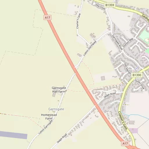
Local Map
⇅
Location Summary
- Garnsgate is located in Lincolnshire
- Administrative Area: Lincolnshire
- Ceremonial County: Lincolnshire
- Historic County: Lincolnshire
- Region & Country: East Midlands / England
⇅
Nearby Towns & Cities
- Long Sutton 1.2 km E
- Wisbech 13.8 km SSE
- Spalding 17.2 km W
- King's Lynn 19.9 km E
- Peterborough 33.1 km SW


⇅
Nearby Localities
- Lutton GowtsVillage 2.3 km NE
- GedneyVillage 2.5 km NW
- Gedney DykeVillage 3.0 km N
- LuttonVillage 3.1 km NNE
- Little SuttonVillage 3.4 km E
- Fleet HargateVillage 3.6 km NW
- FleetVillage 3.7 km WNW
- Tydd St MaryVillage 4.4 km SSE
- Sutton St JamesVillage 5.0 km SSW
- Holbeach HurnVillage 5.0 km NNW


⇅
Smaller Settlements
- Sutton Crosses 2.1 km SSE
- Gedney Broadgate 2.2 km WSW
- Holbeach 6.5 km WNW
- Guy's Head 7.4 km ENE
- Holbeach St Matthew 8.9 km N
- Ingleborough 9.5 km SSE
- Fitton End 10.0 km S
- Loosegate 10.8 km WNW
- Austendike 12.1 km W
- Haroldsbridge 12.2 km SSW


⇅
Beaches
- Snettisham Beach24.6 km ENE
- Snettisham Scalp24.7 km ENE
- Stubborn Sand26.9 km ENE
⇅
Parks
- Butt Green64.0 km S
- Larks Green31.8 km SW
- New Pasture53.8 km SSW
- Wilsford Warren44.1 km WNW
⇅
Woods
- Eagle Plantation2.8 km ENE
- North Belt Plantation15.8 km ESE
- The Spinney14.0 km WNW
- Three Acres16.3 km ESE

⇅
Hills
- Festival Hill15.5 km W
- Galley Hill23.4 km E
- Holding's Hill23.2 km E
- Mill Hill2.0 km ESE
⇅
Lakes
- Ashleigh Fishing Lake13.6 km SW
- Partridge Fishing Lake13.3 km SW
- The Fleet11.6 km E
- Wash Gould11.3 km NNW
⇅
Waterfalls
- Neptune Waterfall131.0 km SSW
- The Cascade113.4 km SW
- Tower Waterfall130.9 km SSW
⇅
Headlands
- North Weir Point123.5 km SE
- Tripcock Ness141.8 km S

⇅
Islands
- Inner Tidal Bank12.9 km ENE
- Outer Trial Bank11.4 km NE
⇅
Wetlands
- Fleet Marsh3.7 km NNW
- Tydd St Mary's Marsh5.5 km SE
- Lutton Marsh5.6 km NE
⇅
Health Services
- North Cambridgeshire HospitalHospital 13.8 km SSE
- Johnson Community HospitalHospital 17.3 km W
- Beech LodgeMedical 6.1 km W
- Holbeach Hospital and Nursing HomeMedical 7.8 km WNW
⇅
Education
- Long Sutton Primary School and NurserySchool 867 m ENE
- University Academy Long SuttonSchool 2.1 km ENE
- University of LincolnUniversity 6.6 km WNW
⇅
Railway Stations
- Spalding17.6 km W
- Kings Lynn20.4 km E
⇅
Bus Stations
- Spalding Bus Station17.4 km W
- Kings Lynn Bus Station20.1 km E
⇅
Coach Stations
- Milton Keynes Coachway97.6 km SW
- Stansted Airport Coach Station100.1 km S
⇅
Ferry Terminals
- Normanton Chain Ferry89.9 km W
- Reedham Ferry North100.7 km ESE
⇅
Airports
- Cambridge City Airport64.7 km S
- Wickenby Aerodrome66.7 km NNW
⇅
Airfields
- Wingland Airfield3.4 km N
- Fenland Airfield10.5 km WSW
⇅
Heliports
- Magpas Air Ambulance51.1 km SSW
- Lincs and Notts Air Ambulance HQ59.5 km NW
⇅
Harbours
- Brancaster Harbour43.2 km ENE
- Farndon Harbour71.2 km WNW