
Great Oxendon
About Great Oxendon
Great Oxendon, in West Northamptonshire, has East Farndon only 2.2 km North West, Clipston only 2.6 km South West, Arthingworth situated 3.1 km South East, Little Bowden lying 3.2 km North North East and Braybrooke lying 3.7 km East North East. Other nearby hamlets and settlements include Thorpe Underwood, Brampton Ash, Foxhall and Sulby.
You might learn something new by clicking through to a nearby place.
The information presented here is derived from OS, ONS and OSM under open licence.
⇅
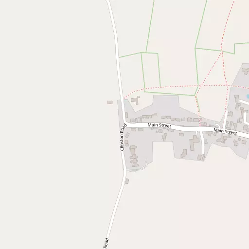
Local Map
⇅
Location Summary
- Great Oxendon is located in West Northamptonshire
- Administrative Area: West Northamptonshire
- Ceremonial County: West Northamptonshire
- Historic County: West Northamptonshire
- Region & Country: East Midlands / England
⇅
Nearby Towns & Cities
- Market Harborough 4.0 km N
- Desborough 7.1 km E
- Kettering 14.3 km ESE
- Corby 16.0 km ENE
- Leicester 25.4 km NNW


⇅
Nearby Localities
- East FarndonVillage 2.2 km NW
- ClipstonVillage 2.6 km SW
- ArthingworthVillage 3.1 km SE
- Little Bowden District 3.2 km NNE
- BraybrookeVillage 3.7 km ENE
- KelmarshVillage 4.2 km S
- Marston TrussellVillage 4.7 km WNW
- Lubenham Village 4.7 km NNW
- SibbertoftVillage 5.3 km W
- HarringtonVillage 5.5 km SE


⇅
Smaller Settlements
- Thorpe Underwood 6.3 km ESE
- Brampton Ash 7.2 km ENE
- Foxhall 7.4 km SE
- Sulby 7.7 km W
- Orton 8.5 km ESE
- Laughton 9.0 km NW
- West Langton 9.7 km N
- Welham 9.8 km NNE
- Pipewell 10.9 km E
- Stonton Wyville 11.7 km N
⇅
Beaches
- Snettisham Beach103.7 km ENE
- Snettisham Scalp103.9 km ENE
- Stubborn Sand106.1 km ENE
⇅
Parks
- Bilton Common26.6 km WSW
- Buckwell Green21.8 km SE
- Foot Meadow23.1 km S
- The Green24.3 km S

⇅
Woods
- Coldmeadow Spinney2.3 km ESE
- Long Spinney2.5 km E
- Round Spinney2.0 km ESE
- Sixteen Spinney2.7 km ESE
⇅
Hills
- Clack Hill3.9 km NNE
- Far Hill3.7 km SSE
- Moot Hill3.9 km W
- Warren Hill4.5 km SE

⇅
Lakes
- Dale Pond6.8 km S
- Lubenham Hill Lake3.9 km NNW
- Sulby Reservoir7.7 km WSW
- The Lake4.6 km WNW
⇅
Waterfalls
- Neptune Waterfall88.9 km SSE
- The Cascade46.7 km S
- Tower Waterfall88.3 km SSE
⇅
Headlands
- Botany Bay Point117.0 km SSE
- Tripcock Ness125.2 km SE
⇅
Islands
- Brown's Island28.2 km NE
- The Islands16.0 km NNW

⇅
Wetlands
- Lucas Marsh19.6 km NNW
- Summer Leys25.1 km SE
- Priory Water35.2 km N
⇅
Health Services
- St Luke's HospitalHospital 4.9 km N
- Woodland HospitalHospital 11.3 km ESE
- Sibbertoft ManorMedical 4.9 km W
- Cheaney CourtMedical 6.6 km E
⇅
Education
- Farndon Fields Primary SchoolSchool 2.4 km N
- Clipston Endowed (Voluntary Controlled) Primary SchoolSchool 2.6 km SW
- Tresham College of Further and Higher EducationUniversity 15.7 km ESE
⇅
Railway Stations
- Market Harborough4.3 km NNE
- Kettering14.3 km ESE
⇅
Bus Stations
- North Gate Bus Station22.8 km S
- Leicester Haymarket Bus Station25.7 km NNW
⇅
Coach Stations
- Milton Keynes Coachway45.8 km SSE
- Shakespeare's Birthplace Coach Terminal60.0 km WSW
⇅
Ferry Terminals
- Normanton Chain Ferry44.7 km NNW
- Embankment Pier117.8 km SSE
⇅
Airports
- Coventry Airport38.6 km WSW
- East Midlands Airport50.8 km NNW
⇅
Airfields
- Sywell Aerodrome17.9 km SSE
- Leicester Airport19.3 km NNW
⇅
Heliports
- Nottingham Heliport44.5 km N
- Magpas Air Ambulance46.5 km E
⇅
Harbours
- Farndon Harbour69.1 km N
- Chelsea Harbour119.2 km SSE