
Great Work
About Great Work
Great Work sits within Cornwall. Places nearby include Tresowes Green situated 1.4 km South South East, Germoe around 1.7 km South South West, Godolphin Cross situated 1.8 km East North East, Townshend around 2.2 km North and Ashton just 2.3 km South South East. Other nearby hamlets and settlements include Boscreege, Balwest, Herland Croft and Trescowe.
You may notice something interesting if you explore one of the nearby places.
All information is drawn from OS, ONS and OSM under open licence, reflecting the best available public data.
⇅
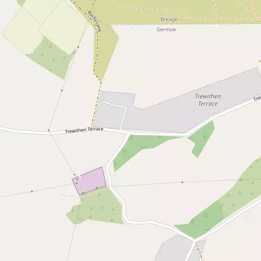
Local Map
⇅
Location Summary
- Great Work is located in Cornwall
- Administrative Area: Cornwall
- Ceremonial County: Cornwall
- Historic County: Cornwall
- Region & Country: South West / England
⇅
Nearby Towns & Cities


⇅
Nearby Localities
- Tresowes GreenVillage 1.4 km SSE
- GermoeVillage 1.7 km SSW
- Godolphin CrossVillage 1.8 km ENE
- TownshendVillage 2.2 km N
- AshtonVillage 2.3 km SSE
- CarleenVillage 2.4 km E
- Praa SandsVillage 2.7 km SSW
- RelubbusVillage 2.7 km WNW
- Rinsey CroftVillage 2.8 km SSE
- BreageVillage 3.4 km SE


⇅
Smaller Settlements
- Boscreege 252 m SSE
- Balwest 808 m SSE
- Herland Croft 843 m E
- Trescowe 1.6 km W
- Millpool 1.9 km W
- Newtown 2.3 km SW
- Pengersick 2.4 km SSW
- Polladras 2.6 km E
- Hendra 2.8 km S
- Trew 2.8 km ESE


⇅
Beaches
- Lesceave Por3.3 km S
- Porthcew3.7 km S
- Praa Sands3.0 km SSW
⇅
Parks
- Lanner Moor15.9 km NE
- Palm Cross Green108.2 km ENE
- Summerleaze Down97.8 km NE
- Trungle Moor13.6 km WSW

⇅
Woods
- Crenver Grove5.3 km NE
- Frythens Wood5.2 km WNW
- Gurlyn Wood2.7 km NW
- Trevelyan Plantation3.6 km W

⇅
Hills
- Godolphin Hill630 m N
- Prospidnick Hill6.2 km E
- Tregonning Hill978 m SE
- Tresowes Hill1.8 km SE
⇅
Lakes
- Cargenwen Reservoir7.5 km NE
- Carnsew Pool7.6 km NNW
- The Loe7.7 km SE
- Tregathenan Reservoir6.4 km E
⇅
Waterfalls
- Golitha Falls73.5 km ENE
- White Lady Waterfall104.9 km ENE
- Yealm Steps107.5 km ENE
⇅
Headlands
- Hoe Point3.5 km SSW
- Trewavas Head4.2 km S
⇅
Islands
- Godrevy Island13.0 km N
- St Michael's Mount7.7 km W
⇅
Wetlands
- Arch Zawn5.0 km SW
- Basore Point6.1 km WSW
- Caca-stull Zawn7.3 km SE
⇅
Health Services
- St Michael's HospitalHospital 7.0 km NNW
- Helston Community HospitalHospital 8.5 km ESE
- The Beeches Nursing HomeMedical 7.0 km NNW
- Millpond View Care HomeMedical 7.0 km NNW
⇅
Education
- Germoe Community Primary SchoolSchool 1.5 km SSW
- Godolphin Primary SchoolSchool 1.7 km ENE
- Cornwall College of Further and Higher EducationUniversity 13.2 km NNE
⇅
Railway Stations
- Prospidnick Halt5.4 km E
- Tregadjack Sidings5.6 km E
⇅
Bus Stations
- Camborne Bus Station10.9 km NNE
- Penzance Bus Station11.5 km W
⇅
Coach Stations
- Plymouth Coach Station91.5 km ENE
- Torquay Coach Station135.9 km ENE
⇅
Ferry Terminals
- Penzance Ferry Terminal11.3 km W
- Trelissick26.4 km ENE
⇅
Airports
- Land's End Airport21.6 km W
- Newquay Cornwall Airport43.1 km NE
⇅
Airfields
- Royal Navy Air Station Culdrose9.9 km ESE
- Predannack Airfield17.2 km SE
⇅
Heliports
- Penzance Heliport10.1 km W
- Cornwall Air Ambulance Station43.8 km NE
⇅
Harbours
- Porthleven Harbour6.2 km SE
- Newlyn Harbour12.8 km WSW