
Gulworthy
About Gulworthy
Gulworthy, in Devon, has Gunnislake only 1.8 km South West, Lower Dimson around 2.0 km West South West, Middle Dimson situated 2.2 km West South West and North Dimson around 2.4 km West South West. Other nearby hamlets and settlements include Chipshop, Morwellham Quay, Walreddon, Rushford and Okeltor.
You may find out something new or interesting if you click a nearby place to see more local information.
This page uses OS, ONS and OSM data supplied under open licence.
⇅
Local Map
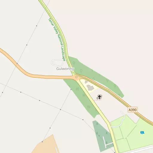
⇅
Location Summary
- Gulworthy is located in Devon
- Administrative Area: Devon
- Ceremonial County: Devon
- Historic County: Devon
- Region & Country: South West / England
⇅
Nearby Towns & Cities
- Tavistock 3.8 km ENE
- Callington 9.4 km WSW
- Saltash 14.0 km S
- Launceston 16.4 km NW
- Plymouth 18.6 km S


⇅
Nearby Localities
- GunnislakeVillage 1.8 km SW
- Lower DimsonDistrict 2.0 km WSW
- Middle DimsonDistrict 2.2 km WSW
- North DimsonDistrict 2.4 km WSW
- Higher DimsonDistrict 2.5 km SW
- DrakewallsDistrict 3.0 km SW
- ChilsworthyVillage 3.4 km W
- AlbastonDistrict 3.5 km SW
- St Ann's ChapelVillage 3.6 km SW
- LatchleyVillage 4.0 km W


⇅
Smaller Settlements
- Chipshop 2.5 km NNW
- Morwellham Quay 3.0 km S
- Walreddon 3.5 km ESE
- Rushford 3.5 km N
- Okeltor 4.1 km S
- Portington 4.3 km NW
- Townlake 4.7 km WNW
- Newton 4.9 km SW
- Sydenham Damerel 5.0 km NW
- Middlemoor 5.0 km E


⇅
Beaches
- Firestone Bay19.4 km S
- Pebble Side19.2 km S
- Reform Beach19.3 km S
⇅
Parks
- Palm Cross Green29.7 km SE
- Pleasure Grounds26.2 km NNE
- Summerleaze Down41.4 km NW
- The Lawn51.4 km E


⇅
Woods
- Hangingcliff Wood923 m W
- Hatch Wood1.5 km SW
- Luscombedown Plantation1.2 km SSW
- Newton Wood1.4 km NE


⇅
Hills
- Greenhill3.3 km WSW
- Hanging Cliff7.4 km SSW
- Kit Hill7.3 km WSW
- The Beacon6.8 km NNE
⇅
Lakes
- Double Waters4.1 km SE
- Inny Foot8.4 km NW
- Inny Ham Mere8.6 km NW
- Old Mill Leat8.6 km NNE
⇅
Waterfalls
- Broad Falls21.4 km ESE
- White Lady Waterfall11.9 km NNE
- Yealm Steps19.3 km ESE
⇅
Headlands
- Pennard's Point10.3 km S
- Weir Point10.9 km S
⇅
Islands
- Drake's Island20.1 km S
- Erth Island17.7 km SSW
⇅
Wetlands
- Blaxton Marsh10.1 km SSE
- Warleigh Marsh10.5 km SSE
- Marraborough Quay11.5 km SSW

⇅
Health Services
- Tavistock General HospitalHospital 3.1 km ENE
- Plymouth HospitalHospital 14.0 km SSE
- Abbotsfield Hall Residential HomeMedical 2.4 km ENE
- Chollacott Nursing HomeMedical 3.7 km ENE
⇅
Education
- Gulworthy Primary SchoolSchool 71 m SE
- Gunnislake Primary SchoolSchool 2.0 km SW
- University of St Mark and St JohnUniversity 14.0 km SSE
⇅
Railway Stations
- Gunnislake2.8 km SW
- Calstock4.2 km SSW
⇅
Bus Stations
- Kingsbridge Bus Station40.6 km SE
- Exeter Bus Station51.8 km ENE
⇅
Coach Stations
- Plymouth Coach Station18.3 km S
- Torquay Coach Station46.9 km E
⇅
Ferry Terminals
- Torpoint Ferry Terminal17.7 km S
- Plymouth Stonehouse18.9 km S
⇅
Airports
- Plymouth City Airport13.7 km SSE
- Newquay Cornwall Airport59.1 km W
⇅
Airfields
- Davidstow Airfield32.0 km WNW
- Bodmin Airfield33.7 km W
⇅
Heliports
- Lake Heliport55.5 km N
- Cornwall Air Ambulance Station57.1 km W
⇅
Harbours
- Weston Mill Lake15.8 km S
- Sutton Harbour18.9 km SSE