
Hawkmoor Parke
About Hawkmoor Parke
Hawkmoor Parke, in Devon, has Lustleigh only 1.9 km West, Hennock just 2.8 km East, Teign Village situated 3.5 km East and Brimley around 3.9 km South. Other rural settlements include Green Lane, Coombe, Lower Ashton, Westcott and Halford.
You might discover something new by clicking a nearby place for more local details.
Information is sourced from OS, ONS and OSM under open licence, using publicly available datasets.
⇅
Local Map
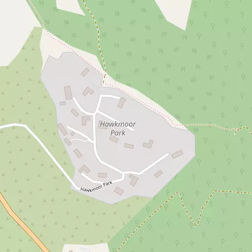
⇅
Location Summary
- Hawkmoor Parke is located in Devon
- Administrative Area: Devon
- Ceremonial County: Devon
- Historic County: Devon
- Region & Country: South West / England
⇅
Nearby Towns & Cities
- Bovey Tracey 2.7 km SSE
- Chudleigh 6.6 km E
- Moretonhampstead 7.2 km NW
- Kingsteignton 10.3 km SE
- Exeter 16.4 km NE


⇅
Nearby Localities
- LustleighVillage 1.9 km W
- HennockVillage 2.8 km E
- Teign VillageVillage 3.5 km E
- BrimleyVillage 3.9 km S
- IlsingtonVillage 5.1 km SSW
- Haytor ValeVillage 5.2 km SW
- ChristowVillage 5.2 km NNE
- TrushamVillage 5.3 km ENE
- ManatonVillage 5.3 km W
- Chudleigh KnightonVillage 5.5 km SE


⇅
Smaller Settlements
- Green Lane 4.3 km SSW
- Coombe 4.5 km NE
- Lower Ashton 5.3 km NE
- Westcott 6.3 km NNW
- Halford 6.4 km S
- Doccombe 6.5 km NNW
- Higher Ashton 6.5 km NE
- Blackpool 6.9 km S
- Sigford 7.5 km SSW
- Preston 8.2 km SE

⇅
Beaches
- Shaldon Beach15.9 km ESE
- Spratt Sand16.2 km ESE
- Teignmouth Beach16.1 km ESE

⇅
Parks
- Palm Cross Green32.6 km SSW
- Pennsylvania Park18.2 km NE
- Pleasure Grounds25.2 km WNW
- The Lawn16.3 km ESE

⇅
Woods
- Eastpark Copse326 m NNW
- Northcombe Copse463 m SE
- Shaptor Bottom Copse247 m E
- Shaptor Woods439 m SE
⇅
Hills
- Black Hill4.5 km WSW
- Broom Hill5.1 km ENE
- White Hill4.6 km SSE
- Worley Hill5.3 km ENE

⇅
Lakes
- Indio Lake3.6 km SSE
- Kennick Reservoir3.3 km N
- Tottiford Reservoir2.4 km NNE
- Trenchford Reservoir1.6 km N

⇅
Waterfalls
- Becka Falls4.3 km WSW
- Broad Falls20.4 km SW
- Horseshoe Falls13.9 km SW
⇅
Headlands
- Bundle Head16.4 km SE
- The Ness16.3 km ESE
⇅
Islands
- Bellpool Island14.1 km SW
- Little Bellpool Island14.2 km SW
⇅
Wetlands
- Blackslade Mire8.5 km SW
- Hackney Marshes11.5 km SE
- Buckland Point11.9 km SE
⇅
Health Services
- Moretonhampstead HospitalHospital 7.4 km NW
- Newton Abbot Community HospitalHospital 10.2 km SE
- Bramble DownMedical 12.2 km S
- Lucerne Nursing HomeMedical 14.5 km NE
⇅
Education
- Bovey Tracey Primary SchoolSchool 2.6 km SSE
- Hennock Community Primary SchoolSchool 2.8 km E
- South Devon College Brunel CentreUniversity 11.8 km SE
⇅
Railway Stations
- Heathfield5.8 km SE
- Teigngrace8.1 km SE
⇅
Bus Stations
- Exeter Bus Station17.1 km NE
- Kingsbridge Bus Station37.4 km S
⇅
Coach Stations
- Torquay Coach Station19.2 km SE
- Plymouth Coach Station41.8 km SW
⇅
Ferry Terminals
- Starcross Pier17.5 km E
- Greenway Quay26.9 km SSE
⇅
Airports
- Exeter Airport23.8 km NE
- Plymouth City Airport36.4 km SW
⇅
Airfields
- Eggesford Airfield30.5 km NNW
- Farway Common Airfield38.7 km ENE
⇅
Heliports
- Lake Heliport60.7 km NW
- Hartland Heliport73.3 km NW
⇅
Harbours
- Lympstone Boat Shelter18.7 km ENE
- Old Harbour20.9 km SE