
Hensington, Woodstock
About Hensington
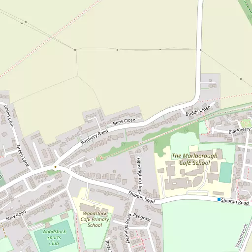
Hensington is 1.2 km WNW from Woodstock in the county of Oxfordshire. Nearby places include Old Woodstock around 1.2 km West North West, Bladon only 2.3 km South South West, Shipton-on-Cherwell situated 2.6 km East and Thrupp only 3.1 km East South East. Other settlements close by include Bunkers Hill, East End, Enslow, Oxford Spires Park and Woodleys.
You may notice something interesting if you explore one of the nearby places.
All place information is taken from OS, ONS and OSM under open licence.
⇅
Local Map
⇅
Location Summary
- Hensington is a neighbourhood in Woodstock
- Administrative Area: Oxfordshire
- Ceremonial County: Oxfordshire
- Historic County: Oxfordshire
- Region & Country: South East / England
⇅
Nearby Towns & Cities


⇅
Nearby Localities
- Old WoodstockDistrict 1.2 km WNW
- BladonVillage 2.3 km SSW
- Shipton-on-CherwellVillage 2.6 km E
- ThruppVillage 3.1 km ESE
- WoottonVillage 3.4 km NNW
- BegbrokeVillage 3.5 km SSE
- CombeVillage 4.0 km WSW
- Long HanboroughVillage 4.3 km SW
- TackleyVillage 4.7 km NE
- Church HanboroughVillage 4.9 km SW


⇅
Smaller Settlements
- Bunkers Hill 2.2 km ENE
- East End 3.0 km WSW
- Enslow 3.2 km ENE
- Oxford Spires Park 3.2 km SE
- Woodleys 3.9 km NW
- Glympton 5.3 km NNW
- Worton 5.8 km S
- The Green 6.1 km SW
- Gosford 6.5 km SE
- Over Kiddington 6.7 km NW


⇅
Beaches
- Cotswold Hills Beach47.3 km WSW
- Goatee Beach104.9 km S
- Weston Point106.9 km S
⇅
Parks
- Loop Meadow27.3 km SSE
- Merton Field12.9 km SSE
- The Green22.2 km NE
- The Green26.8 km NNE

⇅
Woods
- Campsfield Wood1.4 km SSE
- Icehouse Clump1.5 km W
- Queen Elizabeth's Island1.4 km WSW
- Weaveley Furze1.5 km NE

⇅
Hills
- Dog Kennel Hill3.3 km SW
- Jacob's Hill3.5 km WSW
- Pound Hill3.6 km NE
- Worcester Hill3.7 km NW
⇅
Lakes
- Pool Head2.5 km SW
- Queen Pool1.3 km WSW
- The Lake1.9 km SW
- Thrupp Wide3.0 km ESE
⇅
Waterfalls
- Neptune Waterfall57.5 km ESE
- The Cascade29.9 km NE
- Tower Waterfall56.8 km ESE
⇅
Headlands
- Beachley Point94.0 km WSW
- Botany Bay Point71.0 km SE
⇅
Islands
- Fiddler's Island11.0 km SSE
- Isle of Rhea11.2 km SE
⇅
Wetlands
- Ranger's Marsh11.7 km WNW
- Brassey31.7 km W
- Wanborough Marsh41.6 km SW
⇅
Health Services
- Witney Community HospitalHospital 12.2 km SW
- John Radcliffe HospitalHospital 12.9 km SE
- Lincroft Meadow Care HomeMedical 3.8 km SE
- Floryn House Care HomeMedical 4.7 km SSE
⇅
Education
- Woodstock Church of England Primary SchoolSchool 324 m SSW
- The Marlborough Church of England SchoolSchool 396 m SE
- Stroud CourtUniversity 9.7 km S
⇅
Railway Stations
- Hanborough3.5 km SW
- Combe4.0 km WSW
⇅
Bus Stations
- Aylesbury Bus Station36.6 km E
- Swindon Bus Station43.9 km SW
⇅
Coach Stations
- Shakespeare's Birthplace Coach Terminal45.7 km NNW
- High Wycombe Coachway47.8 km ESE
⇅
Ferry Terminals
- Hampton Ferry Boathouse83.4 km SE
- Hammerton's Pier84.0 km ESE
⇅
Airports
- London Oxford Airport2.2 km SE
- Wellesbourne Mountford Airfield42.3 km NNW
⇅
Airfields
- Weston-on-the-Green Airfield9.1 km ENE
- Enstone Airfield10.7 km NW
⇅
Heliports
- The London Heliport90.8 km ESE
- Magpas Air Ambulance95.0 km NE
⇅
Harbours
- Lydney Harbour81.7 km W
- Chelsea Harbour90.4 km ESE