
Hinwick
About Hinwick
Hinwick is in Bedford. Local places nearby include Podington just 1.1 km North North East, Wollaston situated 3.0 km West North West, Wymington just 3.3 km North East and Little Wymington situated 3.9 km North North East. Other rural settlements include Farndish, Strixton, Knuston, Knotting and Knotting Green.
You may notice something interesting if you explore one of the nearby places.
All information is drawn from OS, ONS and OSM under open licence, reflecting the best available public data.
⇅
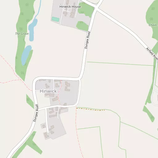
Local Map
⇅
Location Summary
⇅
Nearby Towns & Cities
- Rushden
- Higham Ferrers
- Wellingborough
- Irthlingborough
- Milton Keynes
⇅
Nearby Localities
⇅
Smaller Settlements
⇅
Beaches
- Snettisham Beach
- Snettisham Scalp
- Stubborn Sand
⇅
Parks
- Buckwell Green
- Foot Meadow
- The Green
- The Green
⇅
Woods
- Chain Spinney
- Hall Lane Spinney
- Slade Plantation
- The Grove
⇅
Hills
- Beacon Hill
- Coldharbour Hill
- Cracknell Hill
- Windmill Hill
⇅
Lakes
- Grebe Lake
- Grendon Brook (Bozeat Arm)
- Neats Pond
- Plain Pond
⇅
Waterfalls
- Neptune Waterfall
- The Cascade
- Tower Waterfall
⇅
Headlands
- Botany Bay Point
- Tripcock Ness
⇅
Islands
- Heron Island
- Millholme Island
⇅
Wetlands
- Summer Leys
- Ouse Fen
- West Marsh
⇅
Health Services
- Isebrook Hospital
- Manor Hospital
- Meadow View
- Rushden Park Nursing Home
⇅
Education
- Christopher Reeves Primary School
- Wollaston School
- Wellingborough Campus
⇅
Train Stations
- Wellingborough
- Bedford
⇅
Bus Stations
- North Gate Bus Station
- Bletchley Bus Station
⇅
Coach Stations
- Milton Keynes Coachway
- Luton Airport Bus and Coach Station
⇅
Ferry Terminals
- Normanton Chain Ferry
- Embankment Pier
⇅
Airports
- London Luton Airport
- Cambridge City Airport
⇅
Airfields
- Sackfield Airfield
⇅
Heliports
- Magpas Air Ambulance
⇅
Harbours
- Chelsea Harbour
- Farndon Harbour