
Hollocombe Town
About Hollocombe Town
Hollocombe Town, in Devon, has Ashreigney lying 2.4 km North, Riddlecombe lying 3.2 km North West, Winkleigh around 3.3 km South and Wembworthy just 3.7 km East South East. Other countryside places nearby include Hollocombe, Churchwater, Cottwood, Bridge Reeve and Ingleigh Green.
You may find out something new or interesting if you click a nearby place to see more local information.
All place information is taken from OS, ONS and OSM under open licence.
⇅
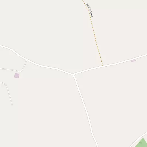
Local Map
⇅
Location Summary
- Hollocombe Town is located in Devon
- Administrative Area: Devon
- Ceremonial County: Devon
- Historic County: Devon
- Region & Country: South West / England
⇅
Nearby Towns & Cities
- North Tawton 10.2 km SSE
- Great Torrington 15.3 km WNW
- Okehampton 16.6 km SSW
- South Molton 17.0 km NNE
- Exeter 34.6 km ESE


⇅
Nearby Localities
- AshreigneyVillage 2.4 km N
- RiddlecombeVillage 3.2 km NW
- WinkleighVillage 3.3 km S
- WembworthyVillage 3.7 km ESE
- BurringtonVillage 5.5 km N
- BroadwoodkellyVillage 5.6 km S
- DoltonVillage 5.6 km W
- IddesleighVillage 6.6 km WSW
- ChulmleighVillage 6.6 km ENE
- MonkokehamptonVillage 7.4 km SW


⇅
Smaller Settlements
- Hollocombe 635 m ESE
- Churchwater 2.6 km NNW
- Cottwood 3.5 km NNW
- Bridge Reeve 4.0 km ENE
- Ingleigh Green 4.8 km SSW
- Upcott 5.2 km WSW
- Colleton Mills 5.8 km NE
- Dowland 5.9 km W
- Brushford 6.1 km SE
- Iddlecott 6.1 km W


⇅
Beaches
- Horsey Ridge26.5 km NW
- Instow Beach25.1 km NW
- Westward Ho! Beach27.0 km NW
⇅
Parks
- Pennsylvania Park34.4 km ESE
- Pleasure Grounds17.0 km S
- Summerleaze Down42.0 km W
- The Warren37.7 km NNW
⇅
Woods
- Clover Hill Copse740 m SSW
- Headcombe Copse731 m NE
- Hollocombe Wood475 m SSE
- Shute Close Wood710 m E

⇅
Hills
- Bransgrove Hill2.8 km ESE
- Bude Hill4.0 km SE
- Higher Stentiford4.2 km WSW
- Hound Hill4.8 km N
⇅
Lakes
- Claypitt's Water789 m E
- Golden Pool7.4 km W
- Junction Pool7.1 km NNE
- Storm Pond10.8 km W
⇅
Waterfalls
- Becka Falls33.9 km SSE
- Horseshoe Falls41.7 km SSE
- White Lady Waterfall30.5 km SSW
⇅
Headlands
- Cockington Head27.2 km WNW
- Gallantry Bower35.4 km WNW
⇅
Islands
- Horsey Island26.9 km NW
- Island of Rocks22.2 km SSW
⇅
Wetlands
- Roach Marsh5.6 km ENE
- Long Marsh9.2 km ENE
- Black Rock Marsh11.1 km WNW
⇅
Health Services
- Torrington Community HospitalHospital 15.1 km WNW
- South Molton Community HospitalHospital 16.7 km NNE
- Hatherleigh Nursing HomeMedical 11.9 km SW
- Hatchmoor Nursing HomeMedical 14.4 km NW
⇅
Education
- Winkleigh Community Primary SchoolSchool 3.5 km S
- Burrington Church of England (Controlled) Primary SchoolSchool 5.6 km N
- PetrocUniversity 22.0 km NNW
⇅
Railway Stations
- Eggesford5.5 km E
- Kings Nympton6.6 km NNE
⇅
Bus Stations
- Barnstaple Bus Station22.7 km NNW
- Exeter Bus Station34.9 km ESE
⇅
Coach Stations
- Torquay Coach Station54.3 km SSE
- Plymouth Coach Station58.5 km SSW
⇅
Ferry Terminals
- Starcross Pier45.8 km SE
- Torpoint Ferry Terminal59.1 km SSW
⇅
Airports
- Exeter Airport41.5 km ESE
- Plymouth City Airport52.5 km SSW
⇅
Airfields
- Eaglescott Airfield5.4 km NNW
- Eggesford Airfield6.5 km ESE
⇅
Heliports
- Lake Heliport26.6 km NW
- Hartland Heliport42.3 km WNW
⇅
Harbours
- Lynmouth Harbour39.5 km NNE
- Lympstone Boat Shelter45.0 km SE