
Holme
About Holme
Holme is in Central Bedfordshire. Neighbouring places include Broom lying 1.6 km West North West, Langford situated 1.7 km South, Stanford lying 2.9 km South West, Upper Caldecote lying 3.9 km North North West and Lower Caldecote lying 4.0 km North North West. Other rural areas close to here include Edworth, Newton, Millow and Seddington.
You may notice something interesting if you explore one of the nearby places.
These details are compiled from OS, ONS and OSM data released under open licence.
⇅
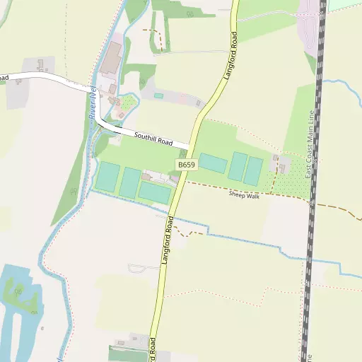
Local Map
⇅
Location Summary
- Holme is located in Central Bedfordshire
- Administrative Area: Central Bedfordshire
- Ceremonial County: Bedfordshire
- Historic County: Central Bedfordshire
- Region & Country: Eastern / England
⇅
Nearby Towns & Cities
- Biggleswade 1.9 km N
- Shefford 5.7 km SW
- Stotfold 6.5 km SSE
- Sandy 6.7 km NNW
- Cambridge 30.5 km ENE


⇅
Nearby Localities
- BroomVillage 1.6 km WNW
- LangfordVillage 1.7 km S
- StanfordVillage 2.9 km SW
- Upper CaldecoteVillage 3.9 km NNW
- Lower CaldecoteVillage 4.0 km NNW
- SouthillVillage 4.1 km W
- HenlowVillage 4.1 km SSW
- CliftonVillage 4.4 km SSW
- IckwellVillage 4.7 km NW
- DuntonVillage 5.1 km ENE


⇅
Smaller Settlements
- Edworth 3.9 km ESE
- Newton 4.4 km ENE
- Millow 4.4 km ENE
- Seddington 4.9 km NNW
- Stratford 5.0 km N
- Astwick 5.1 km SE
- Stotfold Common 5.3 km SSE
- Ireland 5.5 km W
- Brook End 5.8 km NNW
- Bury End 5.8 km ESE


⇅
Other places with this name
- Holme, Cambridgeshire44.9 km N
- Holme, Nottinghamshire 122.6 km NNW
- Holme, North Lincolnshire 166.2 km N
- Holme 179.1 km NNW
- Holme 195.5 km NNW
- Holme 212.8 km NNW
- Holme 214.9 km NNW
- Holme, North Yorkshire 253.4 km NNW
- Holme, Westmorland and Furness 288.5 km NNW
⇅
Beaches
- Bell Wharf Beach86.6 km SE
- Hadleigh Ray83.8 km SE
- Mill Beach77.8 km ESE
⇅
Parks
- Fishers Green Meadow17.1 km S
- Reed Green18.4 km ESE
- Wimpole Park17.1 km ENE
- Woolenwick Schools Meadow18.2 km SSE
⇅
Woods
- Ash Covert1.8 km NW
- Brickclamp Covert3.2 km WNW
- Lowsiebush Covert3.7 km WNW
- Palmer's Spinney4.3 km NW
⇅
Hills
- Bunker's Hill5.2 km N
- Cockshoot Hill5.2 km WSW
- Icehouse Hill4.6 km W
- Topler's Hill3.5 km SE

⇅
Lakes
- Basin Pond4.3 km WNW
- Bath Ponds4.1 km WNW
- Bilberry Pond3.7 km SSW
- Round Basin4.5 km W
⇅
Waterfalls
- Neptune Waterfall47.9 km SSW
- The Cascade51.3 km W
- Tower Waterfall47.8 km SSW
⇅
Headlands
- Botany Bay Point76.6 km SSW
- Tripcock Ness67.1 km SSE
⇅
Islands
- Longholme Island14.0 km WNW
- Rink Islands15.1 km WNW
⇅
Wetlands
- Fowlmere22.0 km E
- Waterford Marsh30.8 km SSE
- Chesterton Fen34.6 km ENE

⇅
Health Services
- Biggleswade HospitalHospital 3.5 km NNE
- Pinehill HospitalHospital 13.4 km S
- The Beaumont Nursing HomeMedical 2.1 km N
- Potton HouseMedical 3.6 km NNE

⇅
Education
- Langford Lower SchoolSchool 1.3 km S
- Holmemead Middle SchoolSchool 1.6 km NE
- Polhill CampusUniversity 14.3 km NW

⇅
Railway Stations
- Biggleswade1.7 km NNE
- Arlesey4.9 km S
⇅
Bus Stations
- Royston Bus Station17.1 km E
- Stevenage Interchange19.3 km SSE
⇅
Coach Stations
- Luton Airport Bus and Coach Station22.4 km SSW
- Milton Keynes Coachway29.5 km W
⇅
Ferry Terminals
- Blackfriars Pier63.2 km S
- Embankment Pier63.4 km S
⇅
Airports
- London Luton Airport22.4 km SSW
- Cambridge City Airport33.8 km ENE
⇅
Airfields
- Biggleswade Airfield3.6 km WNW
- RAF Henlow6.3 km SSW
⇅
Heliports
- The Egerton-Smith Centre33.7 km ENE
- Magpas Air Ambulance34.3 km N
⇅
Harbours
- Chelsea Harbour66.4 km S
- Cutter's Dock100.7 km SE