
Leadenham Park
About Leadenham Park
Leadenham Park sits within Lincolnshire. Places nearby include Leadenham around 702 m North North East, Fulbeck around 1.2 km South, Welbourn around 3.0 km North East, Caythorpe lying 3.6 km South South West and Frieston only 4.0 km South South West. Other rural settlements include Stragglethorpe, Byard's Leap, Brauncewell and Sutton.
You might learn something new by clicking through to a nearby place.
The information presented here is derived from OS, ONS and OSM under open licence.
⇅
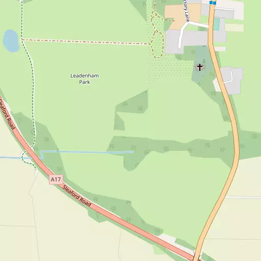
Local Map
⇅
Location Summary
- Leadenham Park is located in Lincolnshire
- Administrative Area: Lincolnshire
- Ceremonial County: Lincolnshire
- Historic County: Lincolnshire
- Region & Country: East Midlands / England
⇅
Nearby Towns & Cities
- Sleaford 13.2 km ESE
- Newark-on-Trent 15.0 km W
- North Hykeham 15.0 km N
- Grantham 16.1 km SSW
- Lincoln 20.5 km N


⇅
Nearby Localities
- LeadenhamVillage 702 m NNE
- FulbeckVillage 1.2 km S
- WelbournVillage 3.0 km NE
- CaythorpeVillage 3.6 km SSW
- FriestonVillage 4.0 km SSW
- Brant BroughtonVillage 4.1 km NW
- Normanton-on-CliffeVillage 5.1 km S
- BrandonVillage 5.7 km SW
- Hough-on-the-HillVillage 5.8 km SSW
- WellingoreVillage 6.2 km NE


⇅
Smaller Settlements
- Stragglethorpe 3.6 km WNW
- Byard's Leap 4.7 km ESE
- Brauncewell 6.4 km E
- Sutton 6.8 km W
- Temple Bruer 6.9 km ENE
- Carlton Ashes 7.1 km SSW
- Gelston 7.2 km SSW
- West Willoughby 8.1 km S
- Brauncewell 9.8 km E
- Barkston Heath 10.5 km SSE


⇅
Beaches
- Chapel St Leonards Beach64.9 km ENE
- Ingoldmells Beach64.8 km ENE
- Skegness Beach63.2 km E
⇅
Parks
- Bulwell Forest40.3 km W
- Burgage Green24.4 km W
- Larks Green52.1 km SSE
- Wilsford Warren11.5 km SE

⇅
Woods
- Old Wood896 m ESE
- Railway Plantation678 m E
- St Ann's Plantation444 m E
- Stonepit Plantation893 m E
⇅
Hills
- Bosom Hill5.8 km SSW
- Castle Hill5.7 km SSW
- Mill Mound5.8 km SSW
- Normanton Hill5.0 km SSE
⇅
Lakes
- Joyce's Broad11.5 km NW
- Tar Lane Pond12.1 km S
- The Lake10.8 km S
- The Moats10.8 km S
⇅
Waterfalls
- Kinder Downfall94.0 km WNW
- Lumb Fall115.1 km NW
- The Cascade117.7 km SSW
⇅
Headlands
- Flamborough Head122.8 km NNE
- Red Cliff Point133.1 km N
⇅
Islands
- Branston Island24.4 km NE
- Torksey Island29.8 km NNW

⇅
Wetlands
- Guildhall Springs12.1 km ESE
- Smithy Marsh19.9 km NW
- Laughterton Marsh27.6 km NNW
⇅
Health Services
- Ash VillaHospital 11.8 km SE
- Newark HospitalHospital 14.8 km W
- Welbourn Hall Private Nursing HomeMedical 2.9 km NE
- Roxholm HallMedical 10.5 km E
⇅
Education
- Leadenham Church of England Primary SchoolSchool 657 m NNE
- Sir William Robertson AcademySchool 2.0 km NE
- Newark CollegeUniversity 14.8 km W
⇅
Railway Stations
- Ancaster8.0 km SSE
- Rauceby11.5 km SE
⇅
Bus Stations
- Newark Bus Station15.3 km W
- Grantham Bus Station16.3 km SSW
⇅
Coach Stations
- Chesterfield Coach Station59.6 km WNW
- Meadowhall Interchange68.3 km NW
⇅
Ferry Terminals
- Normanton Chain Ferry51.5 km WSW
- Hull Ferry Port79.4 km NNE

⇅
Airports
- Wickenby Aerodrome33.3 km NNE
- Nottingham City Airport36.2 km WSW
⇅
Airfields
- RAF Cranwell6.7 km ESE
- RAF Barkston Heath10.1 km S
⇅
Heliports
- Lincs and Notts Air Ambulance HQ14.2 km NNE
- Nottingham Heliport38.1 km SW
⇅
Harbours
- Farndon Harbour17.7 km W
- South Killingholme Haven69.8 km NNE