
Little Raveley
About Little Raveley
Little Raveley is in Cambridgeshire. Neighbouring places include Wistow only 2.5 km East North East, Upwood just 2.7 km North, Abbots Ripton around 3.1 km South West, Broughton only 3.2 km South East and Kings Ripton just 3.4 km South. Other countryside settlements include Great Raveley, Wennington, Church End and Alconbury Weald.
You may find out something new or interesting if you click a nearby place to see more local information.
This page uses OS, ONS and OSM data supplied under open licence.
⇅
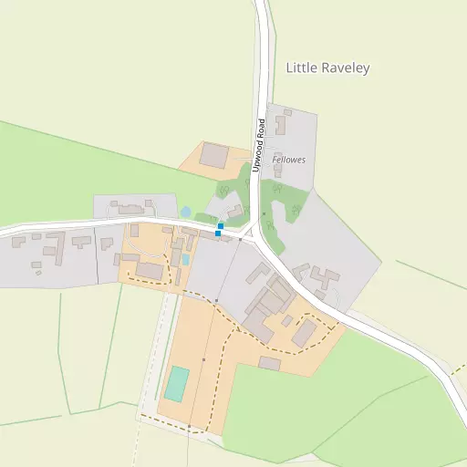
Local Map
⇅
Location Summary
- Little Raveley is located in Cambridgeshire
- Administrative Area: Cambridgeshire
- Ceremonial County: Cambridgeshire
- Historic County: Cambridgeshire
- Region & Country: Eastern / England
⇅
Nearby Towns & Cities
- Ramsey 6.0 km NNE
- Huntingdon 8.3 km SSW
- Godmanchester 9.4 km S
- St Ives 10.4 km SSE
- Peterborough 19.8 km NNW


⇅
Nearby Localities
- WistowVillage 2.5 km ENE
- UpwoodVillage 2.7 km N
- Abbots RiptonVillage 3.1 km SW
- BroughtonVillage 3.2 km SE
- Kings RiptonVillage 3.4 km S
- WoodwaltonVillage 4.3 km WNW
- Ramsey EndDistrict 4.8 km E
- BuryVillage 4.9 km NE
- Old HurstVillage 5.2 km SE
- WarboysVillage 5.3 km E


⇅
Smaller Settlements
- Great Raveley 1.4 km NNW
- Wennington 1.9 km WSW
- Church End 5.3 km WNW
- Alconbury Weald 5.6 km SW
- Fenton 6.4 km E
- West End 6.9 km SE
- Coppingford 9.0 km W
- Ramsey Hollow 9.1 km NE
- Woolley 11.8 km WSW
- Steeple Gidding 12.0 km W


⇅
Beaches
- Snettisham Beach65.3 km NE
- Snettisham Scalp66.1 km NE
- Stubborn Sand69.0 km NE
⇅
Parks
- Butt Green29.0 km SE
- Larks Green25.8 km NNW
- New Pasture8.0 km SSW
- Wimpole Park29.4 km SSE
⇅
Woods
- Kingsland Spinney938 m NNW
- Raveley Wood1.4 km SSW
- Ten Acre Spinney1.6 km NW
- Wennington Wood1.4 km SW

⇅
Hills
- Hartford Hill5.9 km SSE
- Shipman Hill7.0 km SW
- Walton Hill4.5 km W
- Wyton Hill5.2 km SSE
⇅
Lakes
- Dam Pit3.3 km SE
- Heath Pond6.0 km E
- Ridge's Pond7.1 km SE
- The Weir5.4 km E
⇅
Waterfalls
- Neptune Waterfall85.2 km SSW
- The Cascade72.0 km SW
- Tower Waterfall85.1 km SSW
⇅
Headlands
- Tripcock Ness100.8 km S
- West Point114.1 km SSE
⇅
Islands
- Battcock's Island9.2 km SSE
- The Island9.3 km S
⇅
Wetlands
- Ouse Fen13.8 km ESE
- Gault Hole17.9 km E
- Chesterton Fen29.2 km SE

⇅
Health Services
- Hinchingbrooke HospitalHospital 8.4 km SSW
- Doddington Community HospitalHospital 17.9 km NE
- The Red HouseMedical 5.5 km NNE
- Primrose Hill Care HomeMedical 6.5 km S
⇅
Education
- Abbots Ripton Church of England SchoolSchool 3.0 km SW
- Upwood Primary SchoolSchool 3.3 km NNE
- Madingley HallUniversity 23.9 km SSE
⇅
Railway Stations
- Huntingdon8.8 km SSW
- Whittlesea16.5 km N
⇅
Bus Stations
- Huntingdon Bus Station8.5 km SSW
- Drummer Street Bus Station29.1 km SE
⇅
Coach Stations
- Milton Keynes Coachway53.5 km SW
- Luton Airport Bus and Coach Station60.2 km SSW
⇅
Ferry Terminals
- Normanton Chain Ferry85.1 km WNW
- Blackfriars Pier99.3 km S
⇅
Airports
- Cambridge City Airport31.6 km SE
- London Luton Airport60.2 km SSW
⇅
Airfields
- Upwood Airfield3.8 km NNE
- RAF Wyton5.9 km SSE
⇅
Heliports
- Magpas Air Ambulance7.0 km WSW
- The Egerton-Smith Centre31.1 km SE
⇅
Harbours
- Brancaster Harbour84.4 km NE
- Farndon Harbour87.1 km NNW