
London Apprentice
About London Apprentice
London Apprentice is in Cornwall. Neighbouring places include Polgooth only 1.3 km West North West, Tregorrick only 1.4 km North North East, Trelowth situated 2.1 km West North West and Sticker only 2.8 km West. Other countryside settlements include Levalsa Meor, Little Polgooth, Nansladron, St Mewan and Higher Porthpean.
You might learn something new by clicking through to a nearby place.
Information is sourced from OS, ONS and OSM under open licence, using publicly available datasets.
⇅
Local Map
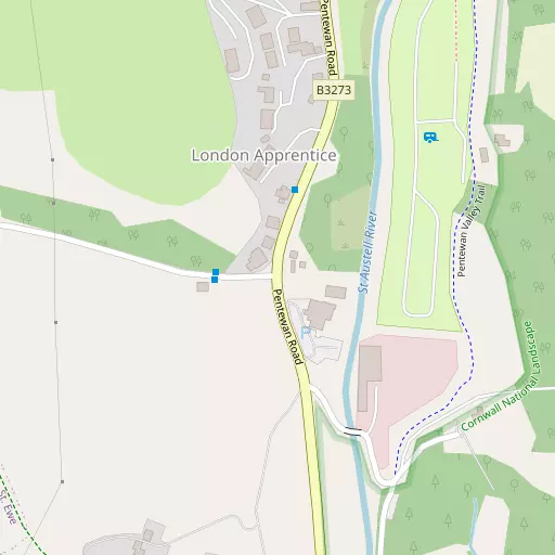
⇅
Location Summary
- London Apprentice is located in Cornwall
- Administrative Area: Cornwall
- Ceremonial County: Cornwall
- Historic County: Cornwall
- Region & Country: South West / England
⇅
Nearby Towns & Cities
- St Austell 2.6 km NNE
- St Blazey 7.9 km NE
- Fowey 12.0 km E
- Lostwithiel 13.8 km NE
- Truro 18.7 km WSW


⇅
Nearby Localities
- PolgoothVillage 1.3 km WNW
- TregorrickVillage 1.4 km NNE
- TrelowthVillage 2.1 km WNW
- StickerVillage 2.8 km W
- PentewanVillage 2.9 km SSE
- DuporthVillage 3.0 km NE
- TrewoonVillage 3.0 km NNW
- Mount CharlesDistrict 3.1 km NE
- CharlestownVillage 3.6 km ENE
- Sandy BottomDistrict 3.8 km NE


⇅
Smaller Settlements
- Levalsa Meor 526 m S
- Little Polgooth 1.2 km W
- Nansladron 1.6 km S
- St Mewan 2.0 km NNW
- Higher Porthpean 2.2 km ENE
- Lower Porthpean 2.5 km ENE
- Lower Sticker 2.8 km W
- Trenarren 2.8 km ESE
- Tregiskey 3.6 km S
- Hewas Water 4.0 km W


⇅
Beaches
- Carnjewey Beach2.5 km ENE
- Porth Pean Beach2.7 km ENE
- Silvermine Beach2.6 km E
⇅
Parks
- Lanner Moor30.2 km WSW
- Palm Cross Green64.8 km E
- Summerleaze Down60.3 km NNE
- Trungle Moor59.1 km WSW
⇅
Woods
- Peckhill Wood828 m S
- Roseweek Plantation959 m ENE
- Shepherdshill Wood608 m SE
- Thomas's Plantation634 m ESE

⇅
Hills
- Castle Hill6.3 km S
- Crow Hill6.8 km W
- Sticker Down2.2 km W
- Watch Hill5.5 km NW

⇅
Lakes
- Carpalla Mica Dam6.0 km NW
- Great Treverbyn Mica Dam5.9 km N
- Hill's Quarry2.3 km NNW
- Trethurgy Reservoir4.7 km NNE

⇅
Waterfalls
- Golitha Falls28.5 km NE
- White Lady Waterfall59.6 km NE
- Yealm Steps62.4 km ENE
⇅
Headlands
- Drennick3.4 km ESE
- Silvermine Point2.6 km E
⇅
Islands
- Gull Island4.6 km ENE
- Zacry's Islands22.3 km NW
⇅
Wetlands
- Appletree Point4.0 km ENE
- The Battery5.1 km SSE
- Brawn Point12.2 km E
⇅
Health Services
- Penrice HospitalHospital 2.4 km ENE
- Fowey HospitalHospital 11.8 km ENE
- TregarneMedical 2.8 km NNE
- Old Roselyon Manor Nursing HomeMedical 7.3 km NE
⇅
Education
- St Mewan Community Primary SchoolSchool 2.0 km NNW
- Pondhu Primary SchoolSchool 2.0 km N
- Cornwall CollegeUniversity 21.6 km WNW
⇅
Railway Stations
- St Austell2.8 km NNE
- Par8.2 km ENE
⇅
Bus Stations
- Truro Bus Station18.6 km WSW
- Newquay Bus Station23.0 km WNW
⇅
Coach Stations
- Plymouth Coach Station47.1 km E
- Torquay Coach Station91.4 km ENE
⇅
Ferry Terminals
- Fowey Quay11.8 km E
- Polruan Ferry11.9 km E
⇅
Airports
- Newquay Cornwall Airport20.7 km NW
- Plymouth City Airport50.5 km ENE
⇅
Airfields
- Bodmin Airfield22.7 km NNE
- St Merryn Airfield24.5 km NNW
⇅
Heliports
- Cornwall Air Ambulance Station18.4 km NW
- Penzance Heliport54.7 km WSW
⇅
Harbours
- Charlestown Docks3.6 km ENE
- Mevagissey Harbour5.3 km SSE