
Markwell
About Markwell
Markwell is in Cornwall. Among the nearby places are St Germans lying 1.5 km West South West, Landrake around 2.2 km North, Polbathic lying 2.6 km South West and Trematon situated 2.7 km East North East. Other rural places nearby include St Erney, Trevollard, Trehan, Trerulefoot and Antony Passage.
You may find extra local information by clicking a nearby place.
This page uses OS, ONS and OSM data supplied under open licence.
⇅
Local Map
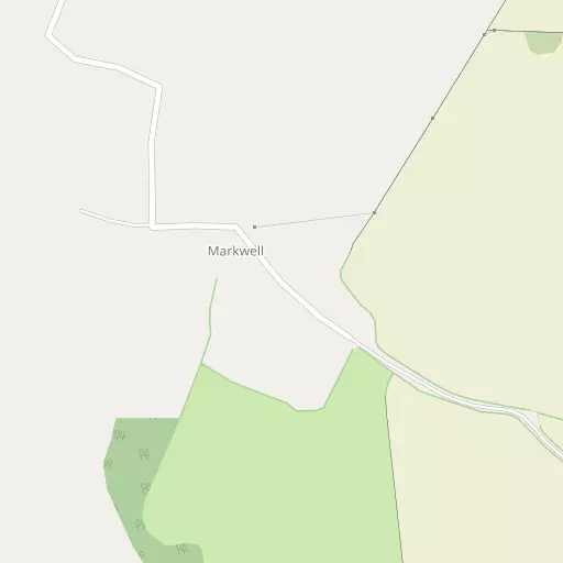
⇅
Location Summary
- Markwell is located in Cornwall
- Administrative Area: Cornwall
- Ceremonial County: Cornwall
- Historic County: Cornwall
- Region & Country: South West / England
⇅
Nearby Towns & Cities
- Saltash 6.0 km E
- Torpoint 7.6 km ESE
- Callington 11.2 km N
- Looe 12.5 km WSW
- Plymouth 11.5 km ESE


⇅
Nearby Localities
- St GermansVillage 1.5 km WSW
- LandrakeVillage 2.2 km N
- PolbathicVillage 2.6 km SW
- TrematonVillage 2.7 km ENE
- TidefordVillage 2.7 km WNW
- SheviockVillage 3.3 km S
- LatchbrookDistrict 4.0 km ENE
- CraftholeVillage 4.1 km S
- Burraton CoombeDistrict 4.2 km E
- ForderVillage 4.2 km E


⇅
Smaller Settlements
- St Erney 709 m NNE
- Trevollard 1.7 km E
- Trehan 3.5 km E
- Trerulefoot 4.0 km W
- Antony Passage 4.6 km ESE
- Budge's Shop 4.6 km W
- Bethany 5.0 km WNW
- Blunts 5.3 km NNW
- Narkurs 5.4 km WSW
- Maryfield 5.9 km ESE


⇅
Beaches
- Beaks Horn5.2 km SSW
- Finnygook Beach4.8 km SSW
- Long Sands5.6 km SSE


⇅
Parks
- Palm Cross Green29.4 km ESE
- Pleasure Grounds42.5 km NNE
- Summerleaze Down50.9 km NNW
- The Lawn61.8 km ENE
⇅
Woods
- Broom Down Wood735 m NW
- Craggs' Wood929 m WNW
- Treluggan Wood950 m E
- West Down Wood615 m NW

⇅
Hills
- Berry Down3.0 km S
- Berry Hill515 m NE
- Erth Hill2.7 km SSE
- Windmills Hill1.3 km NNE

⇅
Lakes
- Crafthole Reservoir4.1 km S
- Eglarooze Reservoir4.7 km SW
- Old Mill Leat2.5 km NW
- Spring Pond2.8 km N
⇅
Waterfalls
- Golitha Falls17.8 km WNW
- White Lady Waterfall28.3 km NNE
- Yealm Steps25.3 km ENE
⇅
Headlands
- Britain Point4.9 km SSW
- Looking Glass6.9 km ESE
⇅
Islands
- Drake's Island11.4 km ESE
- Erth Island1.9 km SSE
⇅
Wetlands
- Warren Point3.6 km SSE
- Jupiter Point4.8 km ESE
- The Marsh5.6 km ENE
⇅
Health Services
- Royal Eye InfirmaryHospital 12.4 km E
- Derriford HospitalHospital 12.8 km E
- The Elms Care CentreMedical 4.5 km ENE
- Asheborough House Care CentreMedical 4.8 km E
⇅
Education
- St Germans Primary SchoolSchool 1.7 km SW
- Sir Robert Geffrey's SchoolSchool 2.4 km NNE
- Peninsula Dental SchoolUniversity 9.7 km ESE
⇅
Railway Stations
- St Germans1.3 km SW
- Saltash6.1 km E
⇅
Bus Stations
- Kingsbridge Bus Station39.2 km ESE
- Truro Bus Station55.7 km WSW
⇅
Coach Stations
- Plymouth Coach Station11.3 km ESE
- Torquay Coach Station54.4 km E
⇅
Ferry Terminals
- Torpoint Ferry Terminal7.9 km ESE
- Plymouth Stonehouse10.2 km ESE
⇅
Airports
- Plymouth City Airport13.4 km E
- Newquay Cornwall Airport51.2 km W
⇅
Airfields
- Bodmin Airfield28.4 km WNW
- Davidstow Airfield34.5 km NW
⇅
Heliports
- Cornwall Air Ambulance Station48.9 km W
- Lake Heliport70.1 km N
⇅
Harbours
- Weston Mill Lake7.6 km E
- Fort Picklecombe Harbour11.1 km SE
