
Newton, Newton (South Cambridgeshire)
About Newton
Newton lies 1.9 km NW from Newton (South Cambridgeshire) in Cambridgeshire. Places nearby include Harston around 1.9 km North West, Little Shelford lying 2.6 km North East, Thriplow just 2.8 km South, Foxton just 2.8 km West South West and Hauxton only 2.8 km North. Other settlements close by include Freestones Corner, Bridgefoot, Flint Cross and Dyer's Green.
You may find extra local information by clicking a nearby place.
All place information is taken from OS, ONS and OSM under open licence.
⇅
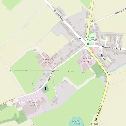
Local Map
⇅
Location Summary
- Newton is a neighbourhood in Newton (South Cambridgeshire)
- Administrative Area: Cambridgeshire
- Ceremonial County: Cambridgeshire
- Historic County: Cambridgeshire
- Region & Country: Eastern / England
⇅
Nearby Towns & Cities
⇅
Nearby Localities
⇅
Smaller Settlements
- Freestones Corner
- Bridgefoot
- Flint Cross
- Dyer's Green
- Old Wimpole
- Broad Green
- Strethall
- Catmere End
- Wendy
- Shaftenhoe End
⇅
Other places with this name
Closest
- Newton, Central Bedfordshire
- Newton, Suffolk
- Newton, North Northamptonshire
- Newton, Norfolk
- Newton, Warwickshire
Furthest away
- Newton, Highland
- Newton, Highland
- Newton, Highland
- Newton, Highland
- Newton, Moray
⇅
Beaches
- Brightlingsea Beach
- Mill Beach
- West Mersea Beach
⇅
Parks
- Butt Green
- Empty Common
- Reed Green
- Wimpole Park
⇅
Woods
- Fen Wood
- Kidman's Plantation
- The Spinney
- Well Head Plantation
⇅
Hills
- Chalk Hill
- Clunch Pit Hill
- Harston Hill
- Rowley's Hill
⇅
Lakes
- Dernmere
- Great Nine Wells
- Little Nine Wells
- Well Head
⇅
Waterfalls
- Neptune Waterfall
- The Cascade
- Tower Waterfall
⇅
Headlands
- Tripcock Ness
- West Point
⇅
Islands
- Duck Island
- Riddy Island
⇅
Wetlands
- Fowlmere
- Chesterton Fen
- The Marsh
⇅
Health Services
- Royal Papworth Hospital
- Addenbrooke's Hospital
- Barley Manor Care Home
- Maycroft Care Home
⇅
Education
- Harston and Newton Community Primary School
- Thriplow Church of England (Voluntary Aided) Primary School
- Strangeways Research Laboratory
⇅
Railway Stations
- Foxton
- Shelford
⇅
Bus Stations
- Addenbrooke's Bus Station
- Drummer Street Bus Station
⇅
Coach Stations
- Stansted Airport Coach Station
- Luton Airport Bus and Coach Station
⇅
Ferry Terminals
- Canary Wharf Pier
- North Greenwich Pier
⇅
Airports
- Cambridge City Airport
- Stansted Airport
⇅
Airfields
- Duxford Airfield
- Bourn Airfield
⇅
Heliports
- The Egerton-Smith Centre
- Magpas Air Ambulance
⇅
Harbours
- Chelsea Harbour
- Harwich Harbour