
Onley
About Onley
Onley, in West Northamptonshire, has Barby just 2.7 km East, Willoughby situated 2.7 km South, Dunchurch around 3.2 km West North West, Hillmorton Paddock only 3.5 km North North East and Grandborough around 4.0 km South West. Other countryside places nearby include Woolscott, Sawbridge, Emery Row and Wolfhamcote.
You might learn something new by clicking through to a nearby place.
This information is based on OS, ONS and OSM data released under open licence.
⇅
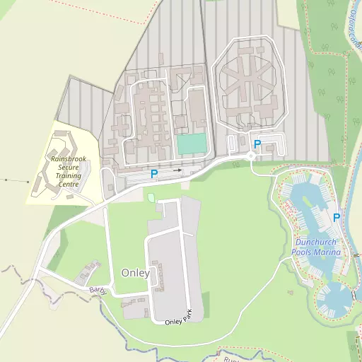
Local Map
⇅
Location Summary
- Onley is located in West Northamptonshire
- Administrative Area: West Northamptonshire
- Ceremonial County: West Northamptonshire
- Historic County: West Northamptonshire
- Region & Country: East Midlands / England
⇅
Nearby Towns & Cities
- Rugby 5.2 km NNW
- Daventry 9.5 km SE
- Southam 12.7 km SW
- Lutterworth 14.6 km NNE
- Coventry 19.9 km WNW


⇅
Nearby Localities


⇅
Smaller Settlements
- Woolscott 2.7 km SW
- Sawbridge 4.3 km SSW
- Emery Row 4.9 km E
- Wolfhamcote 4.9 km SSE
- Kites Hardwick 4.9 km WSW
- Nethercote 5.9 km S
- Hill 6.9 km WSW
- Lower Shuckburgh 7.9 km SSW
- Little Lawford 8.6 km NNW
- Cosford 9.2 km N


⇅
Beaches
- Cotswold Hills Beach88.6 km SW
- Snettisham Beach128.9 km ENE
- Snettisham Scalp129.1 km ENE
⇅
Parks
- Bell Green Wildlife Conservation Area19.9 km NW
- Bilton Common4.6 km NW
- Stoneleigh Community Orchard18.5 km W
- The Green11.8 km SSE

⇅
Woods
- Cock Robin Plantation3.1 km NW
- Railway Spinney2.3 km NW
- Sutton's Spinney3.1 km SW
- Tiltup's Wood2.9 km ESE

⇅
Hills
- Barby Hill1.8 km E
- Beck Hill3.7 km WSW
- Bunkers Hill2.7 km WSW
- Cleves Hill3.2 km ESE
⇅
Lakes
- Barby Straight2.3 km NE
- Draycote Water5.5 km W
- Sow Brook (North)4.3 km N
- Sow Brook (South)4.6 km NNW

⇅
Waterfalls
- Neptune Waterfall86.2 km SSE
- The Cascade36.8 km SSE
- Tower Waterfall85.5 km SSE
⇅
Headlands
- Botany Bay Point111.0 km SSE
- Summerhouse Island118.8 km NW
⇅
Islands
- Crescent Wood Island34.7 km WNW
- The Islands29.2 km NNE
⇅
Wetlands
- Welches Meadow19.3 km WSW
- Wyken Slough20.4 km NW
- Lucas Marsh31.5 km NNE
⇅
Health Services
- Hospital of St CrossHospital 4.3 km N
- Danetre HospitalHospital 10.1 km SE
- Anya Court Care HomeMedical 3.5 km NW
- Overslade HouseMedical 4.3 km NNW
⇅
Education
- Barby Church of England Primary SchoolSchool 2.7 km E
- Bilton Grange Preparatory SchoolSchool 2.9 km NW
- Richard Crossman BuildingUniversity 19.4 km WNW
⇅
Railway Stations
- Rugby5.9 km N
- Long Buckby11.4 km ESE
⇅
Bus Stations
- Daventry Bus Station9.6 km SE
- Pool Meadow Bus Station20.1 km WNW
⇅
Coach Stations
- Shakespeare's Birthplace Coach Terminal34.8 km WSW
- Birmingham Coach Station46.7 km WNW
⇅
Ferry Terminals
- Normanton Chain Ferry52.8 km N
- Hammerton's Pier116.8 km SSE
⇅
Airports
- Coventry Airport16.8 km WNW
- Wellesbourne Mountford Airfield29.0 km WSW
⇅
Airfields
- Sywell Aerodrome31.0 km E
- Shenington Airfield31.2 km SSW
⇅
Heliports
- Nottingham Heliport58.8 km NNE
- Crossplain Poultry Farm64.7 km NNW
⇅
Harbours
- Farndon Harbour86.2 km NNE
- Lydney Harbour110.4 km SW