
Oxlode
About Oxlode
Oxlode, in Cambridgeshire, has Pymoor only 1.0 km East, Manea situated 3.1 km North North West, Coveney just 4.3 km South and Little Downham only 4.4 km South East. Other countryside places nearby include Purls Bridge, Welches Dam, Way Head, Dunkirk and Downham Hythe.
You might discover something new by clicking a nearby place for more local details.
The place data here is drawn from OS, ONS and OSM under open licence.
⇅
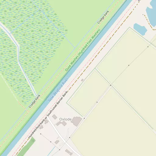
Local Map
⇅
Location Summary
- Oxlode is located in Cambridgeshire
- Administrative Area: Cambridgeshire
- Ceremonial County: Cambridgeshire
- Historic County: Cambridgeshire
- Region & Country: Eastern / England
⇅
Nearby Towns & Cities
⇅
Nearby Localities
⇅
Smaller Settlements
⇅
Beaches
- Snettisham Beach
- Snettisham Scalp
- Stubborn Sand
⇅
Parks
- Butt Green
- Empty Common
- Larks Green
- New Pasture
⇅
Woods
- Great Spinney
- Hall Plantation
- Redmoor Plantation
- The Rookery
⇅
Hills
- Burnt Hill
- Honey Hill
- Little Hill
- Widden's Hill
⇅
Lakes
- Ballast Hole Pond
- Burrow Pond
- Robin Knight's Pond
- Stanker's Pond
⇅
Waterfalls
- Neptune Waterfall
- The Cascade
- Tower Waterfall
⇅
Headlands
- North Weir Point
- Tripcock Ness
⇅
Islands
- Battcock's Island
- Holt Island
⇅
Wetlands
- Gault Hole
- Ouse Fen
- Chesterton Fen
⇅
Health Services
- Princess of Wales Hospital
- Doddington Community Hospital
- The Grange
- The Limes
⇅
Education
- Manea Community Primary School
- Downham Feoffees Primary School
- College of West Anglia
⇅
Railway Stations
- Manea
- Littleport
⇅
Bus Stations
- Mildenhall Bus Station
- Drummer Street Bus Station
⇅
Coach Stations
- Stansted Airport Coach Station
- Luton Airport Bus and Coach Station
⇅
Ferry Terminals
- Harwich Ferry Port
- Reedham Ferry North
⇅
Airports
- Cambridge City Airport
- Stansted Airport
⇅
Airfields
- Chatteris Airfield
- Upwood Airfield
⇅
Heliports
- The Egerton-Smith Centre
- Magpas Air Ambulance
⇅
Harbours
- Brancaster Harbour
- How Hill Staithe