
Pipers Pool
About Pipers Pool
Pipers Pool is in Cornwall. Local places nearby include Polyphant around 2.1 km South, Egloskerry situated 2.8 km North North East, Tregadillett around 3.8 km East and Lewannick only 3.9 km South South East. Other rural communities nearby include Gospenheale, Trewen, Trenault, Badharlick and Tregeare.
You may find extra local information by clicking a nearby place.
All information is drawn from OS, ONS and OSM under open licence, reflecting the best available public data.
⇅
Local Map
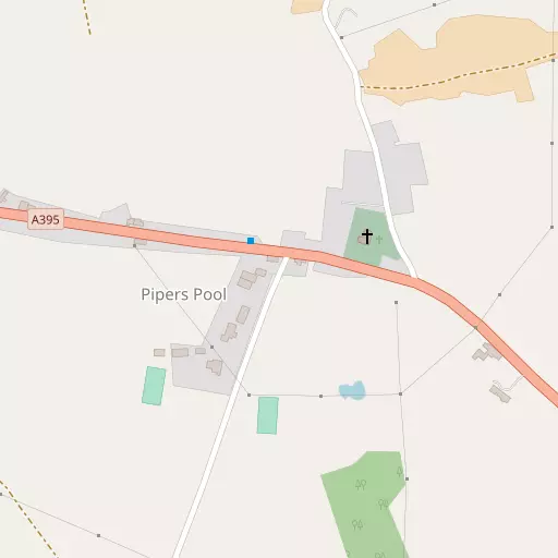
⇅
Location Summary
- Pipers Pool is located in Cornwall
- Administrative Area: Cornwall
- Ceremonial County: Cornwall
- Historic County: Cornwall
- Region & Country: South West / England
⇅
Nearby Towns & Cities
- Launceston 7.2 km E
- Camelford 15.3 km W
- Callington 17.6 km SE
- Liskeard 19.5 km S
- Plymouth 36.8 km SE


⇅
Nearby Localities
- PolyphantVillage 2.1 km S
- EgloskerryVillage 2.8 km NNE
- TregadillettVillage 3.8 km E
- LewannickVillage 3.9 km SSE
- TresmeerVillage 4.3 km NW
- AltarnunVillage 4.6 km SW
- FivelanesVillage 4.7 km SW
- LangoreVillage 4.8 km ENE
- TrevadlockVillage 5.0 km S
- TrewintVillage 5.3 km SW


⇅
Smaller Settlements
- Gospenheale 234 m NNE
- Trewen 914 m SW
- Trenault 971 m SSE
- Badharlick 2.2 km N
- Tregeare 3.0 km NW
- Laneast 3.1 km W
- Kestle 3.1 km E
- Badgall 3.4 km NW
- Trebeath 3.7 km N
- Newmills 4.0 km ENE

⇅
Beaches
- Crackington Beach17.4 km NW
- Rusey Beach16.6 km NW
- The Strangles17.1 km NW
⇅
Parks
- Palm Cross Green51.1 km SE
- Pennsylvania Park67.3 km E
- Pleasure Grounds34.8 km ENE
- Summerleaze Down23.2 km NNW

⇅
Woods
- Bridge Plantation1.6 km NNW
- Coombe Corner Plantation1.6 km NW
- Lodge Plantation987 m NW
- Northdown Plantation1.4 km S
⇅
Hills
- Gallows Hill6.0 km ENE
- Tregearedown Beacon2.8 km NNW
- Trekennick Tor5.2 km WSW
- Trewint Downs6.3 km SW

⇅
Lakes
- Ladies' Mile6.8 km S
- Mill Pond4.1 km NW
- Old Mill Leat7.1 km SE
- Swan Pool6.9 km S
⇅
Waterfalls
- Golitha Falls15.9 km S
- White Lady Waterfall24.1 km E
- Yealm Steps41.1 km ESE

⇅
Headlands
- Cambeak18.0 km NW
- Fire Beacon Point17.4 km WNW

⇅
Islands
- Chapel Rock23.2 km NNW
- The Island21.5 km WNW
⇅
Wetlands
- Trewint Marsh5.8 km SW
- Redmoor Marsh6.6 km SSW
- Watery Marsh7.1 km SSW

⇅
Health Services
- Launceston HospitalHospital 7.3 km E
- LaylandHospital 19.6 km S
- Kernow HouseMedical 7.3 km E
- Cedar GrangeMedical 7.4 km ENE
⇅
Education
- Egloskerry SchoolSchool 2.8 km NNE
- Tregadillett Community Primary SchoolSchool 3.8 km E
- University of St Mark and St JohnUniversity 34.2 km SE
⇅
Railway Stations
- Newmills4.1 km ENE
- Launceston7.0 km E
⇅
Bus Stations
- Newquay Bus Station50.3 km WSW
- Barnstaple Bus Station57.4 km NNE
⇅
Coach Stations
- Plymouth Coach Station36.5 km SE
- Torquay Coach Station67.7 km ESE
⇅
Ferry Terminals
- Torpoint Ferry Terminal34.2 km SE
- Bodinnick34.5 km SSW
⇅
Airports
- Plymouth City Airport34.0 km SE
- Newquay Cornwall Airport44.4 km WSW
⇅
Airfields
- Davidstow Airfield10.8 km W
- Bodmin Airfield20.4 km SW
⇅
Heliports
- Cornwall Air Ambulance Station42.9 km WSW
- Hartland Heliport43.3 km N
⇅
Harbours
- Weston Mill Lake32.8 km SE
- Polperro Harbour33.5 km S