
Preston Deanery
About Preston Deanery
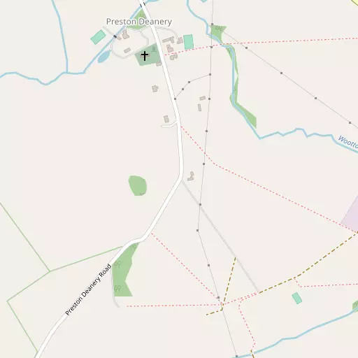
Preston Deanery sits within West Northamptonshire. Local places nearby include Hackleton situated 1.6 km East, Quinton only 1.7 km South West, Piddington lying 1.8 km South East and Wootton lying 3.0 km West North West. Other rural localities include Quinton Green, Swan Valley, Whiston, Tathall End and Hulcote.
You may find extra local information by clicking a nearby place.
The details shown here use OS, ONS and OSM data provided under open licence.
⇅
Local Map
⇅
Location Summary
- Preston Deanery is located in West Northamptonshire
- Administrative Area: West Northamptonshire
- Ceremonial County: West Northamptonshire
- Historic County: West Northamptonshire
- Region & Country: East Midlands / England
⇅
Nearby Towns & Cities
- Northampton 6.2 km NNW
- Olney 10.5 km ESE
- Towcester 11.7 km SW
- Newport Pagnell 14.3 km SE
- Milton Keynes 17.6 km SSE


⇅
Nearby Localities
- HackletonVillage 1.6 km E
- QuintonVillage 1.7 km SW
- PiddingtonVillage 1.8 km SE
- WoottonDistrict 3.0 km WNW
- HortonVillage 3.1 km ESE
- Great HoughtonVillage 3.5 km N
- BrackmillsDistrict 3.5 km NNW
- HardingstoneDistrict 3.7 km NW
- CourteenhallVillage 3.8 km SW
- CollingtreeVillage 3.9 km W


⇅
Smaller Settlements
- Quinton Green 2.4 km SSW
- Swan Valley 7.4 km WNW
- Whiston 7.9 km NE
- Tathall End 9.1 km SSE
- Hulcote 9.9 km WSW
- Dalscote 10.5 km W
- Gayhurst 10.7 km SE
- Tyringham 10.8 km SE
- Warrington 10.8 km E
- Caldecote 11.0 km WSW


⇅
Beaches
- Cotswold Hills Beach96.4 km SW
- Snettisham Beach115.1 km NE
- Snettisham Scalp115.6 km NE
⇅
Parks
- Buckwell Green16.0 km NE
- Foot Meadow6.6 km NW
- The Green9.9 km WNW
- The Green15.0 km SSE
⇅
Woods
- Grange Park2.6 km W
- Grange Spinney2.6 km W
- Little Gap Spinney2.1 km NW
- Preston Wood892 m S

⇅
Hills
- Blisworth Hill6.6 km WSW
- Combe Hill7.8 km NE
- Hunsbury Hill5.9 km WNW
- Organ's Hill5.1 km SSE
⇅
Lakes
- Charcoal Pond6.6 km ESE
- Grange Pond2.3 km SE
- Paradise Ponds7.1 km ENE
- Park Pond5.8 km E

⇅
Waterfalls
- Neptune Waterfall60.4 km SSE
- The Cascade21.5 km SSW
- Tower Waterfall59.9 km SSE
⇅
Headlands
- Botany Bay Point88.3 km SSE
- Tripcock Ness99.5 km SE
⇅
Islands
- Heron Island17.0 km E
- Millholme Island15.4 km E
⇅
Wetlands
- Summer Leys12.7 km NE
- Welches Meadow47.3 km WNW
- Lucas Marsh47.4 km NNW
⇅
Health Services
- St Andrew's HospitalHospital 5.3 km NNW
- Three Shires HospitalHospital 5.4 km NNW
- Cliftonville Care HomeMedical 5.6 km NNW
- The Angela GraceMedical 5.9 km NNW
⇅
Education
- Hackleton Church of England Primary SchoolSchool 1.3 km E
- Caroline Chisholm SchoolSchool 2.1 km WNW
- University of Northampton Waterside CampusUniversity 5.2 km NNW
⇅
Railway Stations
- Northampton6.6 km NW
- Boughton11.4 km NNW
⇅
Bus Stations
- North Gate Bus Station6.4 km NNW
- Daventry Bus Station22.6 km WNW
⇅
Coach Stations
- Milton Keynes Coachway18.1 km SE
- Luton Airport Bus and Coach Station47.3 km SE
⇅
Ferry Terminals
- Normanton Chain Ferry72.7 km NNW
- Hammerton's Pier90.4 km SSE
⇅
Airports
- Coventry Airport47.6 km WNW
- London Luton Airport47.9 km SE
⇅
Airfields
- Sywell Aerodrome13.3 km NNE
- Cranfield Airport20.6 km SE

⇅
Heliports
- Magpas Air Ambulance45.6 km ENE
- The Egerton-Smith Centre69.4 km E
⇅
Harbours
- Chelsea Harbour91.7 km SSE
- Farndon Harbour97.1 km N