
Sarsden
About Sarsden
Sarsden sits within Oxfordshire. Nearby places include Churchill lying 1.5 km North West, Kingham situated 3.3 km West, Lyneham lying 3.4 km South South West, Millend around 3.5 km East South East and Greenend situated 3.7 km East South East. Other countryside settlements include Bruern Abbey, Cornwell, Foscot and Chilson.
You might learn something new by clicking through to a nearby place.
The place data here is drawn from OS, ONS and OSM under open licence.
⇅
Local Map
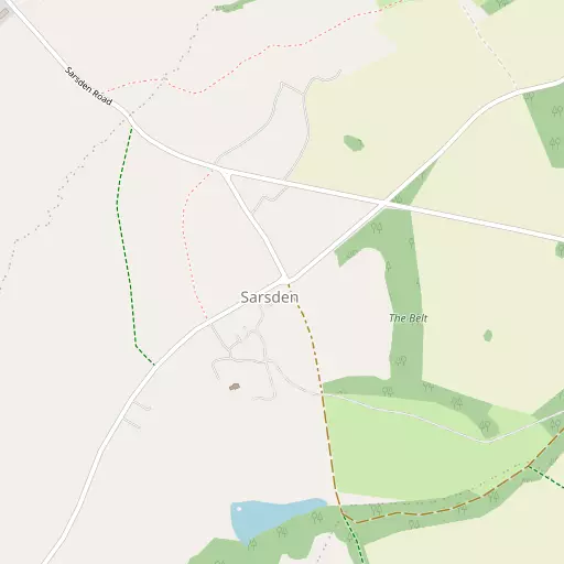
⇅
Location Summary
- Sarsden is located in Oxfordshire
- Administrative Area: Oxfordshire
- Ceremonial County: Oxfordshire
- Historic County: Oxfordshire
- Region & Country: South East / England
⇅
Nearby Towns & Cities
- Chipping Norton 4.4 km NNE
- Charlbury 7.7 km ESE
- Stow-on-the-Wold 10.2 km WNW
- Burford 11.8 km SSW
- Oxford 28.0 km SE


⇅
Nearby Localities


⇅
Smaller Settlements
- Bruern Abbey 3.8 km SW
- Cornwell 4.3 km NNW
- Foscot 4.4 km WSW
- Chilson 4.7 km SE
- Shorthampton 4.9 km SE
- Bould 5.2 km WSW
- Dean 5.3 km E
- Daylesford 5.3 km WNW
- Old Chalford 5.9 km ENE
- Southcombe 6.2 km NE


⇅
Beaches
- Backhill Sands101.1 km WSW
- Cotswold Hills Beach37.8 km SW
- Sugar Loaf Beach95.6 km WSW
⇅
Parks
- Crown Meadow32.3 km NW
- Merton Field28.5 km SE
- The Green31.2 km NE
- The Green31.7 km ENE
⇅
Woods
- Jubilee Plantation1.5 km SE
- Kennels Belt834 m ESE
- Nursery Plantation879 m ENE
- The Belt343 m ESE
⇅
Hills
- Barley Hill2.6 km E
- Barter's Hill1.7 km SSE
- Snow Hill5.0 km SW
- Whitequarry Hill4.4 km NW

⇅
Lakes
- Basin Pond6.1 km SSW
- Chad Lakes6.1 km W
- Round Pond6.0 km SSW
- Stretch Pool4.1 km NNE
⇅
Waterfalls
- Neptune Waterfall74.8 km ESE
- The Cascade40.8 km ENE
- Tower Waterfall74.1 km ESE
⇅
Headlands
- Beachley Point81.0 km WSW
- Sudbrook Point86.1 km WSW
⇅
Islands
- Fiddler's Island26.4 km SE
- Isle of Rhea27.3 km SE
⇅
Wetlands
- Ranger's Marsh5.8 km ESE
- Brassey15.1 km W
- Wanborough Marsh40.5 km SSW
⇅
Health Services
- Chipping Norton War Memorial Community HospitalHospital 5.1 km NE
- North Cotswold HospitalHospital 12.2 km NW
- Langston Nursing HomeMedical 3.4 km W
- Southerndown Nursing HomeMedical 3.7 km N

⇅
Education
- Kingham Primary SchoolSchool 3.0 km WNW
- Kingham Hill SchoolSchool 3.7 km NW
- Common Leys Farm CampusUniversity 12.0 km SE
⇅
Railway Stations
- Kingham3.5 km W
- Ascott-under-Wychwood4.6 km SSE
⇅
Bus Stations
- Swindon Bus Station40.7 km SSW
- Daventry Bus Station48.2 km NE
⇅
Coach Stations
- Shakespeare's Birthplace Coach Terminal33.1 km NNW
- Milton Keynes Coachway62.5 km ENE
⇅
Ferry Terminals
- Harbour Inlet Ferry Landing87.2 km SW
- SS Great Britain Ferry Landing87.3 km SW
⇅
Airports
- London Oxford Airport19.4 km ESE
- Wellesbourne Mountford Airfield31.9 km N
⇅
Airfields
- RAF Little Rissington Airfield9.0 km WSW
- Enstone Airfield10.3 km ENE
⇅
Heliports
- Midlands Air Ambulance Headquarters96.3 km NNW
- Crossplain Poultry Farm101.9 km N
⇅
Harbours
- Lydney Harbour67.6 km WSW
- Floating Harbour86.4 km SW