
Sheepstor
About Sheepstor
Sheepstor sits within Devon. Nearby places include Meavy around 1.9 km West South West, Dousland just 2.6 km West North West, Walkhampton just 3.3 km North West, Yelverton around 3.8 km West and Clearbrook around 4.4 km West South West. Other rural localities include Lovaton, Lake, Hoo Meavy and Sampford Spiney.
You may find extra local information by clicking a nearby place.
All place information is taken from OS, ONS and OSM under open licence.
⇅
Local Map
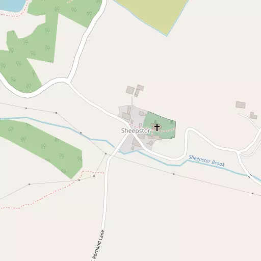
⇅
Location Summary
- Sheepstor is located in Devon
- Administrative Area: Devon
- Ceremonial County: Devon
- Historic County: Devon
- Region & Country: South West / England
⇅
Nearby Towns & Cities


⇅
Nearby Localities
- MeavyVillage 1.9 km WSW
- DouslandVillage 2.6 km WNW
- WalkhamptonVillage 3.3 km NW
- YelvertonVillage 3.8 km W
- ClearbrookVillage 4.4 km WSW
- AxtownDistrict 4.6 km W
- Roborough DownDistrict 4.8 km WSW
- Shaugh PriorVillage 4.9 km SSW
- HorrabridgeVillage 5.1 km WNW
- CrapstoneVillage 5.6 km W


⇅
Smaller Settlements
- Lovaton 2.1 km SW
- Lake 2.9 km WNW
- Hoo Meavy 3.7 km WSW
- Sampford Spiney 5.4 km NNW
- Peat Cot 6.0 km NE
- Whiteworks 6.3 km NE
- Bickham 6.9 km WSW
- Rundlestone 7.5 km N
- Merrivale 7.6 km N
- Roborough 7.8 km SW


⇅
Beaches
- Mount Batten16.3 km SSW
- Pebble Side16.2 km SSW
- Reform Beach16.2 km SSW
⇅
Parks
- Palm Cross Green18.6 km SSE
- Pennsylvania Park45.3 km NE
- Pleasure Grounds27.2 km N
- The Lawn41.0 km ENE


⇅
Woods
- Beechcroft Plantation874 m N
- Burrator Wood752 m WSW
- Longstone Plantation935 m NNW
- Smallcombe Wood722 m SW
⇅
Hills
- Gutter Tor1.8 km ESE
- Legis Tor2.4 km SSE
- Peek Hill2.3 km N
- Sheeps Tor827 m NE

⇅
Lakes
- Big Pond4.7 km SSE
- Burrator Reservoir1.1 km NW
- Crazywell Pool3.6 km NE
- Yelverton Reservoir1.1 km NW
⇅
Waterfalls
- Broad Falls9.3 km E
- Horseshoe Falls15.3 km ENE
- Yealm Steps7.0 km ESE

⇅
Headlands
- Pennard's Point11.7 km WSW
- Weir Point13.4 km WSW
⇅
Islands
- Combestone Island12.3 km ENE
- Long Island14.3 km ENE
⇅
Wetlands
- Foxtor Mires6.4 km ENE
- Ducks' Pool6.6 km E
- Fishlake Mire8.5 km E
⇅
Health Services
- Plymouth HospitalHospital 10.0 km SW
- Derriford HospitalHospital 10.2 km SW
- Hart Care Nursing and Residential HomeMedical 4.6 km W
- Moorland Garden Nursing HomeMedical 5.5 km WSW
⇅
Education
- Meavy Church of England Primary SchoolSchool 1.6 km WSW
- Heather Bridge SchoolSchool 2.8 km WNW
- University of St Mark and St JohnUniversity 9.6 km SW
⇅
Railway Stations
- Plymbridge Wood9.7 km SSW
- Marsh Mills11.2 km SSW
⇅
Bus Stations
- Kingsbridge Bus Station29.3 km SE
- Exeter Bus Station44.4 km NE
⇅
Coach Stations
- Plymouth Coach Station15.3 km SSW
- Torquay Coach Station35.1 km E
⇅
Ferry Terminals
- Barbican Landing Stage15.7 km SSW
- Mount Batten Passenger Ferry Terminal16.0 km SSW
⇅
Airports
- Plymouth City Airport9.3 km SW
- Exeter Airport51.4 km ENE
⇅
Airfields
- Bolt Head Airfield33.9 km SSE
- Eggesford Airfield43.5 km NNE

⇅
Heliports
- Lake Heliport62.2 km NNW
- Cornwall Air Ambulance Station67.7 km W
⇅
Harbours
- Sutton Harbour15.4 km SSW
- Weston Mill Lake15.7 km SW