
Stevington
About Stevington
Stevington lies within Bedford. Among the nearby places are Oakley only 2.0 km East North East, Pavenham just 2.4 km North, Bromham situated 2.9 km South East, Milton Ernest only 4.0 km North East and Chellington only 4.1 km North West. Other rural places nearby include West End, Bury End, Wick End and North End.
You might discover something new by clicking a nearby place for more local details.
This page uses OS, ONS and OSM data supplied under open licence.
⇅
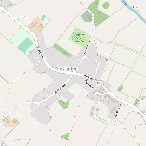
Local Map
⇅
Location Summary
⇅
Nearby Towns & Cities
⇅
Nearby Localities
⇅
Smaller Settlements
⇅
Beaches
- Mill Beach
- Snettisham Beach
- Snettisham Scalp
⇅
Parks
- Buckwell Green
- Elfield Park
- Foot Meadow
- The Green
⇅
Woods
- Fox Covert
- Stevington Belt
- Tucker's Islands
- Wood Craft
⇅
Hills
- Coldharbour Hill
- Cracknell Hill
- Mushroom Hill
- Oakley Hill
⇅
Lakes
- Bromham Lake
- Felmersham Gravel Pits
- Grebe Lake
- Kingfisher Water
⇅
Waterfalls
- Neptune Waterfall
- The Cascade
- Tower Waterfall
⇅
Headlands
- Botany Bay Point
- Tripcock Ness
⇅
Islands
- Apple Island
- Dick's Island
⇅
Wetlands
- Summer Leys
- Fowlmere
- Ouse Fen
⇅
Health Services
- Manor Hospital
- Bedford Hospital South Wing
- Milton Ernest Hall
- Bentley Grange
⇅
Education
- Oakley Kindergarten
- Lincroft Academy
- Polhill Campus
⇅
Train Stations
- Bedford
- Bedford St Johns
⇅
Bus Stations
- Bletchley Bus Station
- North Gate Bus Station
⇅
Coach Stations
- Milton Keynes Coachway
- Luton Airport Bus and Coach Station
⇅
Ferry Terminals
- Embankment Pier
- Festival Pier
⇅
Airports
- London Luton Airport
- Cambridge City Airport
⇅
Airfields
- Sackfield Airfield
⇅
Heliports
- Magpas Air Ambulance
⇅
Harbours
- Chelsea Harbour
- Farndon Harbour