
Towan Cross
About Towan Cross
Towan Cross lies within Cornwall. Among the nearby places are Banns Vale around 603 m South East, Mount Hawke situated 1.2 km South East, Porthtowan around 1.5 km West South West and Goonbell lying 2.6 km North East. Other rural communities nearby include Goonvrea, Menagissey, Mawla, Cambrose and Gilbert's Coombe.
You might discover something new by clicking a nearby place for more local details.
This page uses OS, ONS and OSM data supplied under open licence.
⇅
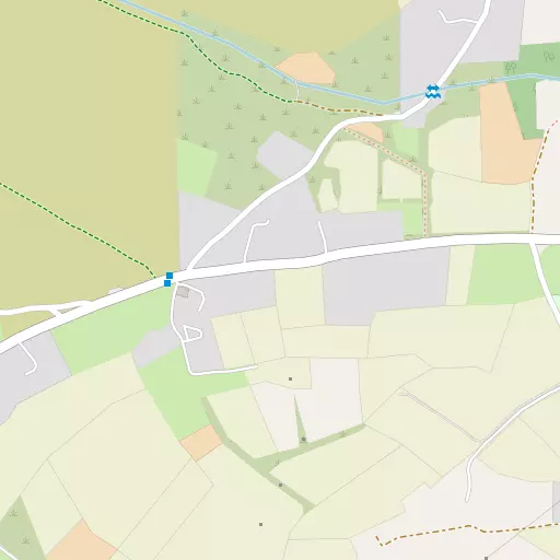
Local Map
⇅
Location Summary
- Towan Cross is located in Cornwall
- Administrative Area: Cornwall
- Ceremonial County: Cornwall
- Historic County: Cornwall
- Region & Country: South West / England
⇅
Nearby Towns & Cities


⇅
Nearby Localities
- Banns ValeDistrict 603 m SE
- Mount HawkeVillage 1.2 km SE
- PorthtowanVillage 1.5 km WSW
- GoonbellDistrict 2.6 km NE
- St AgnesVillage 2.7 km NNE
- Wheal RoseVillage 3.6 km SSE
- BlackwaterVillage 3.6 km SE
- MithianVillage 4.3 km ENE
- ScorrierVillage 4.4 km SSE
- TrevellasVillage 4.6 km NE


⇅
Smaller Settlements
- Goonvrea 1.3 km N
- Menagissey 1.8 km SSE
- Mawla 2.6 km S
- Cambrose 3.7 km SSW
- Gilbert's Coombe 5.0 km SSW
- Sparnon Gate 5.2 km SSW
- Jolly's Bottom 5.2 km SE
- Gollawater 5.6 km ENE
- Tolgus Mount 6.0 km SSW
- Trefula 6.0 km SSE


⇅
Beaches
- Perranporth Beach8.0 km NNE
- Porthtowan Beach1.9 km WSW
- Portreath Beach6.3 km WSW
⇅
Parks
- Lanner Moor8.6 km SSE
- Palm Cross Green94.6 km E
- Summerleaze Down76.8 km NE
- Trungle Moor32.6 km SW

⇅
Woods
- Bridge Moor5.3 km SW
- Mingoose Plantation2.2 km E
- Northabout Plantation2.7 km E
- Penhallow Plantation2.6 km ESE
⇅
Hills
- Mulgram Hill1.5 km NW
- North Downs3.9 km S
- St Agnes Beacon1.8 km N
- Western Hill6.7 km WSW

⇅
Lakes
- Boswyn Reservoir13.0 km SSW
- House of Water7.7 km SSW
- Stithians Reservoir11.8 km S
- Wheal Maid Tailings7.3 km SE
⇅
Waterfalls
- Golitha Falls55.2 km ENE
- White Lady Waterfall86.5 km ENE
- Yealm Steps92.0 km ENE
⇅
Headlands
- St Agnes Head3.2 km NNW
- Tubby's Head2.3 km NNW

⇅
Islands
- Godrevy Island14.0 km WSW
- The Island16.9 km NE
⇅
Wetlands
- Cotty's Point8.3 km NE
- Victoria Point14.7 km ESE
- Point Noe14.9 km NNE
⇅
Health Services
- Camborne Redruth Community HospitalHospital 7.1 km SSW
- Treliske HospitalHospital 9.5 km ESE
- Montrose BarnMedical 4.7 km ENE
- The GreenMedical 5.9 km S
⇅
Education
- Mount Hawke AcademySchool 1.3 km SE
- St Agnes SchoolSchool 2.5 km NNE
- Cornwall College of Further and Higher EducationUniversity 8.0 km SSW
⇅
Railway Stations
- Redruth6.4 km S
- Camborne10.6 km SSW
⇅
Bus Stations
- Camborne Bus Station10.3 km SSW
- Truro Bus Station12.6 km ESE
⇅
Coach Stations
- Plymouth Coach Station76.9 km E
- Torquay Coach Station121.1 km E
⇅
Ferry Terminals
- Trelissick15.9 km ESE
- Philleigh16.1 km ESE
⇅
Airports
- Newquay Cornwall Airport22.1 km NE
- Land's End Airport38.4 km WSW
⇅
Airfields
- Perranporth Airfield5.2 km NNE
- Truro Airfield5.7 km ESE
⇅
Heliports
- Cornwall Air Ambulance Station23.0 km NE
- Penzance Heliport27.4 km SW
⇅
Harbours
- South Harbour16.3 km SSE
- Penryn Harbour16.7 km SE