
Tredinnick
About Tredinnick
Tredinnick, in Cornwall, has Mitchell lying 1.7 km South, Summercourt lying 2.0 km East, St Newlyn East lying 3.7 km West, Quintrell Downs lying 4.3 km North North West and Penhale only 4.6 km East North East. Other rural localities include Chapel Town, St Enoder, Carland Cross and Kestle Mill.
You might learn something new by clicking through to a nearby place.
All place information is taken from OS, ONS and OSM under open licence.
⇅
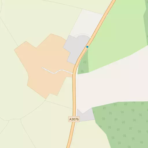
Local Map
⇅
Location Summary
- Tredinnick is located in Cornwall
- Administrative Area: Cornwall
- Ceremonial County: Cornwall
- Historic County: Cornwall
- Region & Country: South West / England
⇅
Nearby Towns & Cities
- Newquay 7.6 km NW
- St Columb Major 8.7 km NNE
- St Austell 15.4 km ESE
- Padstow 19.8 km NNE
- Truro 12.1 km SSW


⇅
Nearby Localities
- MitchellVillage 1.7 km S
- SummercourtVillage 2.0 km E
- St Newlyn EastVillage 3.7 km W
- Quintrell DownsVillage 4.3 km NNW
- PenhaleVillage 4.6 km ENE
- FraddonVillage 5.1 km ENE
- LaneVillage 5.4 km NW
- St Columb RoadVillage 5.5 km NE
- NansledanDistrict 5.8 km NNW
- TrevarrenVillage 6.0 km NE


⇅
Smaller Settlements
- Chapel Town 1.6 km ESE
- St Enoder 2.6 km ENE
- Carland Cross 2.8 km SW
- Kestle Mill 3.3 km NNW
- Mountjoy 4.1 km N
- White Cross 4.2 km NNE
- Brighton 4.3 km ESE
- Colan 5.0 km N
- Menna 5.2 km ESE
- New Mills 5.2 km SE


⇅
Other places with this name
- Tredinnick, Cornwall15.2 km NNE
- Tredinnick, Cornwall37.1 km E
⇅
Beaches
- Lusty Glaze7.6 km NW
- Porth Beach7.5 km NNW
- Tolcarne Beach7.5 km NW
⇅
Parks
- Lanner Moor21.8 km SW
- Palm Cross Green79.0 km E
- Summerleaze Down61.0 km NNE
- Trungle Moor49.8 km SW
⇅
Woods
- Captain's Wood1.8 km SSE
- Gunneton Wood2.1 km SE
- Nantillio Plantation2.3 km SSE
- Oak Tree Covert2.7 km SSE

⇅
Hills
- Crow Hill9.0 km ESE
- Trendeal Hill4.1 km SE
- Watch Hill10.9 km E
- Zelah Hill6.3 km SW
⇅
Lakes
- New Mills Pond5.3 km SE
- Porth Reservoir5.8 km N
- Ruthvoes Reservoir7.6 km NE
- Trenance Boating Lake6.8 km NW
⇅
Waterfalls
- Golitha Falls37.7 km ENE
- White Lady Waterfall68.9 km ENE
- Yealm Steps75.3 km E
⇅
Headlands
- Tolcarne Point7.5 km NW
- Trevelgue Head7.9 km NNW
⇅
Islands
- Porth Island7.8 km NNW
- The Island7.8 km NW
⇅
Wetlands
- Sunny Corner8.8 km NW
- Point Noe9.7 km WNW
- Stem Point10.2 km NNW

⇅
Health Services
- Newquay HospitalHospital 7.0 km NW
- Treliske HospitalHospital 12.9 km SSW
- St MargaretsMedical 4.7 km ENE
- Newquay Nursing and Residential HomeMedical 8.7 km WNW
⇅
Education
- Summercourt Community Primary SchoolSchool 2.6 km E
- St Newlyn East Primary SchoolSchool 3.9 km W
- Cornwall CollegeUniversity 6.5 km NW
⇅
Railway Stations
- East Wheal Rose2.8 km WSW
- Benny Halt2.9 km WNW

⇅
Bus Stations
- Newquay Bus Station7.8 km NW
- Truro Bus Station12.2 km SSW
⇅
Coach Stations
- Plymouth Coach Station60.9 km E
- Torquay Coach Station104.6 km E
⇅
Ferry Terminals
- Philleigh16.9 km S
- Trelissick16.9 km S
⇅
Airports
- Newquay Cornwall Airport8.2 km N
- Land's End Airport56.0 km WSW
⇅
Airfields
- Perranporth Airfield13.2 km WSW
- Truro Airfield14.0 km SW
⇅
Heliports
- Cornwall Air Ambulance Station7.4 km N
- Penzance Heliport44.9 km SW
⇅
Harbours
- Charlestown Docks17.9 km ESE
- Mevagissey Harbour19.0 km SE