
Trevelmond
About Trevelmond
Trevelmond is in Cornwall. Neighbouring places include Treburgie Water only 1.1 km North, Doublebois situated 1.4 km North North West, Dobwalls situated 2.0 km North East, East Taphouse lying 2.2 km West and Herodsfoot situated 3.3 km South South East. Other countryside settlements include St Pinnock, Redpost, Middle Taphouse and Moorswater.
You might learn something new by clicking through to a nearby place.
These details are compiled from OS, ONS and OSM data released under open licence.
⇅
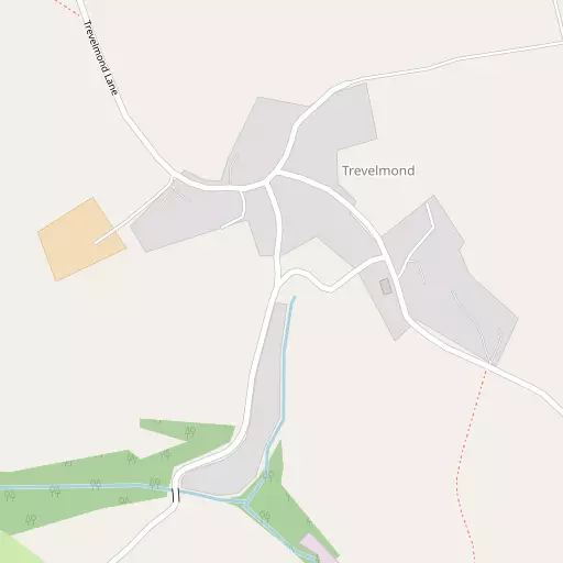
Local Map
⇅
Location Summary
- Trevelmond is located in Cornwall
- Administrative Area: Cornwall
- Ceremonial County: Cornwall
- Historic County: Cornwall
- Region & Country: South West / England
⇅
Nearby Towns & Cities
- Liskeard 5.0 km ENE
- Lostwithiel 10.5 km WSW
- Looe 11.5 km SSE
- Bodmin 13.4 km WNW
- Plymouth 28.9 km ESE


⇅
Nearby Localities
- Treburgie WaterDistrict 1.1 km N
- DoubleboisVillage 1.4 km NNW
- DobwallsVillage 2.0 km NE
- East TaphouseVillage 2.2 km W
- HerodsfootVillage 3.3 km SSE
- St NeotVillage 4.6 km NNW
- St KeyneVillage 4.6 km ESE
- AddingtonDistrict 5.7 km ENE
- DuloeVillage 5.9 km SSE
- TrewidlandVillage 6.5 km ESE


⇅
Smaller Settlements
- St Pinnock 400 m SSW
- Redpost 1.5 km WNW
- Middle Taphouse 3.0 km W
- Moorswater 3.4 km ENE
- Braddock 4.2 km WSW
- West Taphouse 5.0 km W
- Trecangate 5.1 km SW
- Churchbridge 5.2 km SSE
- Redgate 5.6 km NNE
- Pendriscott 5.7 km S


⇅
Beaches
- Millendreath Beach11.6 km SE
- Plaidy Beach11.5 km SE
- Talland Sand12.2 km SSE

⇅
Parks
- Lanner Moor53.4 km WSW
- Palm Cross Green46.8 km ESE
- Pleasure Grounds49.8 km NE
- Summerleaze Down43.2 km N
⇅
Woods
- Cliver Wood1.3 km ESE
- Coppice Wood1.2 km E
- Gratton Wood1.3 km SE
- Middle Quarry Park1.2 km ENE

⇅
Hills
- Druid's Hill7.9 km WSW
- Hobb's Hill6.4 km NNW
- Trefanny Hill6.3 km S
- Tregarrick Tor8.6 km NNE
⇅
Lakes
- Mill Pond6.0 km WSW
- Shillamill Lakes6.4 km SSW
- Siblyback Lake8.1 km NNE
- The Lake6.5 km SW
⇅
Waterfalls
- Golitha Falls5.5 km NNE
- White Lady Waterfall35.8 km NE
- Yealm Steps41.4 km E
⇅
Headlands
- Downend Point12.8 km S
- Peak Rock12.8 km S
⇅
Islands
- Little Island13.5 km SSE
- St George's Island13.2 km SSE
⇅
Wetlands
- Dewey Marsh10.0 km NNW
- Witheybrook Marsh10.4 km NNE
- St Winnow Point10.7 km SW
⇅
Health Services
- LaylandHospital 4.5 km ENE
- Fowey HospitalHospital 13.9 km SSW
- Liskeard Eventide HomeMedical 6.0 km ENE
- Meadowbrook HouseMedical 9.7 km WSW
⇅
Education
- Dobwalls Community Primary SchoolSchool 2.0 km NE
- Braddock Church of England Primary SchoolSchool 2.1 km WSW
- Peninsula Dental SchoolUniversity 27.1 km ESE
⇅
Railway Stations
- Coombe Halt3.7 km E
- Liskeard4.5 km E
⇅
Bus Stations
- Newquay Bus Station39.3 km W
- Truro Bus Station41.8 km WSW
⇅
Coach Stations
- Plymouth Coach Station28.7 km ESE
- Torquay Coach Station70.7 km E
⇅
Ferry Terminals
- Bodinnick13.5 km SSW
- Caffa Mill Slipway13.6 km SSW
⇅
Airports
- Plymouth City Airport30.1 km E
- Newquay Cornwall Airport34.2 km W
⇅
Airfields
- Bodmin Airfield11.3 km NW
- Davidstow Airfield22.3 km NNW

⇅
Heliports
- Cornwall Air Ambulance Station31.9 km W
- Hartland Heliport63.9 km N
⇅
Harbours
- Polperro Harbour12.6 km S
- Fowey Harbour14.3 km SSW