
Ulceby Cross
About Ulceby Cross
Ulceby Cross sits within Lincolnshire. Neighbouring places include Ulceby around 1.2 km South East, Brinkhill only 4.0 km West, Skendleby situated 4.0 km South South East and Swaby around 4.7 km North North West. Other nearby hamlets and settlements include Driby Top, Fordington, Driby, Dalby and Rigsby.
You might discover something new by clicking a nearby place for more local details.
The details shown here use OS, ONS and OSM data provided under open licence.
⇅
Local Map
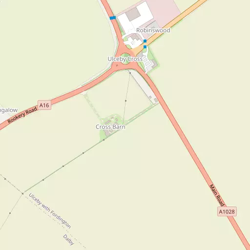
⇅
Location Summary
- Ulceby Cross is located in Lincolnshire
- Administrative Area: Lincolnshire
- Ceremonial County: Lincolnshire
- Historic County: Lincolnshire
- Region & Country: East Midlands / England
⇅
Nearby Towns & Cities
⇅
Nearby Localities
⇅
Smaller Settlements
⇅
Beaches
- Anderby Beach
- Moggs Eye Beach
- Sutton on Sea Beach
⇅
Parks
- Burgage Green
- Doncaster Common
- Larks Green
- Wilsford Warren
⇅
Woods
- Alford Road Plantation
- Black Holt
- Dadley's Stone Wood
- Willow Holt
⇅
Hills
- Badger Hill
- Langton Hill
- Mill Hill
- Red Hill
⇅
Lakes
- Belleau Spring
- Icehouse Pond
- The Moat
- Windmill Lake
⇅
Waterfalls
- Birch Fall
- Kinder Downfall
- Stevenson's Piece
⇅
Headlands
- Flamborough Head
- Red Cliff Point
⇅
Islands
- Branston Island
- Outer Trial Bank
⇅
Wetlands
- Orby Marsh
- Burgh Marsh
- Chapel Point
⇅
Health Services
- County Hospital Louth
- Skegness and District Hospital
- Sandpiper
- South Wold Nursing Home
⇅
Education
- Queen Elizabeth's Grammar School
- Alford County Primary School
- The Campus for Future Living
⇅
Railway Stations
- Thorpe Culvert
- Wainfleet
⇅
Bus Stations
- Louth Bus Station
- Hunstanton Bus Station
⇅
Coach Stations
- Chesterfield Coach Station
- Meadowhall Interchange
⇅
Ferry Terminals
- Hull Ferry Port
- Normanton Chain Ferry
⇅
Airports
- Wickenby Aerodrome
- Humberside Airport
⇅
Airfields
- Strubby Airfield
- Croft
⇅
Heliports
- Lincs and Notts Air Ambulance HQ
- Nottingham Heliport
⇅
Harbours
- Brancaster Harbour
- South Killingholme Haven