
Upper Langridge
About Upper Langridge
Upper Langridge, in Bath and North East Somerset, has Upper Weston just 2.2 km South, Weston just 3.0 km South, Primrose Hill lying 3.3 km South South East and Combe Park just 3.4 km South. Other places in the surrounding countryside include Lansdown, Langridge, Lower Hamswell, Tadwick and Woolley.
You may notice something interesting if you explore one of the nearby places.
All information is drawn from OS, ONS and OSM under open licence, reflecting the best available public data.
⇅
Local Map
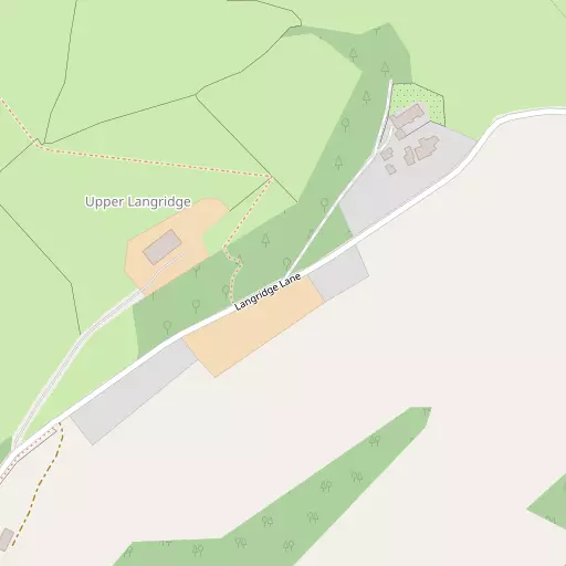
⇅
Location Summary
- Upper Langridge is located in Bath and North East Somerset
- Administrative Area: Bath and North East Somerset
- Ceremonial County: Somerset
- Historic County: Bath and North East Somerset
- Region & Country: South West / England
⇅
Nearby Towns & Cities


⇅
Nearby Localities
- Upper WestonDistrict 2.2 km S
- WestonDistrict 3.0 km S
- Primrose HillDistrict 3.3 km SSE
- Combe ParkDistrict 3.4 km S
- Upper SwainswickVillage 3.5 km ESE
- Beacon HillDistrict 3.5 km SSE
- Weston ParkDistrict 3.5 km S
- LansdownDistrict 3.6 km SSE
- Sion HillDistrict 3.6 km SSE
- KelstonVillage 3.6 km SW


⇅
Smaller Settlements
- Lansdown 749 m SSW
- Langridge 1.3 km E
- Lower Hamswell 1.7 km N
- Tadwick 1.7 km NE
- Woolley 2.1 km ESE
- Charlcombe 2.7 km SE
- Nimlet 2.8 km NE
- Beach 2.8 km WNW
- North Stoke 2.8 km W
- Swineford 3.8 km W


⇅
Beaches
- Backhill Sands32.1 km W
- Cotswold Hills Beach40.0 km NE
- Sugar Loaf Beach28.5 km WNW
⇅
Parks
- Durdham Down16.9 km WNW
- High Common3.8 km SSE
- Lower Common4.3 km SSE
- Pur Down13.7 km WNW
⇅
Woods
- Aldermoor Wood861 m E
- Bamfield's Wood1.0 km ESE
- Brockham Wood1.3 km W
- Chapel Wood380 m S
⇅
Hills
- Freezing Hill2.0 km NNW
- Hanging Hill1.5 km NW
- Lansdown Hill1.1 km S
- Nimlet Hill2.4 km NE


⇅
Lakes
- Boyd Valley Lake4.3 km WNW
- Broadleaze Spring5.2 km NNE
- Monkswood Reservoir3.3 km ENE
- Weston Cut4.5 km S


⇅
Waterfalls
- Llech Sychryd82.8 km WNW
- Pwll Annie80.0 km WNW
- Pwll yr Hesg76.3 km NW
⇅
Headlands
- Battery Point27.6 km WNW
- Beachley Point27.7 km NW
⇅
Islands
- Denny Island17.7 km WSW
- Denny Island29.4 km WNW

⇅
Wetlands
- Hilperton Marsh16.5 km ESE
- Hollow Marsh17.0 km SW
- Horseshoe Point20.4 km WNW
⇅
Health Services
- Royal United HospitalHospital 3.4 km S
- Royal National Hospital for Rheumatic DiseasesHospital 4.9 km SSE
- Larkhall Springs Nursing HomeMedical 4.1 km SE
- BridgemeadMedical 4.5 km SSE
⇅
Education
- Kingswood School Upper Sports FieldsSchool 1.7 km SSE
- Abbot Alphege AcademySchool 1.9 km SE
- Bath Spa University Art and DesignUniversity 3.5 km SSE
⇅
Railway Stations
- Avon Riverside4.7 km W
- Oldfield Park4.9 km S
⇅
Bus Stations
- Cribbs Causeway Bus Station18.4 km NW
- Chippenham Bus Station19.6 km ENE
⇅
Coach Stations
- Millstream Coach Park56.7 km SE
- Southampton Coach Station89.4 km SE
⇅
Ferry Terminals
- Harbour Inlet Ferry Landing15.2 km WNW
- SS Great Britain Ferry Landing15.3 km W
⇅
Airports
- Bristol Airport23.2 km W
- Cotswold Airport35.8 km NE
⇅
Airfields
- Garston Farm Airstrip7.5 km NE
- Colerne Airfield7.9 km ENE
⇅
Heliports
- Cardiff City Heliport52.0 km W
- Midlands Air Ambulance Headquarters136.3 km N
⇅
Harbours
- Floating Harbour14.4 km WNW
- Mud Dock14.5 km WNW