
Wendover Dean
About Wendover Dean
Wendover Dean is in Buckinghamshire. Places nearby include Dunsmore lying 1.3 km West North West, The Lee situated 2.6 km East, Lee Common around 3.6 km East, Great Missenden only 3.9 km South South East and Butler's Cross only 3.9 km North West. Other nearby hamlets and settlements include Kingsash, Little Hampden, Lee Gate and Hunt's Green.
You might discover something new by clicking a nearby place for more local details.
The information presented here is derived from OS, ONS and OSM under open licence.
⇅
Local Map
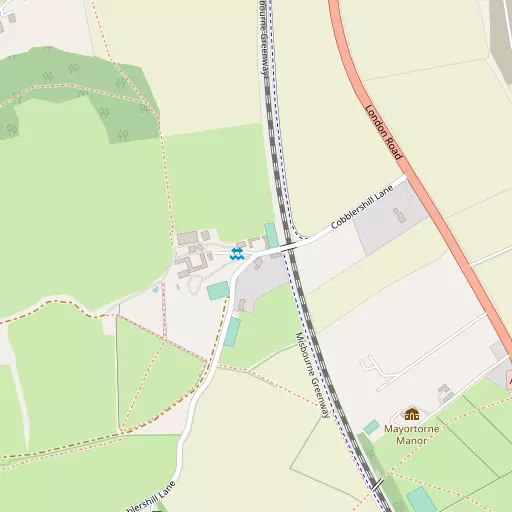
⇅
Location Summary
- Wendover Dean is located in Buckinghamshire
- Administrative Area: Buckinghamshire
- Ceremonial County: Buckinghamshire
- Historic County: Buckinghamshire
- Region & Country: South East / England
⇅
Nearby Towns & Cities
- Wendover 3.1 km N
- Princes Risborough 6.7 km W
- Tring 8.3 km NE
- Chesham 9.1 km ESE
- St Albans 27.4 km E


⇅
Nearby Localities
- DunsmoreVillage 1.3 km WNW
- The LeeVillage 2.6 km E
- Lee CommonVillage 3.6 km E
- Great MissendenVillage 3.9 km SSE
- Butler's CrossVillage 3.9 km NW
- Ballinger CommonVillage 4.1 km ESE
- EllesboroughVillage 4.2 km WNW
- Great HampdenVillage 4.3 km SW
- St LeonardsVillage 4.4 km ENE
- South HeathVillage 4.6 km SE


⇅
Smaller Settlements
- Kingsash 1.6 km ENE
- Little Hampden 1.7 km WSW
- Lee Gate 2.4 km ENE
- Hunt's Green 2.5 km ESE
- Swan Bottom 2.8 km E
- Coombe 3.3 km WNW
- Prestwood 3.9 km S
- Chivery 4.2 km NE
- Chalkshire 4.3 km NW
- World's End 4.7 km NNW


⇅
Beaches
- Chapman Sands98.2 km ESE
- Cotswold Hills Beach84.8 km W
- Hadleigh Ray94.3 km ESE
⇅
Parks
- Balderson's Moor18.0 km E
- Bell Meadow26.5 km E
- Chaulden Meadow16.3 km E
- Seabrook Meadow26.0 km E
⇅
Woods
- Cobblershill Wood1.1 km SSW
- Cockshoots Wood908 m S
- Jubilee Plantation958 m SSW
- Sermon's Wood726 m WNW

⇅
Hills
- Bacombe Hill2.7 km NNW
- Cock's Hill2.7 km NE
- Coombe Hill3.1 km NW
- Lodge Hill2.7 km WNW
⇅
Lakes
- Mill Pond4.8 km WNW
- Warren Water4.7 km SSE
- Weston Turville Reservoir5.1 km NNW
- Wibner Pond3.3 km S
⇅
Waterfalls
- Neptune Waterfall13.9 km ESE
- The Cascade37.7 km NNW
- Tower Waterfall13.2 km ESE
⇅
Headlands
- Botany Bay Point37.2 km SSE
- Tripcock Ness62.4 km ESE
⇅
Islands
- Lock Island18.8 km S
- Taylor Island18.8 km S
⇅
Wetlands
- Cock Marsh17.9 km S
- Wargrave Marsh26.3 km SSW
- Ickenham Marsh28.9 km SE
⇅
Health Services
- The Chiltern HospitalHospital 5.7 km SSE
- Stoke Mandeville HospitalHospital 8.4 km NNW
- Freemantle CourtMedical 5.8 km NW
- Rayners Nursing HomeMedical 7.3 km SE
⇅
Education
- Chiltern Way AcademySchool 2.4 km N
- Lee Common Church of England SchoolSchool 3.3 km E
- Buckinghamshire New UniversityUniversity 10.2 km NNW
⇅
Railway Stations
- Wendover3.2 km NNW
- Great Missenden4.0 km SSE
⇅
Bus Stations
- Aylesbury Bus Station10.5 km NNW
- High Wycombe Bus Station11.5 km S
⇅
Coach Stations
- High Wycombe Coachway13.5 km S
- Luton Airport Bus and Coach Station29.6 km ENE
⇅
Ferry Terminals
- Hammerton's Pier43.3 km SE
- Hampton Ferry Boathouse44.1 km SE
⇅
Airports
- Wycombe Air Park14.7 km SSW
- London Elstree Aerodrome29.6 km ESE
⇅
Airfields
- Halton Airfield6.3 km N
- Bovingdon Airfield13.3 km E
⇅
Heliports
- The London Heliport48.4 km SE
- Magpas Air Ambulance78.9 km NNE

⇅
Harbours
- Chelsea Harbour48.0 km SE
- Hendy's Quay100.0 km S