
West Chinnock
About West Chinnock
West Chinnock is in Somerset. Among the nearby places are Chiselborough just 1.3 km North, Townsend situated 2.2 km West, Norton sub Hamdon only 2.5 km North and Puddle Town just 2.7 km South. Other rural communities nearby include Middle Chinnock, Furringdons Cross, Little Norton, Wigborough and Drayton.
You might learn something new by clicking through to a nearby place.
The details shown here use OS, ONS and OSM data provided under open licence.
⇅
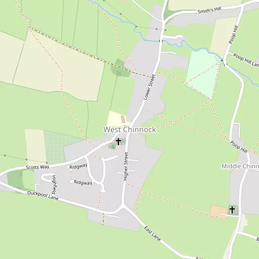
Local Map
⇅
Location Summary
- West Chinnock is located in Somerset
- Administrative Area: Somerset
- Ceremonial County: Somerset
- Historic County: Somerset
- Region & Country: South West / England
⇅
Nearby Towns & Cities
- Crewkerne 4.5 km SW
- South Petherton 4.9 km NW
- Yeovil 9.1 km ENE
- Ilminster 11.0 km W
- Wells 33.2 km NNE


⇅
Nearby Localities
- ChiselboroughVillage 1.3 km N
- TownsendDistrict 2.2 km W
- Norton sub HamdonVillage 2.5 km N
- Puddle TownVillage 2.7 km S
- MerriottVillage 2.7 km WSW
- Haselbury PlucknettVillage 2.7 km S
- East ChinnockVillage 2.8 km E
- MerriottsfordDistrict 2.8 km WSW
- PoundDistrict 2.9 km NW
- BroadshardVillage 3.5 km SW


⇅
Smaller Settlements
- Middle Chinnock 625 m SE
- Furringdons Cross 2.5 km SW
- Little Norton 2.6 km NNE
- Wigborough 2.8 km NW
- Drayton 2.9 km NNW
- Pye Corner 3.0 km SW
- Lower Stratton 3.1 km WNW
- Yeabridge 3.7 km NW
- Watergore 4.3 km WNW
- Broomhill 4.4 km WNW


⇅
Beaches
- Charmouth Beach23.0 km SSW
- Seatown Beach22.3 km SSW
- West Bay Beach23.1 km S

⇅
Parks
- Frenches Farm Natural Greenspace53.9 km ESE
- Pennsylvania Park57.2 km WSW
- Worle Moor50.1 km NNW
- Yargrass Green33.5 km N

⇅
Woods
- Burridge Copse1.0 km N
- Chiselborough Copse1.8 km NNE
- Coombe Copse1.5 km NE
- Rushy Wood2.0 km SSW

⇅
Hills
- Brympton Hill930 m NNE
- Greenham's Hill986 m N
- Snails Hill824 m SSW
- West Chinnock Hill955 m SW
⇅
Lakes
- Culliford's Hole4.6 km NNW
- Mill Pond2.5 km NNE
- Pit Pond3.5 km NE
- Priory Pond4.4 km NE
⇅
Waterfalls
- Becka Falls78.0 km WSW
- Broad Falls93.6 km WSW
- Horseshoe Falls86.9 km WSW
⇅
Headlands
- Bran Point42.2 km SE
- Stert Point38.1 km NNW
⇅
Islands
- Bathing Island31.4 km E
- Fish's Island31.2 km E
⇅
Wetlands
- Coker Marsh7.9 km E
- Wytherston Marsh16.8 km SSE
- Farway Marsh18.5 km WSW

⇅
Health Services
- South Petherton Community HospitalHospital 4.7 km NW
- Crewkerne HospitalHospital 5.0 km SW
- The OrchardsMedical 4.4 km SSW
- La Fontana Care HomeMedical 6.1 km N
⇅
Education
- West Chinnock Church of England Primary SchoolSchool 62 m NW
- Norton Sub Hamdon Church of England Primary SchoolSchool 2.6 km N
- Architectural Association Hooke ParkUniversity 15.4 km SSE
⇅
Railway Stations
- Crewkerne5.2 km SSW
- Yeovil Junction10.2 km E
⇅
Bus Stations
- Taunton Bus Station26.6 km WNW
- Exeter Bus Station57.8 km WSW
⇅
Coach Stations
- Millstream Coach Park69.4 km ENE
- Torquay Coach Station73.8 km SW
⇅
Ferry Terminals
- Starcross Pier58.2 km WSW
- Brownsea Island Ferry58.9 km ESE
⇅
Airports
- Exeter Airport50.3 km WSW
- Bristol Airport51.8 km N
⇅
Airfields
- Yeovil Westland Airfield7.6 km ENE
- Royal Naval Air Station Yeovilton12.9 km NE
⇅
Heliports
- Cardiff City Heliport66.6 km NNW
- Lake Heliport105.3 km W
⇅
Harbours
- Bridport Harbour23.1 km S
- Portland Harbour43.2 km SSE