
Wheatley
About Wheatley
Wheatley lies within Oxfordshire. Neighbouring places include Littleworth around 999 m West, Holton only 1.0 km North North East, Forest Hill around 2.6 km North North West and Cuddesdon situated 2.6 km South. Other rural places nearby include Townsend, Denton, Waterstock, Little Ickford and Albury.
You may notice something interesting if you explore one of the nearby places.
Data shown here comes from OS, ONS and OSM under open licence, using the latest public sources available.
⇅
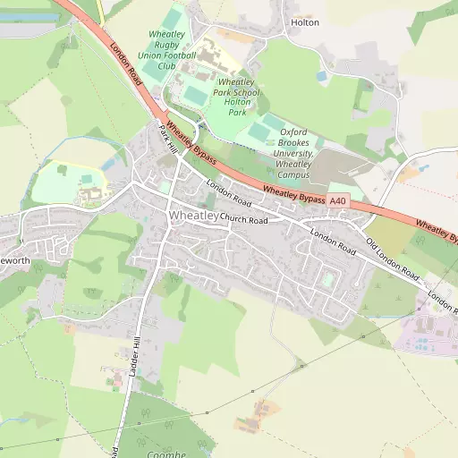
Local Map
⇅
Location Summary
- Wheatley is located in Oxfordshire
- Administrative Area: Oxfordshire
- Ceremonial County: Oxfordshire
- Historic County: Oxfordshire
- Region & Country: South East / England
⇅
Nearby Towns & Cities
⇅
Nearby Localities
⇅
Smaller Settlements
⇅
Other places with this name
- Wheatley, Hampshire
- Wheatley
- Wheatley
⇅
Beaches
- Cotswold Hills Beach
- Goatee Beach
- Weston Point
⇅
Parks
- Loop Meadow
- Merton Field
- The Common
- The Green
⇅
Woods
- Coombe Wood
- Cottage Copse
- Garden Copse
- Warren Wood
⇅
Hills
- Castle Hill
- Red Hill
- Shotover Hill
- Thorn Hill
⇅
Lakes
- Milton Pools
- Newell's Pond
- Rycote Lake
- Sandford Pool
⇅
Waterfalls
- Neptune Waterfall
- The Cascade
- Tower Waterfall
⇅
Headlands
- Botany Bay Point
- Tripcock Ness
⇅
Islands
- Fiddler's Elbow
- Rose Isle
⇅
Wetlands
- Ranger's Marsh
- Wargrave Marsh
- Cock Marsh
⇅
Health Services
- The Churchill Hospital
- The Manor Hospital
- The Triangle Care Home
- Brookfield
⇅
Education
- Wheatley Campus
- John Watson School Steve Drywood Building
- Wheatley Campus
⇅
Train Stations
- Oxford
- Radley
⇅
Bus Stations
- Aylesbury Bus Station
- High Wycombe Bus Station
⇅
Coach Stations
- High Wycombe Coachway
- Milton Keynes Coachway
⇅
Ferry Terminals
- Hampton Ferry Boathouse
- Hammerton's Pier
⇅
Airports
- London Oxford Airport
- Wycombe Air Park
⇅
Airfields
- Chalgrove Airfield
⇅
Heliports
- The London Heliport
⇅
Harbours
- Chelsea Harbour
- Lydney Harbour